09 December 2024
The Goechala Trek is an incredible and tough adventure that allows trekkers to see the magnificent views of Sikkim. This region provides this trek a completely different look with the mesmerizing views of Mount Kanchenjunga and its surrounding peaks nestled from the trek route which will take you through dense forests, alpine meadows, and rugged high mountain terrain.
In this guide, we will present a Goechala Trek itinerary step by step in detail commencing from Yuksom to the Goechala Pass for trekkers’ convenience. In addition, important things to carry while trekking and tips to ensure a comfortable journey will also be present. Optimal time to visit for good sights and weather conditions will be indicated as well allowing you to prepare for your trip.
Goechala Trek's Itinerary
Here is the detailed itinerary for the Goechala trek that you will follow with Himalayan Daredevils:

DAY 1- Siliguri to Yuksom
The Teesta River will be the one river that you will never forget as it will follow you until you have crossed into Sikkim. Madhukunda lies at the mouth of the Teesta River, namely the Rangeet River after crossing the Melli check post, and from there it will assist you in conducting methods between the two states.
Trekkers with Himalayan Daredevils hustle and bustle from Laddoo Gopal Restaurant seated near the Sevoke Road 2-mile checkpoint at 10 o'clock in the morning, which marks the commencement of their journey to Yuksom. You will later be taken to Yuksom, which is the starting point of the trek, and the Goechala trek which commences from this picture-perfect town around the west Sikkim region. It is considered that Yuksam is the first Sikkim capital that is still marked in the town’s traditions and its engineering structures.
There is something that needs to be done in Yuksom before the start of the trek. First, do not skip the police station. Carry a photo ID as well as three photocopies for registration purposes. The second step involves going to the scrutiny post to pay the essential permit fees. Such payment includes many items such as the tent, the porter, and the yaks, as well as other additional payments for photographic purposes. The breakdown might be rather complicated armed with these figures, the average total expense comes to about Rs. 700 per person and your Trek Leader will be on hand to guide you.
DAY 2- Yuksom to Sachen
The ascent continues at a steady angle for the next 2/5 hours but from then onwards, the walk will get steeper up to Sachen. Highlights: Heavily forested area with a suspension bridge and fast-flowing stream Pha Khola at the head of the national park entrance. Water sources: It’s advisable to bring 2 2-liter bottles from Yuksom. Bottles filled up from streams can be crossed in intervals. Goechala trek starts at Yuksom (behind EPW). First, the trail skirts Yuksom’s cultivated fields then it descends into the attractive Rathonggle Valley. The track more often traverses thick jungles with only a few sunlit sections interspersed.
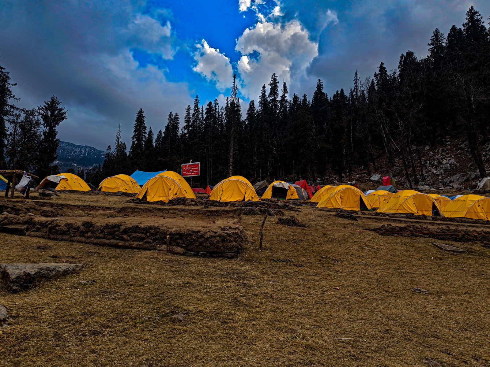
Three long suspension bridges will be crossed – one of which is over the waterfall Tshushay Khola. It is a moderate walk to the second bridge after which the ascent is a steady climb up to Sachen. The campsite for this day, Sachen, is a clearing in the forest with log benches and cabins. Prek River is deeper further down the valley.
Although it is impossible to hear the sound from Sasay Hill, if one tries hard enough, he will undoubtedly be able to find the sound that is present down in the river.
DAY 3- Sachen to Tshoka
The journey from Sachen (2,195 meters) to Tshoka (2,900 meters) is quite captivating for it takes approximately 5.5 hours and one goes from a height of 7400 feet to 9790 feet. The topography in this section of the Goechala trek is of a mixed kind, beginning with rolling hills which are covered with thick daily blooming oak and rhododendron trees in the spring season.
It then becomes quite steep after Bakhim where trekkers experience a good forty minutes of switchbacks till the trail begins an uphill course. The trek has a good number of viewpoints like the Prik Chu River that cuts through the valley and a couple of exhilarating suspension bridges that span the river.
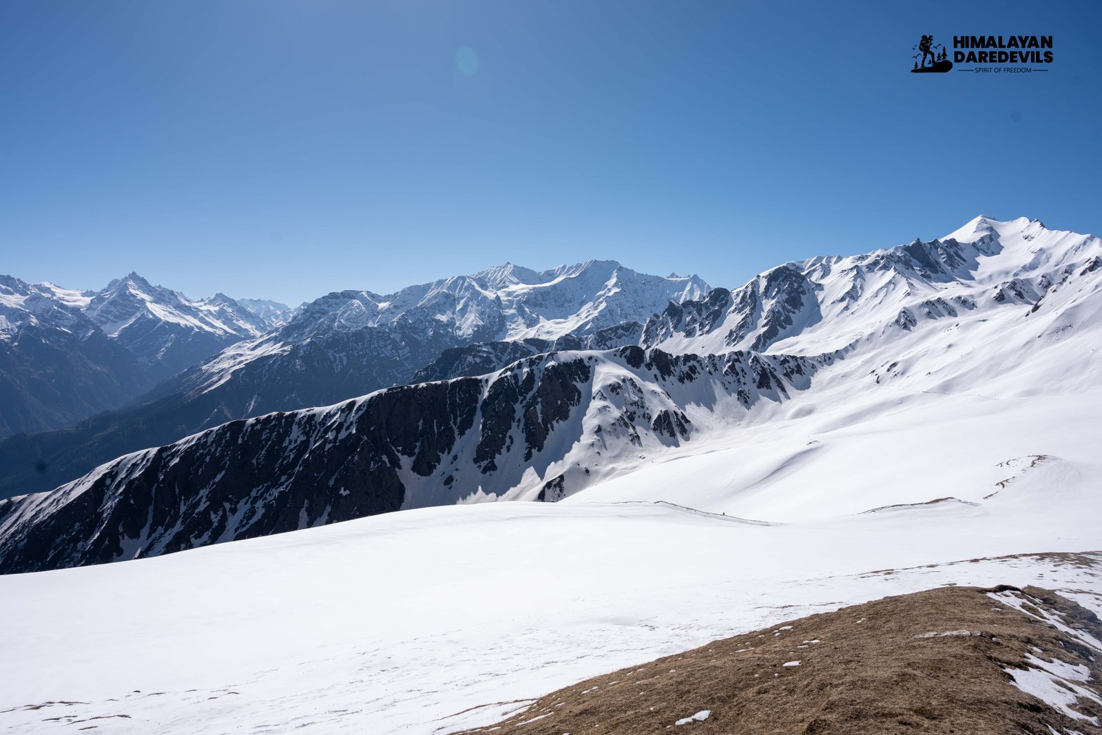
When the trekkers make their way to Tshoka, the beauty of the area becomes more appealing, and the snow-covered mountain peaks can be seen in the distance through the trees. There are individual gaps in the hills that provide some spectacular views of the wide Kanchenjunga range for the first time.
After reaching Tshoka, the first thing that trekkers meet is the quiet and peaceful gompa together with the magnificent view of the white-capped mountains. The temperature around the hills is rather cold throughout the whole journey and the area changes with seasons starting from springs that are lush in trees to autumn that are adorned with flamboyant colors.
DAY 4- Tshoka to Dzongri
The trek from Tshoka (2900 m) to Dzongri (3970 m) is one of the most strenuous portions of approximately 6 hours length on the Goechala Trek with a rather steep climb from 9790 feet to about 13190 feet. In contrast, this section of the trek starts with around 30 minutes of riding and then goes to slower gears to relax the trekkers before the ensuing tasks.
After a brief rest, the above trail again goes very steep until Phedang, a pretty green plateau set in snow-covered hills and adorned with prayer flags from the four corners of the sky. About this point, trekkers often prefer to stop and rest for a long time enjoying the sights before completing the walk.
The steep elevation of over a thousand meters argued to some trekkers the challenge of acclimatization, increasing the level of difficulty of the trek. No longer are trekkers in the forests of dense gentians and magnolia as they ascend the peak, rather the vegetation covers turn into sunburnt rocks and foxtail pastures.
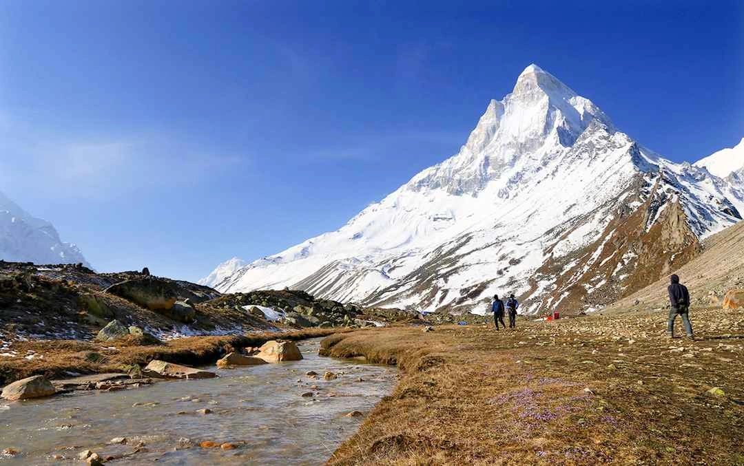
As far as the pleasantness of the scenery is concerned it remains no less beautiful throughout the year and spring is of course when the landscape is enhanced by the blooming flowers of the rhododendrons. The forests of Rosebay Willowherb covered with lichen in autumn leave more dark and enchanting sights which makes the trek enjoyable in every aspect. It is certainly difficult doing the climb, but looking at the imposing mountains around Mt. Pandim makes it worth the effort.
The last stretch towards Dzongri, from Phedang, is a tough one as there are a few more steep climbs, after which the slope gradually becomes less steep as the trekkers approach the area for the camp at night. On reaching Dzongri, which is very windy and quite cold, it is essential to don the layers you have placed on for the purpose.
Isn’t that difficult but the mountains surrounding Dzongri have awe-inspiring views and getting to this high-altitude camping site is one of the most extraordinary experiences of Goechala. Very little water is found in this area, so it is recommended to carry sufficient water from Tshoka, though the trekkers will be able to replenish at streams on the middle section of the route.
DAY 5- Dzongri to Thansing
The trekking time taken to walk from Dzongri 3,970 meters to Thansing 3,704 meters takes about six hours with ascents and descents which are not too gentle but also not too steep. An early start makes it possible for the climbers who wish to reach the summit in the morning to do so and view the Kanchenjunga and the Singalila ranges at sunrise after remotely climbing to the summit 3946 meters.
The view of Alpenglow at this altitude is crazy, the majestic mountains in this region are brilliant gold in color after the sun rises. After further breathtaking views of the mountains surrounded by the sun, trekkers expect to get to great heights as they move towards Dzongri, as from here, their path advances towards Thansing, which should take less effort as it is followed by only a little longer ascents and descents winding around Prek River.
The journey to Thansing is refreshingly beautiful with the views of high-altitude meadows decorated by the majestic Mt. Pandim in the background. On the way, tiny communities of dwarf rhododendrons can be seen while approaching Kokchurang, where the trekkers will encounter the only dependable source of water on this day so make sure to carry sufficient water while leaving from Dizongri.
On the way to Thansing, it is a short and sometimes steep hill, where the well-favored Thansing campsite can be found, in the shadow of Mt. Pandim. Its harsh, heavy surroundings make this calm place one of the best places to camp during the Goechala Trek.
DAY 6- Thansing to Lamuney
From Thansing (3704 m) to Lamuney (4145 m) is a pleasant and straightforward walk for about 2-3 hours. As most of the trail is level, the trekkers can enjoy the surroundings. The trek leader has the option of taking this day as a rest day and allowing trekkers to stay in Thansing in preparation for the trek further, depending on how quickly the group progresses and how well they have acclimatized. The route is enjoyable as well, as the high meadows and mountains are in sight when walking.
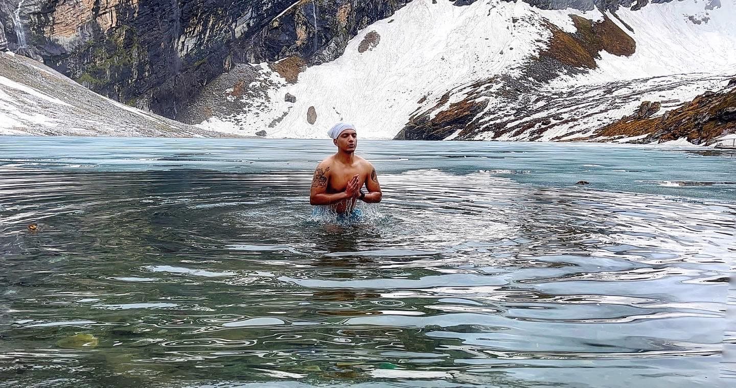
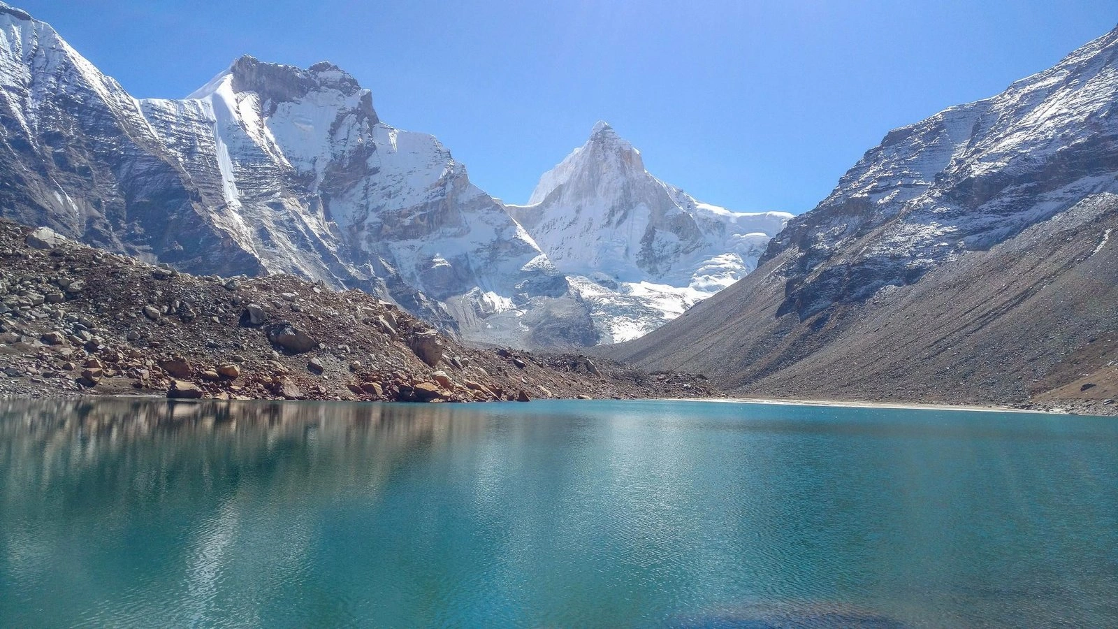
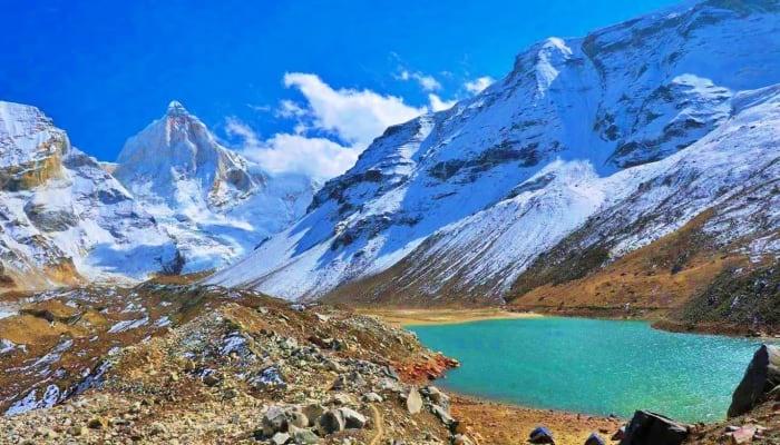
When they arrive at Lamuney, the trekkers can take the time to visit the stunning Samiti Lake which lies a bit higher than the campsite and takes only half an hour to climb up. This quiet and peaceful lake which is surrounded by rugged mountains is frequented by a herd of mountain goats and bluebirds who create a serene ambience.
Such a scene may have trekkers wishing to come here for a short time to admire the lovely views before heading back to Lamuney campsite for the night. The soothing and splendid atmosphere of Lamuney provides a good opportunity for some rest and adjustment before the strenuous parts of the trek.
DAY 7- Lamuney to viewpoint 1 and downwards to Thansing
The trek from Lamuney (4145 meters) to Viewpoint 1 (4602 meters) and down to Thansing (3704 meters) requires between 12 and 13 hours and is the longest day of the Goechala Trek. For those who go for Goechala starting from Lamuney, they begin the trek at three oçlock in the morning while those going from Thansing begin an hour earlier at one oçlock in the morning.
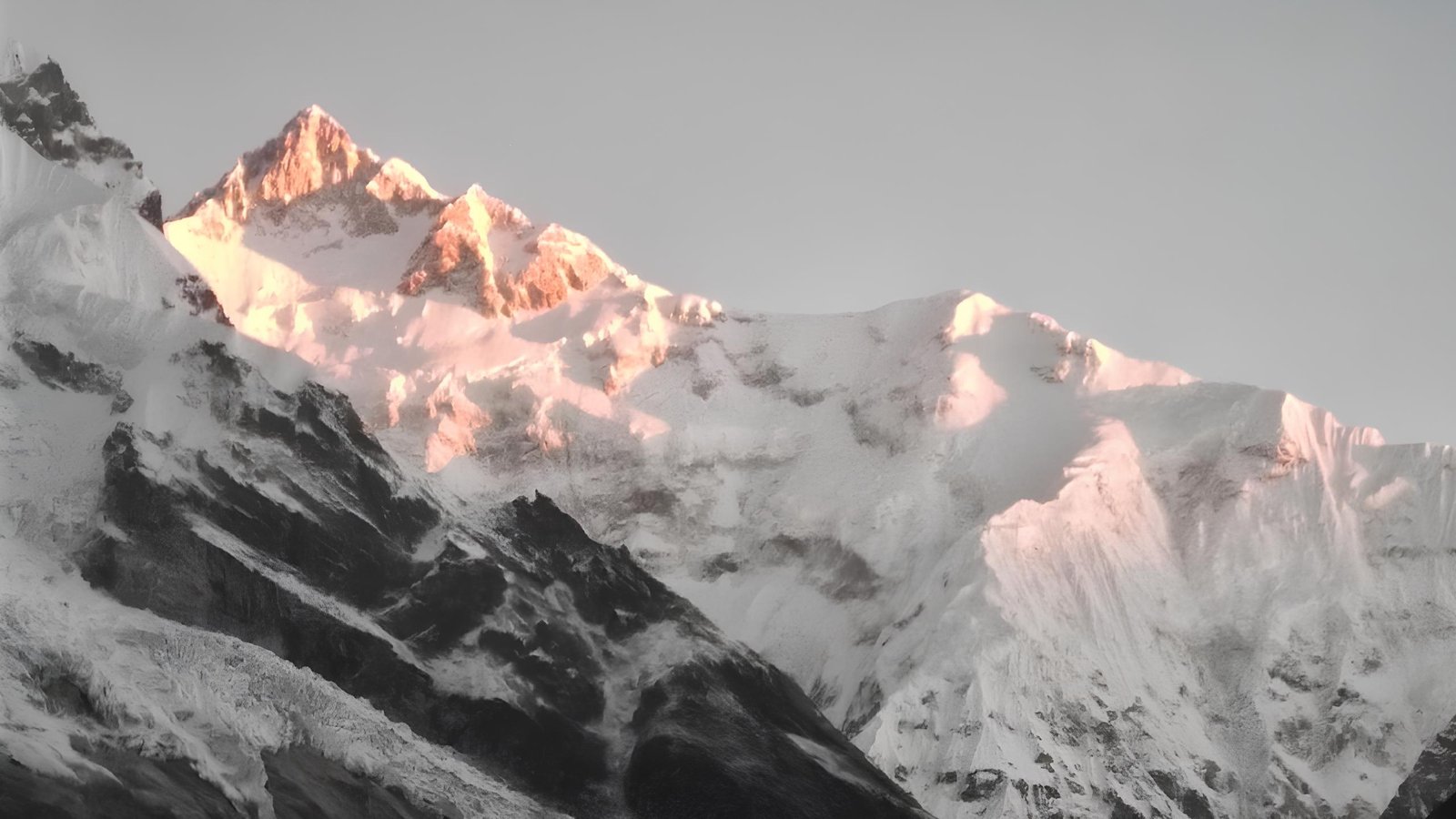
It is done for this purpose so that those who wish to trek to ViewPoint 1 at sunrise do not miss the chance to see the first sunlight bathing the peak Kanchenjunga range. Since a major portion of the elevation gain is done ‘before dawn’, it is essential for trekkers to come with headlamps, since they will need them to climb through the rocky sections in the dark.
Achieving View Point 1 is a milestone, quite literally but also in a figurative sense, since it presents an unobstructed view of the beautiful Kanchenjunga with its snow-covered peaks. The Kanchenjunga’s dazzling peaks at sunrise can be inspiring to some, and for many trekkers is a highlight of the trek as well.
The experience is thrilling with great emotions and quite a sense of accomplishment. After savoring the view, trekkers come back to Thansing and finish the circuit. Although this trek is considered to be challenging, it has days’ effort worth of payoff and is a single-opportunity trip which makes this section one of the top-notch of the Goechala Trek
DAY 8- Thansing to Tshoka via Kokchurang and Phedang
The Kokchurang and Phedang pass over Thansing to Tshoka is an additional good trek of about 9 hours with high ascents of 3914m to 2984m. The day’s initial part is characterized by a continuous gain in elevation which ceases at Kokchurang but, thereafter, the gradient is more or less constant for the next four hours.
This portion of the trek walks the climbers through beautiful pastures and dense forests of rhododendrons, allowing a variety of wildlife, including the colorful Himalayan Monal and other birds to be spotted, in beautiful settings. Beyond Phedang, the angle of the descent towards Tshoka crosses almost straight.
The initial effort to reach Tshoka can be difficult sometimes as the terrain slopes and the weather gets icy in December. One should try to exercise caution and take their steps slowly to reduce the chances of slipping. On the contrary, spring makes it rather more exciting owing to the rhododendron trees that grow on both sides of the trek, further decorating the descent.
Only a few water sources are available along the trail and therefore, one should ideally commence the journey from Thansing with 2 liters of water at the very least. But as one retraces the movements of Machhermo to Kherlang and then Thansing, this section that is behind is certainly now a new one and better looking as well and therefore serves as a well-deserved conclusion to the trekking.
DAY 9- Tshoka to Yuksom through Bakhim and Sachen
Traveling through Bakhim and Sachen, one may take about 6 hours from Tshoka to Yuksom, dropping in height from 2790 meters to 1785 meters. The trail you are following drops steeply at first towards the village of Sachen and then becomes undulating returning to Yuksom at the end.
The trail goes in the same direction as earlier, within an hour the trekkers walk past a few suspension bridges over the Prek Chu River and enter a dense forest brimming with wildlife. A large number of flower species are visible including the blossoming rhododendrons in the Spring season and animal life is also seen when gradually moving in this direction in further descent.
The return journey to Yuksom might not be as tiring as the ascension, however, it is not free of its challenges. The trail from Sachen consists of going up and down gentle slopes and small hills that last quite a while but can be unexpected following a long period of being on a steady descent. A few more peaks are crossed towards the end of the trek and even though they are not very tall, they are frequent enough to take one to the comforting place which is Yuksom where the voyager can rest easy knowing the journey is over.
DAY 10- Yuksom to Siliguri
There is a drive from Yuksom to Siliguri. It is a pretty long journey since it winds around the mountains, offering glimpses of some beautiful scenery. The hills begin to fade and the green resplendence and beauty is gradually replaced by the busy town of Siliguri.
You have come to the end of the unforgettable Goechala trek, where the drive gives you a chance to contemplate the amazing moments and spectacular views that the trek offers.
Best Time to Visit Goechala Trek

Goechala Trek is best around pre-monsoon spring months which extend from March to May and autumn months which stretch from September to November. Trekking during winter brings the best conditions for the trek and climbing the beautiful peak. During the spring season, the trek is rewarded with great weather conditions and the rhododendrons will be in full bloom, providing the trekkers with beautiful views of the mountain.
Winter has great views of snow and scenery but needs a lot of warm clothing as temperatures will be very low. Do not go to the Goechala Trek during the monsoon months as the weather conditions will not be good due to heavy rains, slippery paths, and a lot of mud.
Trekking Essentials for Goechala Trek
Clothing and Layering: Carry warm clothes that are also water resistant, thermal wear, gloves, and a hat which are the least able to absorb moisture. This trek involves going up to an altitude that is cold and therefore requires good descent to be layered to ensure comfort.
Trekking Footwear and Accessories: Purchase durable waterproof boots for trekking on rough terrains and strap on a pair of trekking poles for balance. Don't forget to pack your hat, sunglasses, and a good bag so that you can store your essentials.
Water and Nutrition: Bring two liters of water with you as sources of water are few and far between. For food provision, bring snacks that include energy-rich foods, packed meals, and a trail mix that is high in energy to assist you with the long trekking sessions.
Key Highlights of the Goechala Trek
The Goechala Trek presents you with a remarkable experience while hiking the beautiful sights of Sikkim. Other highlights include the breathtaking views of Mount Kanchenjunga which is the third-highest mountain in the world as well as numerous snow-topped mountains like Pandim and Jannu. The jeep ride indulges beautiful wildflower-covered trails passing dense forests, meadows, and alpine pastures that are adorned with warm blossoms of rhododendrons during the spring season.

Major attractions of the location include the calm waters of Samiti Lake, Viewpoint 1 at sunrise is spectacular, and the peaceful campsite at Thansing. There are many other activities that the trekkers also love such as crossing suspension bridges, trekking through forested areas is an amazing experience.
Challenges and Tips for Trekking the Goechala Trek
Altitude and Acclimatization: The Goechala Trek is one of the highest in the world boasting altitudes exceeding 16,207 feet (4,950 meters) which makes it reasonable to suggest that without sufficient acclimatization, there is the risk of developing altitude-associated sickness. Headaches, dizziness, and even breathlessness during high-altitude treks are common and it is essential to go through the process of acclimatization.
Harsh Weather Conditions: While trekking the Goechala, the weather can be rather treacherous featuring rapid temperature drops, sudden bouts of rain and snowfall. Under such situations, at all times the risk of treks being delayed due to weather is always present which necessitates the need for warm clothing and equipment to protect against the wetness.
Tough Terrain: Physically, the trail is dominated by rocky stretches of stubborn, annoying steeps and occasional slide areas therefore being physically strenuous. This complex and rugged geography would warrant good levels of fitness and stamina to sustain a reasonable trekking speed throughout the trek.
Conclusion
To wrap up, the Goechala Trek is the best of its kind, offering unique views of Mount Kanchenjunga and the surrounding mountains as one trek through the pristine nature of Sikkim. From its fast-changing landscape of alpine meadows and forests to the tranquil essence of Samiti Lake, this trek will appeal to photographers.
A thoughtfully mapped Goechala Trek, necessary trekking items in hand, and the appropriate season make it easy for trekkers to complete the trek without any hardship. Circumstances and challenges notwithstanding, trekkers can look forward to an amazing time on the Goechala Trek, an experience that adventurous spirits will relish. Experienced guides are also provided by Himalayan Daredevils, a prominent adventure company, making the Goechala Trek safe yet exciting at the same time.