Starting From
24,840
21,600.00
Starting From
24,840
21,600.00
Starting From
24,840
21,600.00
Goechala Trek (181+ Reviews)
Circular trek. Returns back to the base camp.
New Jalpaiguri (NJP)
Bagdogra
Yuksom (150 Km drive, approx 8 hours)
Spring treks (Mid March-Mid April), Autumn trek (Sep-Mid Nov)
Yuksom to Yuksom
Meals while on trek ( Veg and Egg)
Hotel/ Guesthouse/ Camping
Sikkim
10 Days
Difficult
15100 Ft
90 Km
Overview
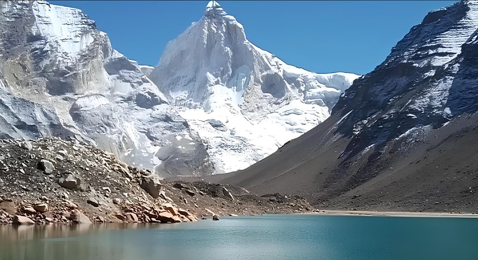
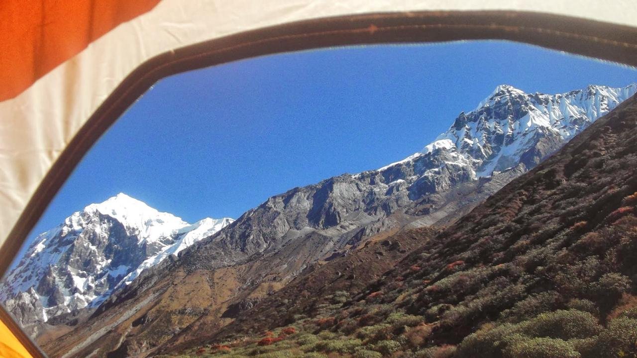
The Goechala Trek is one of the most beautiful and difficult trekking trails in Sikkim Location as it is situated in the eastern Himalayan region. The trek gives the trekkers a chance to see Mount Kanchenjunga, the third-highest mountain in the world, along with other mountain ranges. The route takes the adventurers through green forests, alpine meadows, and high altitudes, thus providing a combination of beauty and a physical challenge. The trek's attraction can be found in the breathtaking sceneries, the different types of ecosystems, and the thrill of crossing the Goechala Pass which is at a height of 4940 meters or 16,210 feet.
The trek starts from Yuksom – a tiny town in Sikkim considered to be the base for the Kanchenjunga region. In 10 days, the trekkers cover all the villages and valleys that are interspersed by oaks, rhododendrons, and pine forests. During the expedition, the trekkers will be able to appreciate the region’s biodiversity including endangered birds and animals, and the culture of the local Sikkimese population. It is important to note that the first few days of the trek are quite steep involving gradual height gain and this enables trekkers to acclimatize to the increasing altitude.
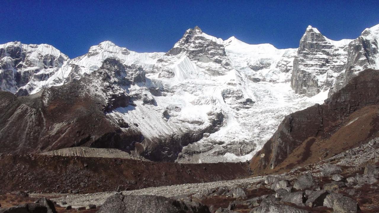
On the way to the base camp, a great number of trekkers reach the glacial landscapes and valleys. It is in the Goechala Pass that the views become even more spectacular — one can appreciate the Kanchenjunga and its neighboring peaks of Pandim, Kabru, and Simvo ranges. A more detailed perspective of the Teesta River glaciers is another juncture that the pass incorporates into its dynamic vistas. This region has many Buddhist monasteries and therefore trekkers will surely get a dose of spirituality while trekking in the region.
The Goechala Trek, besides being beautiful, is a tough trek and a physically and psychologically demanding one. There is a significant amount of altitude, the weather can be indecisive and the terrain is often rough so the trekkers are in hardy situations. Acclimatization is essentially related to altitude sickness. The route demands people from the onset of the day to walk even for longer distances with chronic wet and muddy days.
To sum up, the Goechala Trek is best suited for those who want to explore the less traversed areas in the Himalayas or the cultural aspect of Sikkim. The trek has its highlights like stunning landscapes, varied ecosystems, and the gratifying feeling of crossing the pass which makes it one of the best high-altitude treks in Sikkim India. This offers trekkers and lovers of nature an exciting challenge for it involves one of Earth’s most beautiful mountain ranges that provide a unique experience.
Itinerary
The Teesta River will accompany you the whole way through West Bengal until you reach Sikkim.
Upon reaching the Melli Check Post, the Rangeet River merges with the Teesta marking the boundary between Sikkim and Bengal.
Moving ahead from the Laddoo Gopal Restaurant around Sevoke Road the trek to Yuksom prepares you for the Goechala trek.
At Yuksom, do not begin the trek before registering with the police station and paying the required fees at the scrutiny post.
SHORT ITINERARY:
DETAILED ITINERARY:
While in West Bengal, do not lose track of the Teesta River as it will be your constant companion until you enter Sikkim. After crossing the Melli Check Post, the Rangeet River joins the Teesta, and then, Teesta will be a friend and help you travel along the border of the two states. For those who travel with Himalayan Daredevils, the journey to Yuksom starts from the Laddoo Gopal Restaurant at around 10 AM close to 2 Mile Check Post on Sevoke Road. A vehicle will then transport you to Yuksom, the starting point for the Goechala trek, which starts from this pretty town in the West Sikkim region. Yuksam is said to be the first capital of Sikkim which still is evident in the culture and architecture of the town.
Before beginning the trek, it is necessary to accomplish some formalities in Yuksom. First, do not skip the visit to the police station. Have a valid photo ID and three copies of the photo ID at hand for registration. The second step involves going to the scrutiny post to pay the essential permit fees. Such payment includes many items such as the tent, the porter, and the yaks, as well as other additional payments for photographic purposes. The breakdown might be rather complicated armed with these figures, the average total expense comes to about Rs. 700 per person and your Trek Leader will be on hand to guide you.
The elevation gain is gradual between the periods of 2-5 hours which gets tougher as you near Sachen where a heavy rainforest with a suspension bridge can be seen.
The trek commences immediately behind the Dham stations' check post that traverses across agricultural lands and escalates into the Rathonggle valley.
Post the first bridge, the route becomes more demanding as the second bridge is crossed and the site for Sachen campsite, a quiet grassland is reached.
SHORT ITINERARY:
DETAILED ITINERARY:
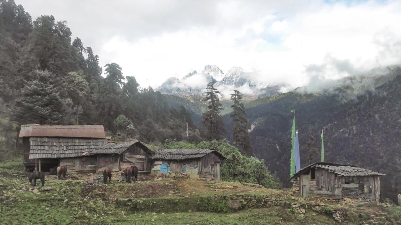
The climb is gradual for 2/5 hours after which the trail gradually becomes steeper up to Sachen. Highlights: Dense rain forest with a suspension bridge as well as a rushing stream Pha Khola at its head at the entrance of the national park. Water sources: We advise you to carry 2 liters of water from Yuksom. Streams have to be crossed at intervals where water bottles can be filled. The Goechala trek starts from Yuksom (behind the checkpost). Initially, the path goes around the farm fields of Yuksom before plunging into the beautiful valley of Rathonggle. The path mostly goes through thick jungles with very few sunlit areas here and there.
Three long suspension bridges will be crossed – one of them over Tshushay Khola waterfall. It is a moderate walk up to the second bridge and beyond this, the trail is steep up to Sachen. Sachen, the day’s campsite, is a point clearing in the woods with wooden rest platforms and a forest cabin. Prek River is much deeper in the valley further down. Even though the sound cannot be seen from Sasay Hill, if one listens closely enough he will hear the sound that can be found in the river below.
Moving from Sachen (2,195m) to Tshoka (2,900 m) takes around 5.5 hours of walking with an elevation increase of 422 meters.
The first part of the trek is much easier owing to easy hills covered with slopes of oak and rhododendron trees, but after Bakhim the terrain gets much harder with steep switchback slopes.
There are other scenic places along the way including the Prik Chu River and two suspension bridges that are fascinating to look at.
As trekkers come closer to Tshoka, snow-clad mountains and the great range of Kanchenjunga la give an elegant appearance of gompa in the backdrop.
SHORT ITINERARY:
DETAILED ITINERARY:
An appealing trek from Sachen (2,195 meters) to Tshoka (2,900 meters) takes about 5.5 hours with a height increase from 7400 feet to 9790 feet. The terrain in this part of the Goechala trek can be described as moderate, starting with gently rolling hills blanketed with lush oak and rhododendron trees that bloom in spring. It then gets steeper after Bakhim where trekkers encounter a good 40 minutes of strenuous switchbacks before the trail inclines gradually. The trek contains quite a few viewpoints such as the Prik Chu River flowing across the valley and two exhilarating suspension bridges across the river.
As the trekkers advance toward Tshoka, the magnificence of the region becomes more visible with the peaks of the mountains blanketed in snow coming into view through the dense tree cover. The mountains are dotted with gaps offering breath-taking views including the first sight of the colossal Kanchenjunga range. Upon arrival at Tshoka, the trekkers first encounter a peaceful gompa and a breathtaking view of the snowy mountains. The weather is notably chilly around the hills during the entire trek and the region transforms with seasons from the springs rich with trees to the autumns painted with flaming colors.
The trail from Tshoka to Dzongri is strenuous and involves a 6-hour trek which gains 4,400 feet from an elevation of 9790 feet to 13190 feet.
The trek begins with an easy climb of about 30 min, after which the slope gradually increases in steepness to reach the beautiful meadow of Phedang.
As trekkers gain elevation the vegetation goes from the dense forests to the timberline and there are great views of Mt. Pandim.
With the arrival at Dzongri, strong cold winds and extremely cold temperature require adequate layering to enjoy the magnificent views of high mountains
SHORT ITINERARY:
DETAILED ITINERARY:
The trek between Tshoka (2900 m) and Dzongri (3970 m) is one of the most arduous stretches of the Goechala Trek which is approximately 6 hours long and ascends a steep elevation from 9790 feet up to 13190 feet. On the contrary, this segment begins with riding up for about 30 minutes and easing into a slow pace to prepare trekkers for the next tasks. After a short break, the above trail proceeds steeply up again until Phedang, a lovely meadow bounded by snowy hills and prayer flags from all over the landscape. It is around here that trekkers like to take a long rest and enjoy the views before completing the walk.
The trail’s level of exertion is heightened by the elevation gain exceeding a thousand meters which can pose challenges to acclimatization. As the trekkers climb, they are going well above the treeline, and hence the range of vegetation changes from dense gentian and magnolia forests to alpine pastures and rocky grounds. The charm of the area is no less stunning throughout the year and in spring surely when the flowers of the rhododendrons add vibrancy to the landscape. In fall the lichen-covered rosebay willowherb forests look darker and more magical which augments the enjoyment of the trek in every sense. Climbing is hard work, but the majestic views of the towering mountains especially Mt. Pandim makes it worthwhile.
The final stage from Phedang to Dzongri has a few more steep climbs which then reduces to a gradual slope as the trekkers near the site for the night. When reaching Dzongri, there are very strong winds and cold temperatures, so placing on layers is very important. It is not easy, but the views from the mountains around Dzongri are spectacular and the journey to this high-altitude campsite is the most remarkable experience of Goechala. Little water is available in this part, so it is advisable to fetch adequate water from Tshoka, although the trekkers will be able to refill at streams on the intermediate route.
The 6-hour trek to Thansing (3,704m) from Dzongri (3,970m) is a mix of easy and steep climbs and descents in equal measure.
On this day the first highlight is climbing Dzongri Top (3,946m) to catch a glimpse of the Kanchenjunga sun rays and sunshine on the Singalila ranges.
Thansing has comfortable temperature zones, with highly colorful microscopic grasslands and rhododendrons, and a water source at Kokchurang.
The tranquil camping site at Thansing provides the vantage of Mt. Pandim compliments the best camping experiences on the Goechala Trek.
SHORT ITINERARY:
DETAILED ITINERARY:
The duration of the trek from Dzongri 3,970 meters to Thansing 3,704 meters is about 6 hours, with gentle to steep ascents and descents balanced out. With a head start, the day begins with a brief yet thrilling climb to Dzongri Top 3946 meters which allows for a breathtaking view of Kanchenjunga and the Singalila ranges at sunrise. The alpenglow at this height is simply wild, and the surrounding mountains are lit up in golden color. After watching the surroundings in the golden light of the rising sun, the trekkers descend towards Dzongri expecting great heights and rather begin their trek towards Thansing which is expected to be easier as it is followed by few long aloof ascents and descents wrapping around the Prek River.
The trek to Thansing is enchantingly picturesque with breathtaking views of high-altitude grasslands behind which stands the towering Mt. Pandim. Along the way, small dwarf rhododendron bushes grow along the way to Kokchurang where the trekkers will have the only water source for the day and so should bring enough water while departing from Dzongri. It is a short, slight climb leading to Thansing after, out of which, the beautiful campsite area lies, beneath the mighty Mount Pandim. This quiet place, with its harsh heavy backdrop, offers one of the best camping experiences on the Goechala Trek. Today’s trek is productive, filled with good views for the eyes and peace for the soul as Thansing becomes a good place to rest before the harder portions of the trek start.
From Thansing (3,704m) to Lamuney (4,145m), two to three hours are necessary, the terrain is mostly flat with good views.
The trek leader might also tell the group that today would be a rest day and in this way, the trekkers could also acclimatize and prepare for the next leg of the trek.
Coming to Lamuney, trek participants have the chance to reach the calm Samiti Lake which is a short half-hour trek above the camping area.
Lamuney has such a pleasant atmosphere which makes it an ideal place for resting and acclimatization, before the difficult parts of the trek.
SHORT ITINERARY:
DETAILED ITINERARY:
It is a short and simple walk from Thansing (3704 m) to Lamuney (4145 m) which takes about 2-3 hours. Most of the trail is level so there is little stress on the trekkers as they take in the vistas around them. The trek leader can use this day as a rest day where he allows the trekkers to stay at Thansing and prepare for the trek further, depending on how fast the group moves and how well they have adjusted. The way is also very beautiful and walking is nice as the high meadows and mountains are also in sight.
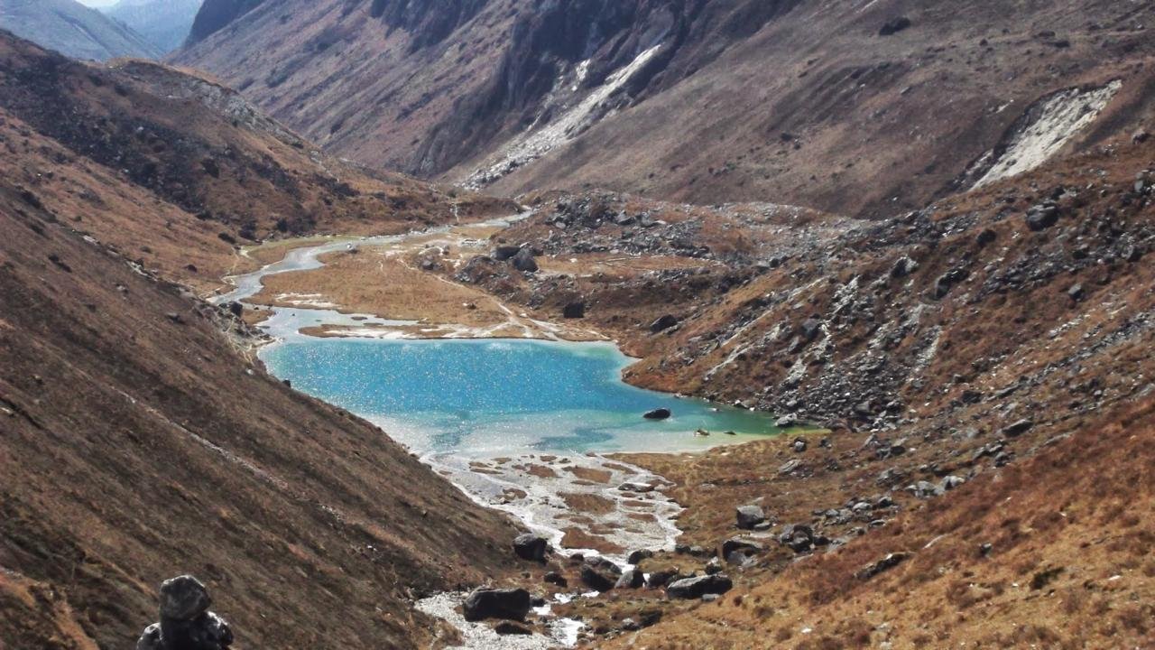
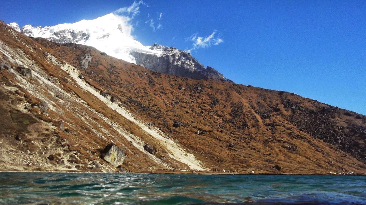
As soon as they reach Lamuney, the trekkers should visit the beautiful Samiti Lake which is located a bit above the campsite and can be reached within a half an hour climb. This peaceful lake surrounded by harsh mountains is home to a herd of mountain goats and bluebirds who occasionally visit this area creating a peaceful setting. Though camping near the lake is prohibited, trekkers should like to come here for a while and enjoy the beautiful views before returning to Lamuney campsite for the night. The calm and wonderful environment of Lamuney makes it a very good place for relaxation and adjustment before the tough parts of the trek.
Trekking from Lamuney (4145m) to Viewpoint 1 (4602m) and back to Thansing (3704m) is done in 12 – 13 hours, the most time-consuming day of the Goecha la Trek.
Based on reports, trekkers leave Thansing at 1 AM or Lamuney at 3 am in order to witness the warm sun that rises over Kanchenjunga.
The climb up to Viewpoint One is said to take place while peculiarly climbing dawn and therefore headlamps and torches are required to navigate over the rocky parts.
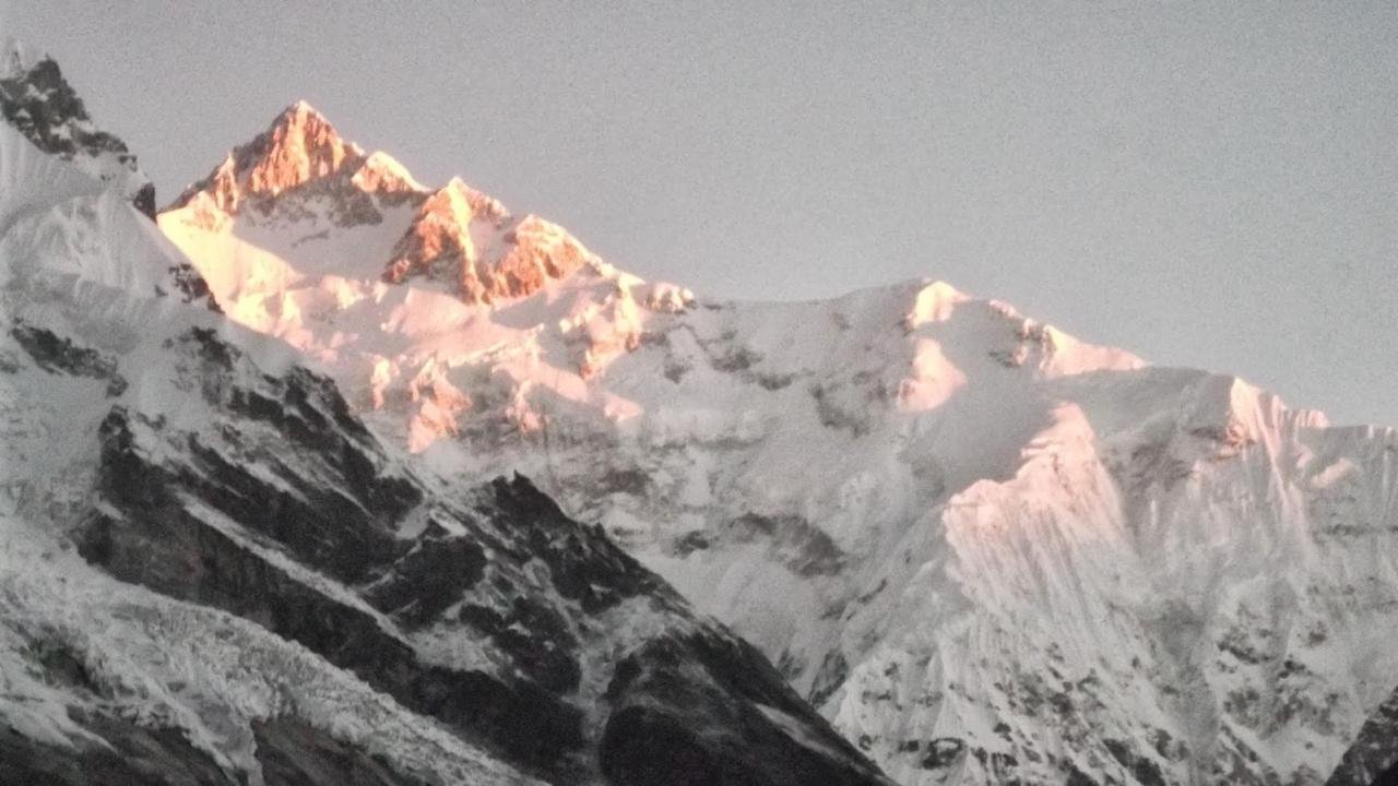
As mentioned above, the sunrise viewpoint where the majestic mountains of Kanchenjunga are situated dresses the trek and elevates the blistering journey to an experience that has hardly come by.
SHORT ITINERARY:
DETAILED ITINERARY:
The journey from Lamuney (4,145 meters) to Viewpoint 1 (4,602 meters) and downwards to Thansing (3,704 meters), takes from 12 to 13 hours which is the longest day of the Goechala Trek. For those starting the trek from Lamuney, the trek begins at three in the morning while for those departing from Thansing, the trek begins slightly earlier around one in the morning. This step is necessary, allowing trekkers at View Point 1 time to see the golden rays of the sun reflect upon the Kanchenjunga range. As a large part of the climb involves ascent in darkness, headlamps must be carried by trekkers to avoid falling while traversing the rocky area at night.
Accomplishing View Point 1 is an achievement in both a physical sense as well as in a figurative one, as it provides a straight view of the beautiful, snow-capped Kanchenjunga in all her splendor. The sight of the dazzling peak at sunrise is captivating, and for many trekkers is the high point of the entire trek. The experience is exhilarating and the emotions are intense with a feeling of satisfaction. After enjoying the view, trekkers return to Thansing and complete the loop. Even though the trek is strenuous, it sees days' worth of labor through and is a once-in-a-lifetime experience that places this part as one of the best of the Goechala Trek.
Trekking further from Thansing to Tshoka takes around 9 hours as it resorts to Kokchurang first then to Phedang with great loss of altitude.
There is a steady early climb toward Kokchournag followed by uniform slope through the meadows and rhododendron forests which happen to be rich in wildlife.
However, after Phedang, it is steep and does not take long to reach Tshoka, and conditions in December become icy, and therefore great care is advised.
Coming in Spring gives a good transition down as trekkers encounter the rhododendron trees on the way. Trekkers should remember to bring 2 liters of water as there are only a few sources
SHORT ITINERARY:
DETAILED ITINERARY:
The pass over Thansing to Tshoka through Kokchurang and Phedang is an impressive return trip of approximately 9 hours with altitude which ranges from 12,910 feet to 9,790 feet. The early part of the day includes a steady climb that ends at Kokchurang, after which the slope becomes more or less uniform for the next 4 hours. This part of the trek takes the climbers through beautiful meadows and forests of rhododendrons at higher altitudes where plenty of wildlife, including the colorful Himalayan Monal and other birds, can be sighted in serene surroundings. After Phedang, the descent towards Tshoka begins at an almost vertical angle.
It is sometimes difficult to return to Tshoka as the path inclines and there are icy conditions in December. One has to be patient and move at a slow pace to avoid any slips. In contrast, spring provides a much more interesting view since rhododendron trees on either side of the path make the descent more pretty. More water sources can be spotted on the trail and thus one has to start from Thansing with at least 2 liters of water. Though you repeat the steps of going back as in Machhermo to Kherlang and up till Thansing, this part behind you is now a different one and is much more beautiful, making up for a great end to the trekking experience.
From the camping site at Tshoka, it takes 6 hours to reach Yuksom passing through these towns Bakhim and Sachen. The distance covered is approximately 2,790 meters on a steep incline and comes down to 1,785 meters.
This place has constant ups and downs consisting of innumerable suspension bridges and fields of dense forest and wildlife.
The trek to Yuksom is less strenuous, but it has many unexpected high points after the climb's sustained low points.
This last leg of the trek reveals excellent vegetation with attractive similar sites bringing an end to the long but fulfilling tour.
SHORT ITINERARY:
DETAILED ITINERARY:
It takes approximately 6 hours to travel from Tshoka to Yuksom through Bakhim and Sachen while losing altitude from 2790 to 1785 meters. The trail you are on descends, initially going steadily downwards to the settlement at Sachen, and later follows a series of ups and downs, returning to Yuksom at the end. The path proceeds in the same direction you have been through before, within an hour the trekkers cross several suspension bridges that span the Prek Chu River and get into the thick woodlands rich in wildlife. It is possible to see a variety of plants including rhododendrons in the spring season and animals while moving in this direction on further descent.
Although the trek back to Yuksom is less exhausting than the climb, it also comes with its share of difficulties. A trek from Sachen alternates between gentle slopes and low hills and although, for the most part, they are quite short; after the extensive periods of being on a downward slope they may be considered slightly surprising. There are a few more climbs towards the end and although they are low, they are persistent enough to bring one to the comforting place that is Yuksom where the trekkers can settle knowing the voyage is finished. Tshoka provides enough water but it is best to bring extra since streams can be depended upon only during certain stretches. This last section of the trek is a great way to end the journey because the beautiful forests that one gets used to and the views one has seen before screen the exit and leave the traveler with contentment.
One can go for early vehicles once the trek is over for Siliguri from Yuksom as it is a long route.
The drive is very scenic as the route cuts through beautiful hills and this fancy drive reaches Siliguri.
Going down, the more carpeted hills start opening up to the crowded area of Siliguri.
The drive is highway marking. It ends the Goechala trek and provides the time to remember all the beautiful scenes and moments of this trek.
SHORT ITINERARY:
DETAILED ITINERARY:
After a strenuous trek, it is wise to board the vehicles as early as possible to drive from Yuksom to Siliguri. It is a pretty long journey since it winds around the mountains, offering glimpses of some beautiful scenery. The hills begin to fade and the green resplendence and beauty is gradually replaced by the busy town of Siliguri .
You have come to the end of the unforgettable Goechala trek, where the drive gives you a chance to contemplate the amazing moments and spectacular views that the trek offers.
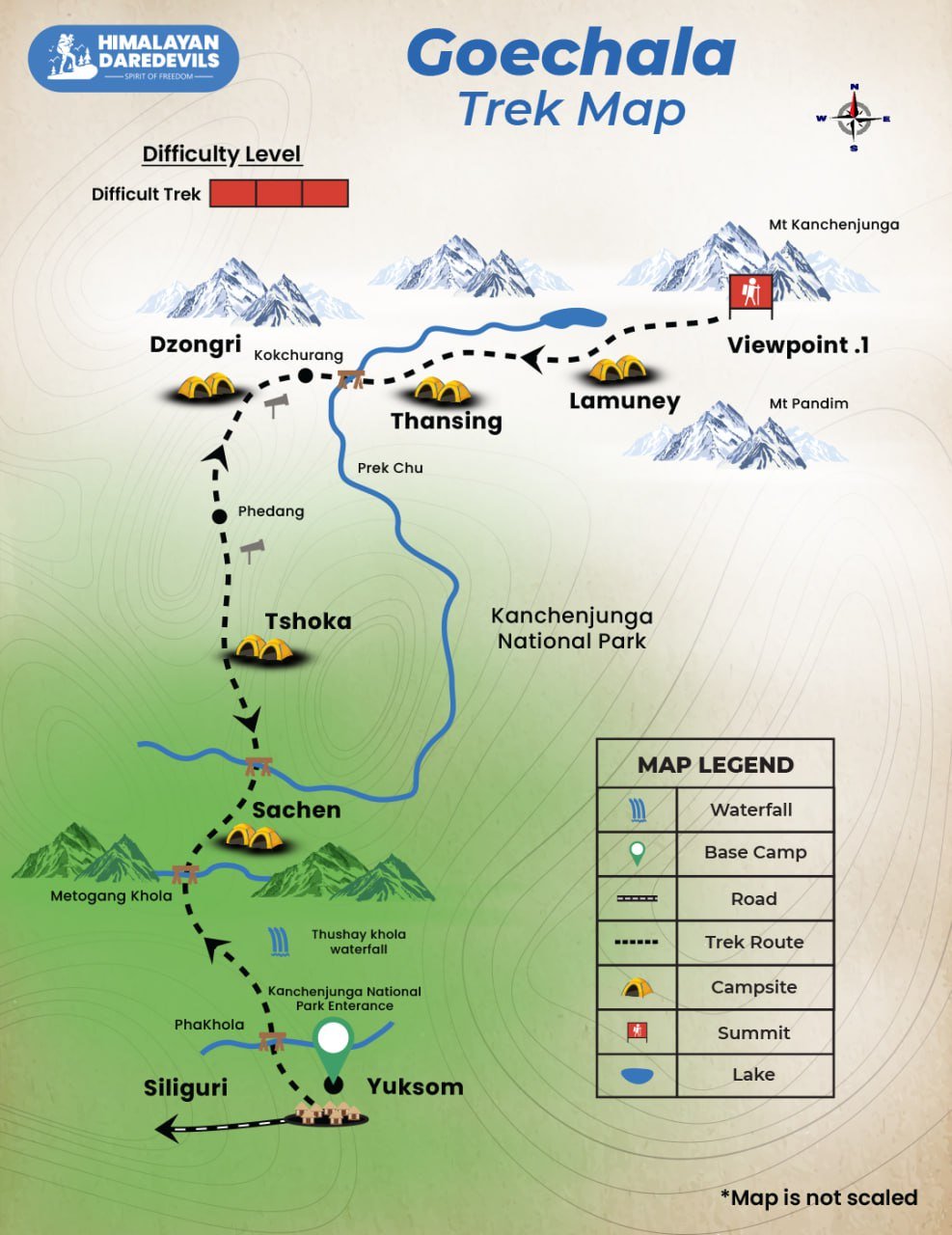
Goechala Trek Map
Inclusions
Exclusions
- Meals during the trek (Starting Lunch on Day 2 till Breakfast on Day 9)
- 2 Nights guest house stay in Yuksom on sharing basis
- Tents on twin sharing basis, Sleeping bags, mats
- Safety Equipment includes static rescue rope, seat harness, carabiners, pulleys
- Services of an experienced Trek guide, cook, helpers.
- Porters or mules for carrying common supplies
- Mountaineering course certified Trek Leader with First Aid certification
- Meals during road journeys
- Transportation from Siliguri to Yuksom and back to Siliguri. Transport (Non Ac)
- Additional Forest/Camping charges for foreign nationals. Approx INR 5000/- to be paid extra by the foreign nationals.
- Meals during Hotel/Guest House Stay
- Cost of any kind of Insurance
- 5% GST
- Any expense of personal nature
- Any expense incurred or loss cost by reasons beyond our control such as bad weather, natural calamities (landslides, floods), flight delays/rescheduling/ cancellations, any accidents/medical evacuations, riots/strikes/war/pandemics etc.
- Any expense not specified in the inclusion list.
What to carry
- Trekking shoes: A good pair of trekking shoes is essential for a comfortable and safe trek. Look for shoes that are sturdy, provide good ankle support, and have a good grip on different types of terrain.
- Backpack with rain cover (50-60 ltr): A backpack is necessary to carry all your gear. Make sure it's the right size for your trek, and comes with a rain cover to keep your belongings dry in case of rain.
- Thermals (upper and lower): Thermals are lightweight and comfortable base layers that help regulate your body temperature in cold weather. Bring both upper and lower thermals to keep warm.
- 3 T-shirts (advisable quick dry): Choose quick-drying T-shirts made from breathable and moisture-wicking materials. This will help keep you cool and dry during your trek.
- 2 trek pants: Choose lightweight and comfortable trek pants that are easy to move in and can dry quickly if wet.
- Jacket (-10 degrees): A warm jacket is essential for cold weather. Choose a jacket that is waterproof and windproof, and provides good insulation.
- Fleece or hood (2): Fleece jackets or hoodies are great mid-layer options to keep warm. Bring at least two, as they can also be used as an extra layer at night.
- Sunglasses (UV protected): Protect your eyes from the sun's harmful UV rays with sunglasses that are designed for outdoor activities.
- Sun cap: A sun cap or hat with a brim will protect your face and neck from the sun.
- Hand gloves: Bring a pair of lightweight gloves to keep your hands warm and protected from wind and sunburn.
- Woolen cap: A woolen cap will keep your head and ears warm at night or in cold weather.
- Socks (3 pairs min): Bring at least three pairs of good quality socks that are moisture-wicking and provide good cushioning and support for your feet.
- Headlamp: A headlamp will come in handy if you're hiking in low-light conditions or need to find your way in the dark.
- Trekking pole (if needed): Trekking poles can help reduce strain on your legs and provide additional support on steep terrain.
- Rain cover\poncho: A rain cover or poncho will keep you and your gear dry during unexpected rain showers.
- Day pack (if you plan to offload your bag): If you plan to offload your backpack during the trek, bring a smaller day pack to carry essentials like water, snacks, and a first aid kit.
- A toiletry kit: Bring a small kit with personal hygiene items, such as a toothbrush and toothpaste, wet wipes, hand sanitizer, and toilet paper.
- Lunchbox, cup, spoon: If you plan to bring your own food, bring a lunchbox, cup, and spoon to carry and eat your meals.
- 2 one-liter bottles: Staying hydrated is crucial, so bring at least two one-liter bottles to carry water.
- 2-3 plastic covers to keep your wet or used clothes: Plastic bags are useful for keeping wet or dirty clothes separate from the rest of your belongings. They can also be used to pack out any trash or waste you generate during the trek.
How to reach
By Air
Bagdogra Airport is the nearest airport (if you plan to come by flight, our pickup point will be STNM Bus / Taxi Stand in Siliguri, which is approx. 20-25 Km from the Airport, and it is advised to arrive either early morning or a day prior if planning by flight).
By Train
New Jalpaiguri (NJP) is the nearest Railway station with great railway connectivity connections; if planning to arrive by train, then book your train till New Jalpaiguri Railway Station (NJP) and from there, take an auto/taxi to STNM Bus / Taxi Stand in Siliguri, which is approx. 30-35 Km from the Airport, and it is advised to arrive either early morning or a day prior if planning by train as sometimes the trains are delayed).
Fitness and preparation guide for Goechala Trek
We recommend jogging as the best routine to get fit for a trek. It works on the same muscles that you use while trekking — your calves, glutes and hamstrings. It helps increase your stamina day by day. It is also an easy routine that does not require any equipment or tools.
Fitness target:
To do this trek comfortably, you must be able to cover 5 km in under 35 minutes. This is the minimum fitness required for this trek.
How to achieve this fitness?
- Start jogging at least 4 days a week
- If you cannot run 5 km immediately, start with 2 km and increase to 5 km over 2-3 weeks.
- Once you’re able to run 5 km, increase your pace day by day.
- Gradually increase your pace and bring it down to 5 km in less than 35 mins.
- You must be able to run 5 km in 35 mins consistently for at least 2 weeks before the trek.
This trek requires at least 6-8 weeks of preparation. The longer, the better. So plan your trek soon and start preparing.
FAQ
The highest point of the Goechala trek is Goechala Pass, located at an altitude of 4,940 meters (16,210 feet). This is the most challenging and rewarding part of the trek, offering panoramic views of some of the highest peaks in the Eastern Himalayas.
The Goechala trek usually takes about 10 days to complete, depending on the pace and itinerary. The trek covers approximately 90 kilometers and is typically divided into 8 to 10 trekking days, with rest days included to acclimatize to the high altitude. Your pace also matters while trekking Goechala trek.
From the Goechala trek, you can enjoy breathtaking views of several major peaks. The peaks include Kanchenjunga (the third-highest mountain in the world), Mt. Pandim, Mt. Simvo, Mt. Jannu, Mt. Kabru, and Mt. Rathong, among others, provides stunning Himalayan views. Sunrise from these peaks will be beautiful to forget.
With proper training and fitness as a beginner you can go for Goechala trek. The Goechala trek is considered a moderate to difficult trek, and it may not be ideal for absolute beginners. The high altitude and challenging terrain require a good level of fitness, stamina, and prior trekking experience.
The Goechala trek is generally safe, but like any high-altitude trek, it requires a lot of caution. Trekkers should be prepared for sudden weather changes, altitude sickness, and physical exhaustion. It is important to trek with a guide or a reputable tour operator, acclimatize properly, and carry sufficient gear for safety and comfort. With the help of a guide, you can make your trek a safe one. However, even with a guide don't forget to be cautious.
The Goechala Trek stands out from the other treks in its mesmerizing views of Kanchenjunga, which is the third highest peak in the world. The trek combines rich biodiversity and various geographical features with breathtaking views of the snow capped mountains which makes it a perfect destination for trekking and for nature lovers.
Yes, the Goechala trek does require a permit. All the trekkers should apply for permits from the Sikkim Forest Department, along with a permit for the restricted area because the Goecha treks goes through a restricted area which is located on the India Nepal border. It is better to avoid these tasks and book a registered trek agency to do it for you.
The beautiful views of Kanchenjunga, exotic diversity of flora and fauna, scenic views of Himalayan peaks of Pandim, Jopuno and Rathong, dense forests, alpine meadows and beautiful glacial lakes are some of the prime attractions of the Goechala trek. It not only takes the trekkers to high altitudes but also exposes them to the rich and vibrant local Sikkimese traditions and cultures.
The Goechala trek is a moderate level trek that is also difficult and requires a trekker to be fit. An individual needs to be in a base fitness level focusing on their cardiovascular fitness, the strength of their legs and their overall endurance. Also, trekkers should be prepared for the possibility of high altitude sickness and long and difficult days of trekking in high altitudes.
Although the Goechala Trek is not exactly considered an extreme adventure, there are still issues owing to its geographical features such as high elevation, unpredicted climatic conditions and difficult pathways. Risks such as Mountain sickness, rough roads with high chances of slippage and harsh weather conditions make it necessary for trekkers to be fit, properly acclimatized, and helm under the training of experts.
Cancellation policy
Life is unpredictable and we understand sometimes you have to cancel or change your trip dates and it is our endeavour to make it as easy possible for you. However, please understand we plan everything including guide fees, permits, accommodation and ration in advance. Therefore any cancellation means inconvenience and certain losses to the people involved in various stages of programme. Keeping that in mind, our cancellation charges are as below-
Cancellation prior to 30 days from start of the event: Get monetary refund with 15% of cancellation charges on trek fee.
Cancellation between 30 days and 15 days to the start of event: 50% on trek fee is non refundable and the remaining 50 % will be given as cash voucher which is valid for 1 year.
Cancellation less than 15 days to the start of event: No refund.
Please note cancellation will be only accepted by email.
Booking amount is non refundable
Note: The Himalayan Daredevils reserves the right to cancel a programme before departure in the event of logistical problems arriving due to natural calamities, strikes, wars on any other circumstances that makes the event inadvisable. In this case, 50% on trek fee is non refundable and the remaining 50 % will be given as cash voucher which is valid for 1 year.
Itinerary changes & trip delays:
We plan itineraries based on the information at the time of planning and in rare circumstances, there are subject to change. In the event that the itinerary is changes or delayed due to unforeseen circumstances such as bad weather conditions, transportation delays, government intervention, landslides etc. We will always aim to give you the best experience possible. However The Himalayan Daredevils are not be held responsible for the cost of delay or changes.
Why Choose Us
Our Best Performance
50,000+
Trekkers
PAN India Treks
250+
Treks
Professional
and Experienced Staff
Best
Grade Equipment
Well Organised
Trek Itineraries
Related Blogs
Read and get more about our treks
The Beauty of Sar Pass Trek - A Visual Journey Through the Himalayas
Gaumukh Tapovan Trek: Detailed Itinerary, Trekking Essentials & Best Time to Visit
