Starting From
19,548
16,999.00
Starting From
19,549
16,999.00


Starting From
19,549
16,999.00
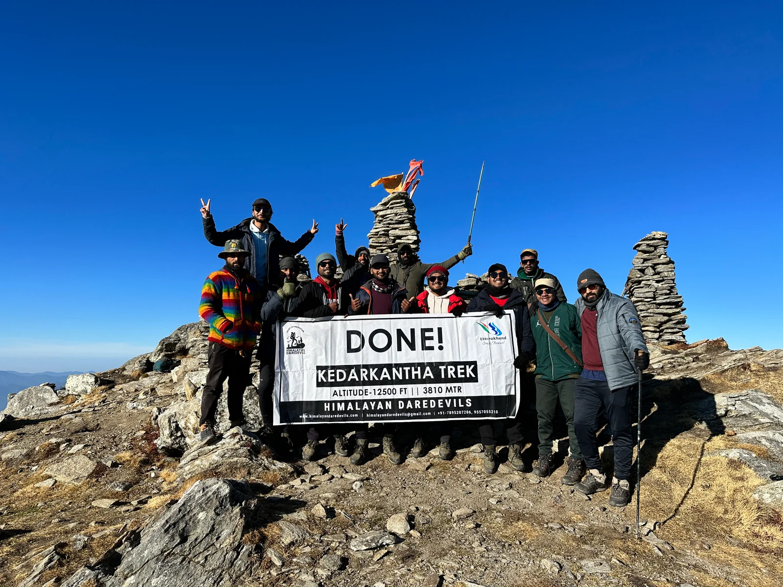
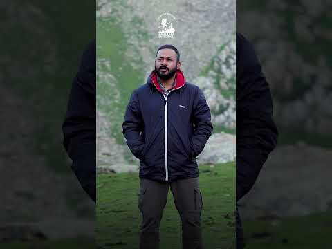
Ali Bedni Bugyal Trek (214+ Reviews)
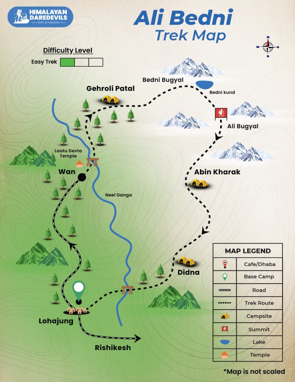
Circle trail | Camping in various locations, starting and ending at the same point.
Dehradoon Railway Station
Jolly grant Airport - Dehradoon
Lohajung
March | April | May | June | September | October | November
Lohajung to Lohajung
Veg
Guesthouse / Camping tent
Uttarakhand
6 Days
Easy
12100 Ft.
32 Km
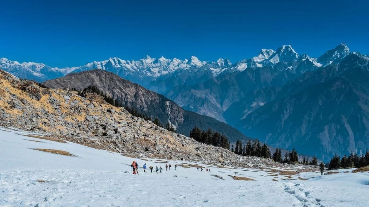
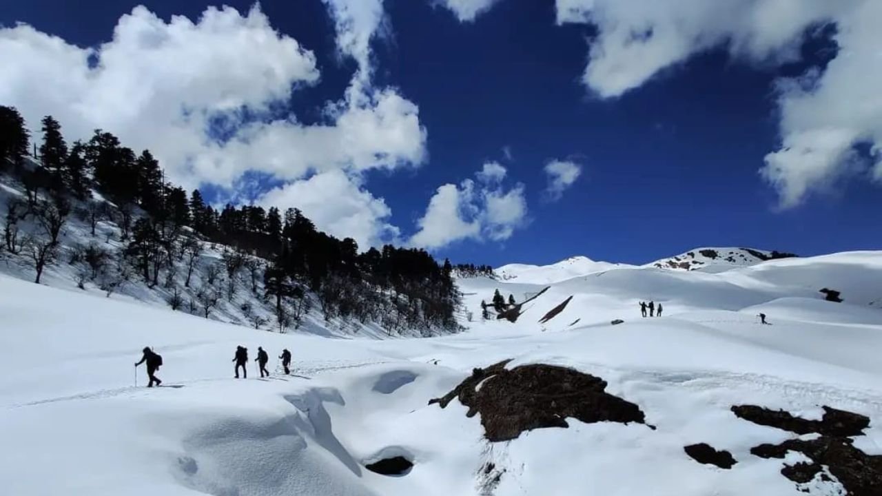
Overview of Ali Bedni Bugyal Trek
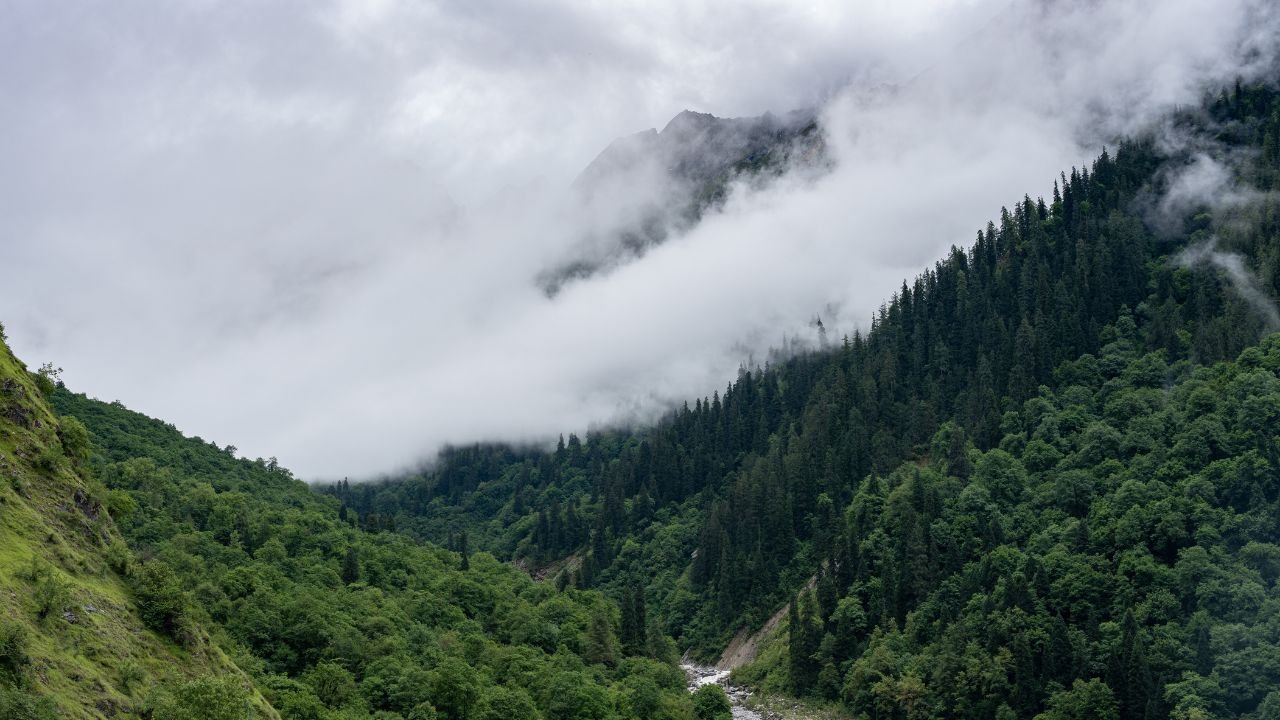
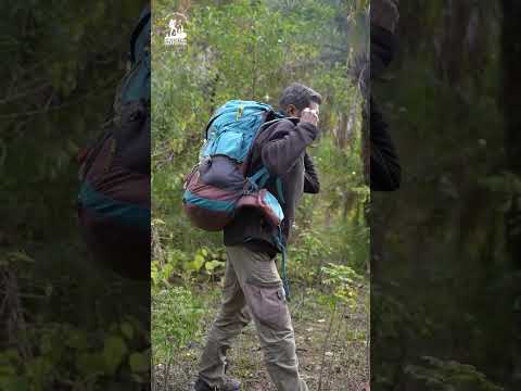
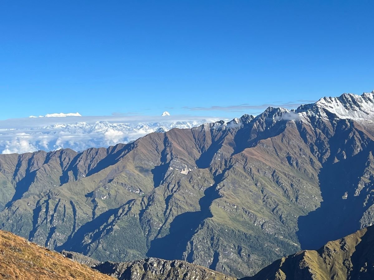
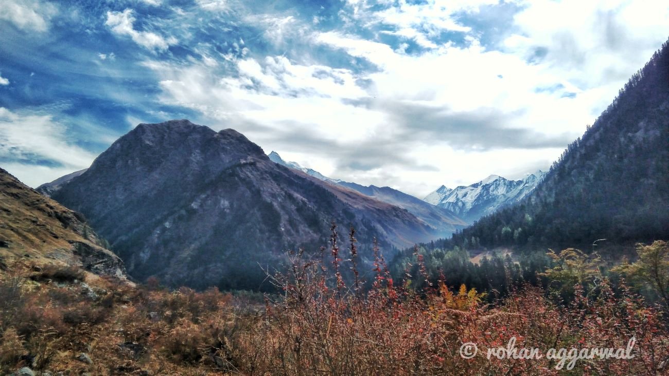
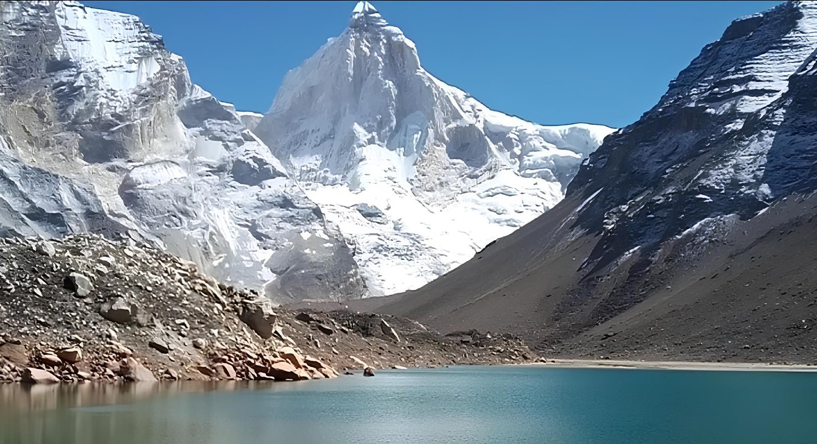
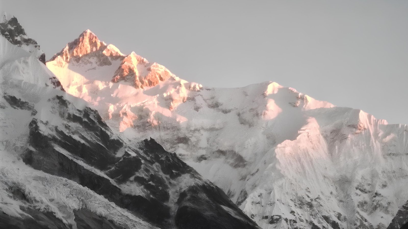
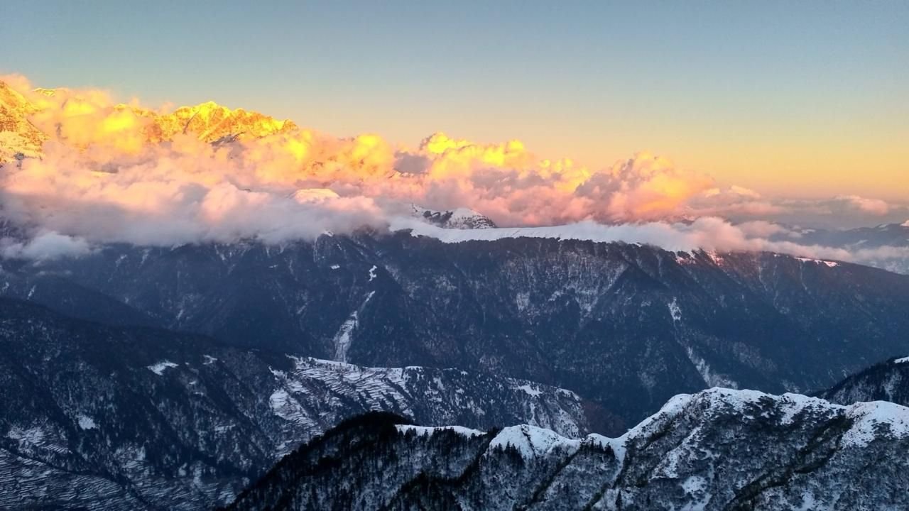
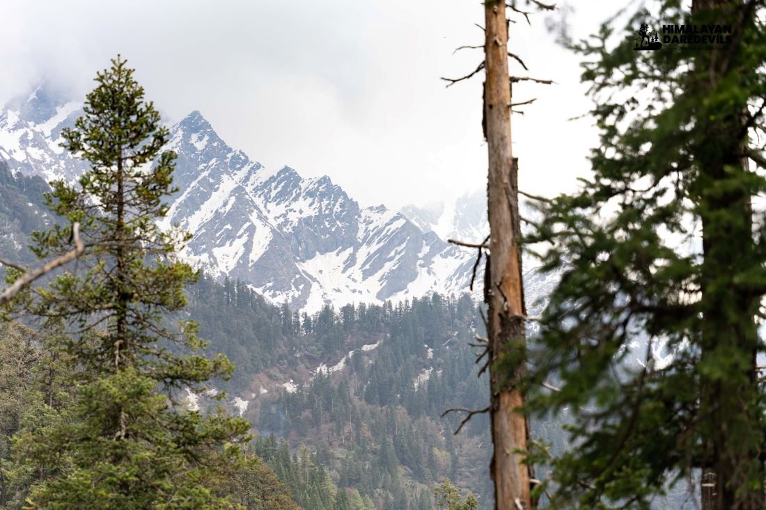
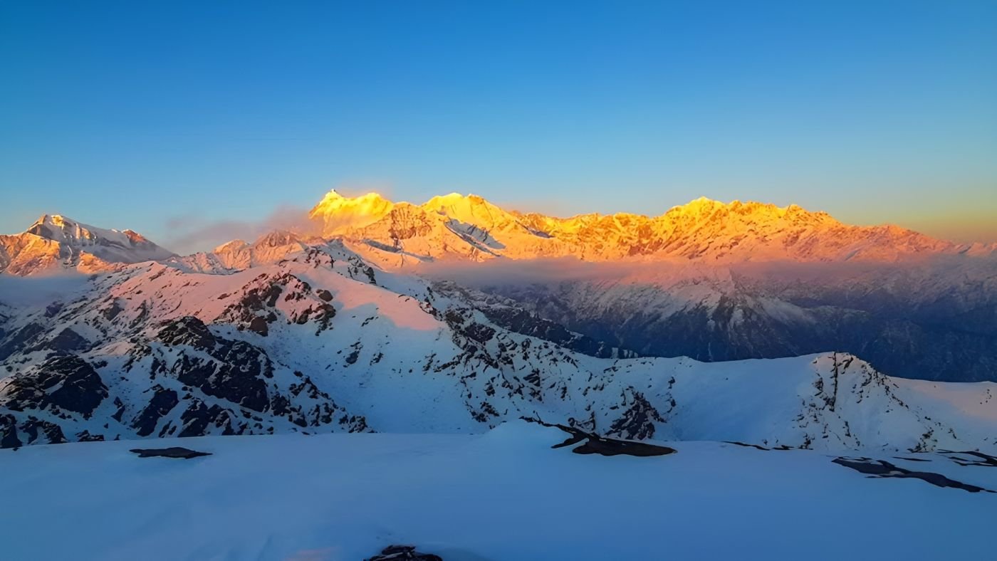
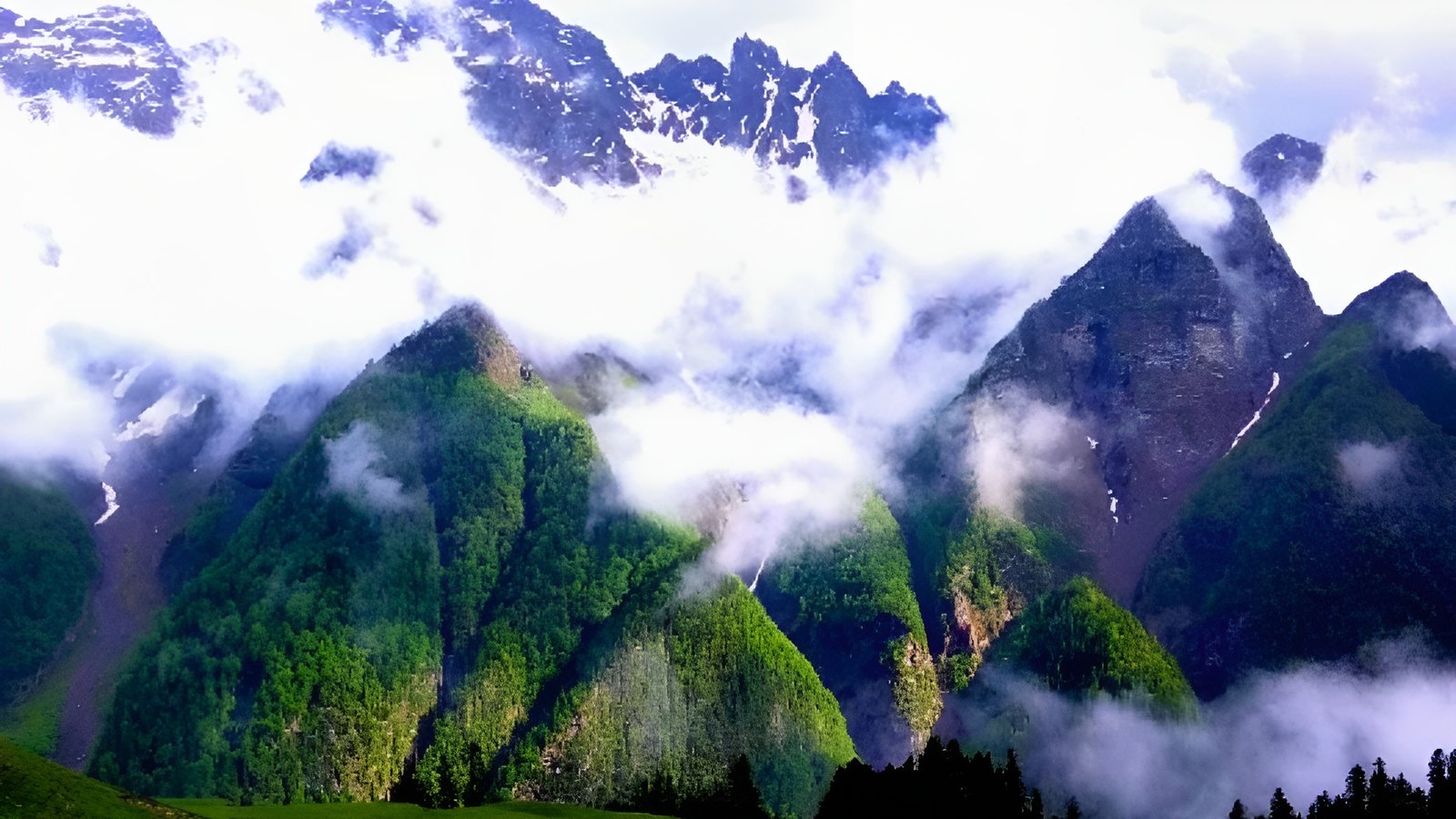
One of the most breathtaking and fulfilling Himalayan treks in the Garhwal Himalayas of Uttarakhand is the Ali Bedni Bugyal Trek, which encourages trekkers to embrace the area's natural beauty. Beautiful meadows, thick forests, and peaceful alpine lakes abound on this high-altitude trek, with views of snow-covered peaks such as Nanda Ghunti and Trishul. The trek rises to about 3,659 meters (12,000 feet) and is suitable for both experienced trekkers and beginners. It also offers insights into the local history and traditions. The trek starts from Lohajung, a scenic village that serves as the base camp. The trail passes through forests of oak, rhododendron, and pine, home to diverse flora and fauna. As the altitude increases, the views open up to majestic Himalayan landscapes. Trekkers also pass by remote mountain villages, providing opportunities to engage with local communities. While on the Bedni Bugyal Trek trekkers traverse through a diverse range of terrains, each with its unique character and charm. Below is a breakdown of the trail's primary terrain segments: Route: Lohajung to Wan Description: You find the charming village roads welcoming you at the beginning of the trek. Here you will find the charming mountain villages, cultivated step-farms, and traditional Garhwali homes. The trail here is relatively gentle and allows you to acclimatize and also enjoy the beautiful sceneries as you move ahead. The villagers with their smiling faces are known to invite the trekkers inside their homes for a quick tea and a chat about life in the city and village. You will get to cross cold water channels trickling down from the glaciers above, spot livestocks and get a glimpse of daily Himalayan life – making it a culturally enriching start to the journey before entering forested and high-altitude terrain. Dense Oak and Rhododendron Forests Route: Wan to Ghairoli Patal Description: You leave the warm embrace of the Himalayan villages and walk into the lush canopy of ancient oak, pine and rhododendron trees, offering a cool and mystical forest walk. The path will show you the himalayan flora and fauna, from vibrant flowers to colorful birds, a heaven for nature lovers. If you visit the trek during the spring time you will find the forest covered in fiery red of the crimson rhododendron flowers and in places there would be patches of pink flower covered trees. Though the trail is beautiful and cool, it can get slippery. You will also find sudden steep slopes that would test your physical fitness level. Rolling Alpine Meadows (Bugyals) Route: Ghairoli Patal to Ali Bugyal and Bedni Bugyal Description: This is the part of the trek that trekkers wait eagerly for, the most iconic stretch of the trek. As the forest clears up the alpine meadows known as bugyals can be seen, stretching far into the horizon, in the background the Trishul and Nanda Ghunti shine with their snow capped peaks shining like royal crowns. The grassy terrain is soft underfoot and ideal for camping. As you walk across the ridgelines, the sky opens up, and the air feels crisp. Sunrise and sunset here are unforgettable, often painting the meadows in golden hues. Rocky Ridges and Sacred Alpine Zone Route: Bedni Bugyal to Bedni Kund and towards Pathar Nachauni (optional extension) Description: The higher reaches of the trek take you to a totally different world, where low sunlight and harsh terrain make it difficult for vegetation to grow. The landscape becomes more rugged, with fewer trees and more rocky outcrops. The air is thinner, and trekkers begin to feel the altitude. The terrain is moderate but demands attention due to loose stones and increased wind exposure. This place also holds religious importance to the locals as this is the way to the Nanda Devi Raj Jat, a religious pilgrimage that takes place every 12 years Snow Terrain (Seasonal: Winter Variant) Route: Entire trail (Lohajung to Bedni Bugyal) during December–February Description: In winter, the trail transforms into a winter wonderland, but only the brave can witness the otherworldly beauty of this place as during the cold winters the trail is around five times more difficult to trek on. Meadows vanish beneath layers of snow, and the forests sparkle with frost. Walking becomes more strenuous, requiring microspikes or gaiters for grip. Although the trek becomes more demanding, the solitude and surreal beauty are unmatched. Only well-prepared or experienced trekkers should attempt this seasonal variant due to the risks of snowstorms and freezing temperatures. The Ali Bedni Bugyal meadow is known for its vast grassy expanses and seasonal wildflowers. It’s a popular camping site under starlit skies with panoramic views of Trishul and Nanda Ghunti. Another key highlight is Bedni Kund, a sacred alpine lake surrounded by high-altitude terrain, offering a serene and spiritual experience. Expansive Alpine Meadows - Ali and Bedni Bugyal The main attraction of the trek, two of the most beautiful alpine treks in India, standing at a height of around 3,300-3,500 meters. Each season offers a different color, covered in lush green grass during summer and golden hues in autumn, they offer an otherworldly experience. The vast meadows offer the perfect location to relax and look down at the green valleys and up at the snow capped mountains. The openness of the meadows against the backdrop of towering snow-clad peaks makes them perfect for camping, photography, and simply soaking in Himalayan serenity. Panoramic Views of Himalayan Giants The trek brings you closer to the Himalayan Giants that are the Mt. Trishul (7,120 m) and Nanda Ghunti (6,309 m). Once you reach Ali Bugyal these two giants show up and follow you everywhere. Nanda Ghunti is revered by the locals and looking at the majestic mountain many realise why it is so. On clear days, the morning light hitting Trishul creates a golden glow that trekkers often describe as the highlight of their Himalayan experience. There is no better feeling than waking up and coming out of your tent to see the majestic mountain covered up in snow. and having an Ali Bedni Bugyal guide by our experts ensures you don’t miss any of the best viewpoints or experiences. Sacred Bedni Kund You find the pristine Bedni Kund near the Bedni Bugyal. This lake holds spiritual significance and is linked to the Nanda Devi Raj Jat Yatra, a revered pilgrimage. It is a resting point of the Goddess Nanda on her symbolic journey to her husband’s abode, Mount Kailash. Even outside the pilgrimage years the site holds spiritual significance to the locals and the visitors. The beautiful alpine lake surrounded by the tall majestic mountains is a perfect spot to sit down and meditate about life, meaning and purpose. Ideal Campsite Under Starry Skies Ali and Bedni Bugyal are one the best sites to watch the starry skies above and see all the lights of the milky way galaxy. The remote location has no light pollution, flat meadows offering an unobstructed view of the midnight sky. The ideal trekking months are March to June and September to November, during the spring and autumn seasons. These months offer clear weather, mild temperatures, and vibrant natural scenery. The winter season brings snow, enhancing the beauty but increasing the difficulty, making it better suited for seasoned trekkers. Here’s a breakdown of what each season brings to help you choose the perfect time for your adventure: Temperature: Daytime: 16°C to 23°C (60°F to 73°F) Nighttime: 5°C to 10°C (41°F to 50°F) What This Season Offers: Summer/Monsoon (June to August) Temperature: Daytime: 20°C to 28°C (68°F to 82°F) Nighttime: 10°C to 15°C (50°F to 59°F) What This Season Offers: Autumn (September to November) Temperature: Daytime: 15°C to 22°C (59°F to 72°F) Nighttime: 2°C to 8°C (36°F to 46°F) What This Season Offers: Winter (December to February) Temperature: Daytime: 8°C to 12°C (46°F to 54°F) Nighttime: -5°C to -10°C (23°F to 14°F), especially at higher altitudes What This Season Offers:Starting Point and Trail Description
Village Paths & Cultivated Terraces
Terrain: Stone-paved village trails, farmlands, terraced fields
Terrain: Shaded, moist forest trail with earthy ground and moss-covered rocks
Terrain: Open grasslands, gentle ridges, undulating meadows
Terrain: Uneven ridges, rocky patches, exposed high-altitude terrain
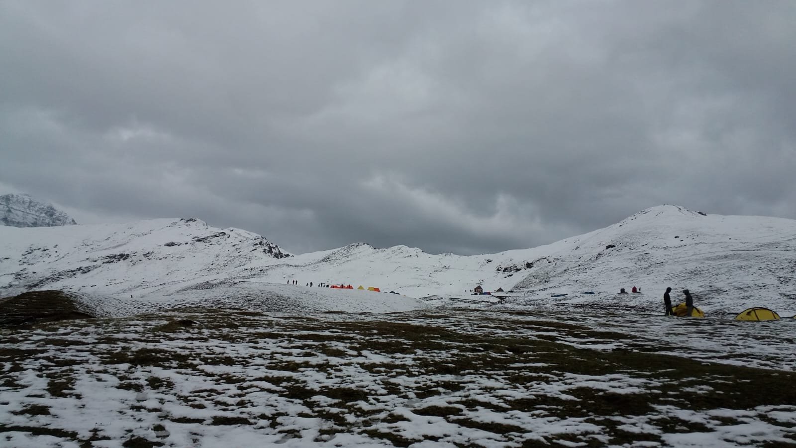
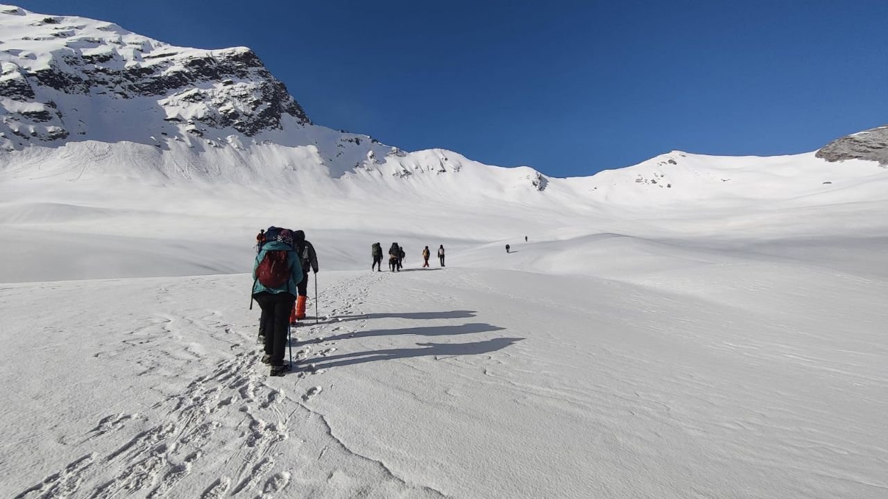
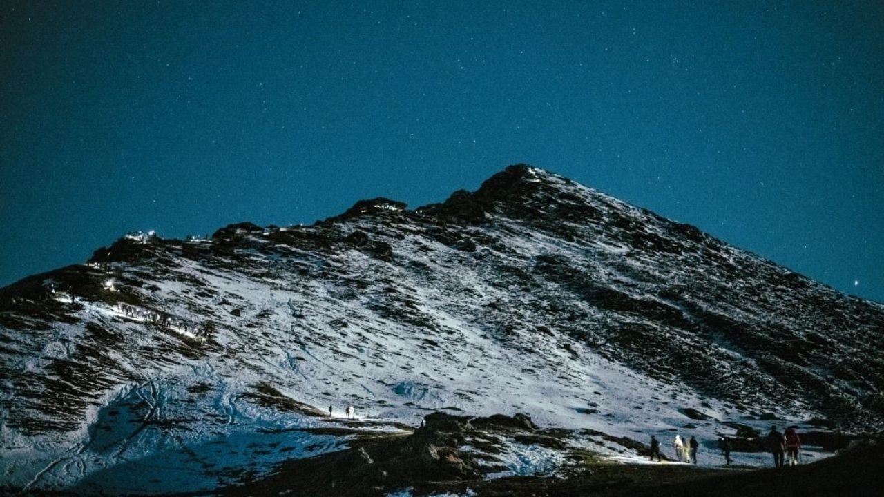
Terrain: Snow-covered trails, icy slopes, buried meadows.Highlights of the Ali Bedni Bugyal Trek
Best Time to Visit Ali Bedni Bugyal Trek
Spring (March to May)
Tips & Tricks For Ali Bedni Bugyal Trek by Himalayan Daredevils Expert Guide


Itinerary
Upon arriving, guests can enjoy a breathtaking long drive of roughly 7-8 hours which introduces them to various green mountains and hills that eventually lead them to the base camp of Lohajung at the end of the journey where one’s sight is filled with views of the Garhwal Himalayas.
On the other hand, throughout the journey, the sight of Nanda Ghunti peak can be witnessed while the village offers a calm environment in order to acclimatize before beginning the trek.
In Lohajung, there are 7-8 villages close which gives the chance to experience the local culture and also indulge in some shopping for various trekking essentials.
In those moments, settle down at Lohajung enjoy the beautiful landscapes, and prepare yourself mentally for the trek.
SHORT ITINERARY:
DETAILED ITINERARY:
The first step towards the Ali Bedni Bugyal is a picturesque drive that takes you to Lohajung, the base camp of the trek. The distance is nearly about 190 kilometers and it is said to be one of the most beautiful tours one can imagine. After Nainital, the road passes through green hills and crooked mountain passes with views of the Garhwal Himalayas in the distance, especially on sunny days. It takes about 7 - 8 hours with the hills being replaced by forests as you get closer to Lohajung.
As soon as you set your eyes on Lohajung, the mesmerizing Nanda Ghunti peak welcomes you. Lohajung is a quaint little village situated at the intersection of multiple mountain ranges, and there's a handful of other villages in the vicinity - around 7-8. The scenic beauty of the village is famous and it makes for an excellent place to get adjusted before getting to the trekking part. Although a few local boutiques do sell trekking materials such as jackets, gloves, and shoes, it is recommended that before one comes here, these pieces of stuff be taken along.
To get to the beginning of your trek, you will need to get into a car for about 45 minutes which will take you from Lohajung to Wans: what a ride!
After some time of trek, ancient cypress trees will come into your line of sight as well as two trails. One of them goes to the temple of Latu Devta.
Lohajung, Wan, and the valley can all be seen and enjoyed at the same time after approximately 30-45 minutes climbing Ranaka Dhar.
Continue your trek through the beautiful forest of oaks and rhododendron trees until you reach Gehroli Patal campsite where a stunning view of Mt. Trishul awaits you.
SHORT ITINERARY:
DETAILED ITINERARY:
To begin your journey, you take a motor vehicle from Lohajung to Wan. This takes around 45 minutes.
The first road from Wan is cemented and runs through a few houses. After 15 minutes of your trek, there is a small group of cypress trees that are centuries old! It would take four people to go all the way around the tree! Give it a try and wrap yourself around it.
From this point, two marked trails are visible. One goes straight on towards the ridge. The other one is a lateral distance from the shrine of Latu Devta temple. This local hero is Latu Devta who is locally worshipped to guard the area. The mountain folks worship him before venturing onto higher reaches during Nanda Devi Jat Yatra. Listen to the temple bells here and schedule the safe trek before returning to the ascending route towards the ridge of Ranaka Dhar. It takes 30-45 minutes to move upwards from Wan to Ranaka Dhar. At the time when Ranaka Dhar is reached, enjoy the sights of Lohajung, Wan, and the valley under it!
Hereafter, there is a gentle slope to the famous Neel Ganga. The bridge on Neel Ganga can be described as perfect for a relaxing moment. Trees cover the river and the water cascades over rocks in the shade. The water here is soothing and quite cool.
The breathtaking gradual climb to Gehroli Patal, the first campsite, starts at this very spot. The trail which gently winds its course now traverses Oak and Rhododendron trees and the route is covered with layers of dry leaves crumbling and crackling under your trekking shoes. Among the various flora that you will come across on this ascent include walnuts, pears, Himalayan roses, and other varieties. You may even see birds like a flycatcher, magpies, and some others. Do be attentive.
This is an approximately 3-hour trek that takes you to a beautiful grooved area with a green trekkers’ hut and Trishul hilly peak in its vicinity. This is then, Gehroli Patal.
If the day is free of clouds you will get remarkably clear sights of Mt Trishul overshadowing the entire region. This is the place to make your camp for the night.
As you keep moving up, cross the oak and rhododendron forests and come to the bedni bugyal with its meadows and bedni Kund in the background.
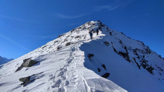
Walk for some time and you will come to Bedni top, the highest altitudinal point of the trek with fantastic views of Mount Trishul and Mount Nanda Ghunti.
Be aware of abrupt changes in weather cold, sun shining bright makes way for clouds with sporadic rains.
Move in the direction of Ali Bugyal, a large meadow full of horses grazing. From here head on up towards the Abin Kharak campsite, situated on the ridge
SHORT ITINERARY:
DETAILED ITINERARY:
Carry on with your trek and go to the top of the climb where the oak and rhododendron forest is located. A cyclone traces the vertical bars and rather follows them beyond the tree density straight till you reach Bedni Bugyal. In the extreme distance but still hundreds of meters away is located the famed Bedni Kund.
From here, simply go 800 meters straight ahead and you will have arrived at a great vantage point that is the highest point on the trek which is Bedni Top. The greatest views are at the top of the hill. Mt Trishul and Mt Nanda Ghunti all at that time are right in front of you.
The climate in the vicinity is changeable, with shifts that seem haphazard and can be quite breathtaking. The warm, golden sunshine is one moment present, but the following moment clouds rush in delivering a distinct gloom to the area.
Upon attaining Bedni Top, one would start traversing down towards the main trail. This is the same path used by the other trekkers as well while embarking on the well-known Roopkund Trek, however, today your direction changes towards Ali Bugyal. Paces after following the ridge, the slope becomes gentler while the horizon transforms into mesmerizing panoramic scenes of the vast stretches of meadow.
You are only two kilometers away from Ali Bugyal, which is approximately the same height as Ali Bugyal. It is just two kilometers away. There is beauty here; clouds tumble slowly up the ridge and now and then scatter over the tops of mountains. Herds of horses graze on the meadows at ease while foals dash about without a care in the world and move unchallenged across the wild terrain.
Your journey does not stop here as you are en route to Abin Kharak campsite towards the left of the ridge.
Start the day by enjoying the view of rolling hills and large green plains and feeling the urge to walk on grass with no shoes to bother you.
Start descending from Abin Kharak.
Approximately 1.5 to 2 kilometers later, turn left, and you will see a mountain which is the last piece of the landscape making the descent a sight to behold.
The path goes through thick oak and rhododendron forests to Didna and beyond where there are nice views of Lohajung Kulling and Wan over the clear stream making it an ideal camping site.
SHORT ITINERARY:
DETAILED ITINERARY:
Take a breath in the morning and let your eyes wander across the beautiful rolling hills over the fields of Ali Bugyal. If you feel the urge to get rid of your slippers and touch the ground with your bare feet, do not resist!
You are right at the edge of a ridge that stretches in all directions like an umbrella. So many square kilometers of green pastures have been carved out from the elevations of the mountain.
Today’s walking goes down from Abhin Kharak to Didna village, during which scenic cotton fields and valleys provide wonderful landscapes.
After taking this breakfast, where you stop at Abhin Kharak, after a distance of around 1.5 km, an unusual feature of the landscape comes into view. So, for a distance of about 1.5 - 2 kilometers, you should gaze straight across to your left. Quite some distance away, one can see the mountaintop you should look out for. As you go down the hills, which is interesting, don’t forget to turn back and witness the sight. This will be followed by a further descent to Tolpani. Here, the woodland continues to adorn the pathway on both sides.
The drop, however, is a pleasant one as it goes through some of the thickest oak and rhododendrons that you will ever see. Below you is a massive brown carpet that is a horizontal layer of leaves. The jungle keeps transforming thunderously every thirty minutes and perhaps is one of the least polluted areas till Didna.
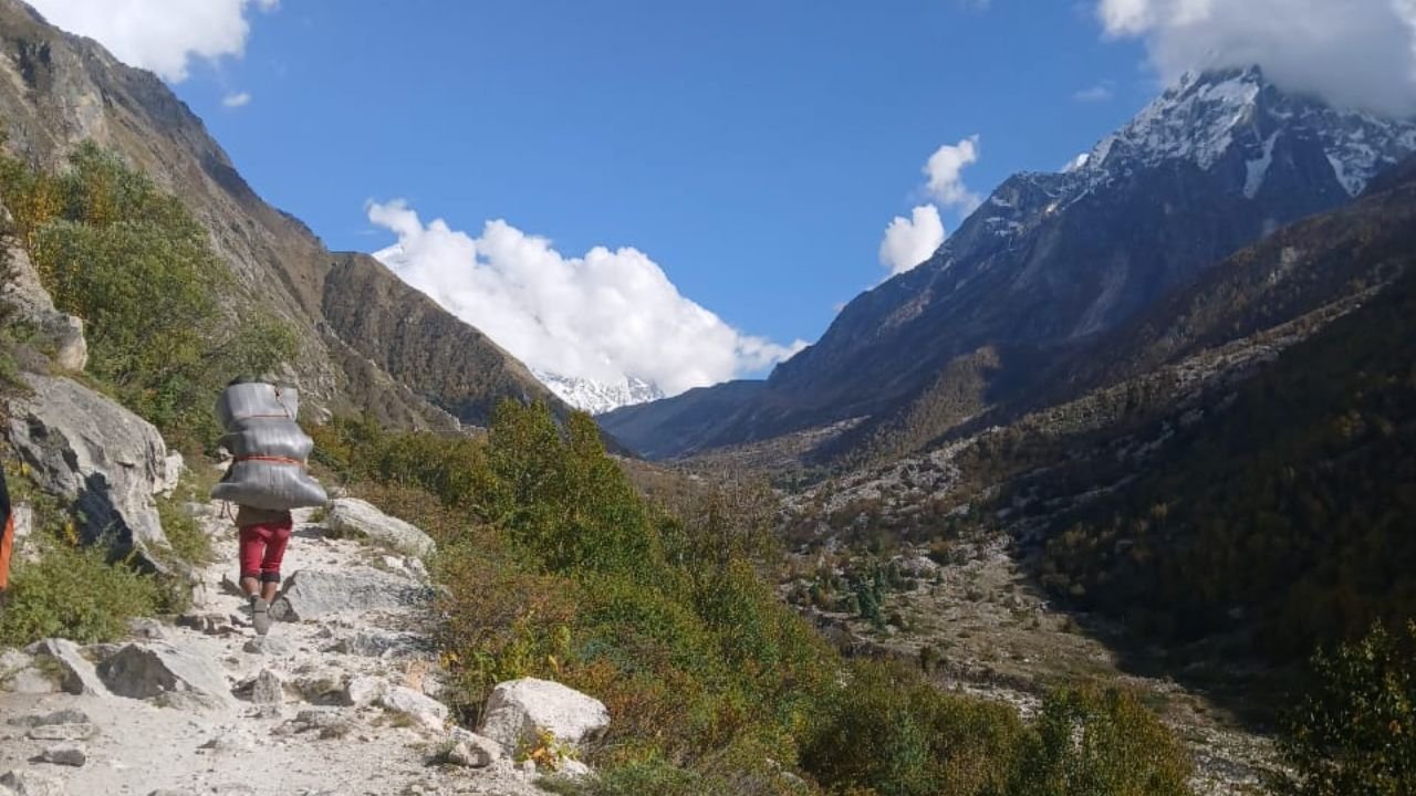
To the right of Didna stretches a clear stream and an ideal campsite. The camping activities around this identified site offer you an opportunity to check into one of the most isolated villages in Uttarakhand. Right across the valley, Lohajung, Kulling, and Wan spanned in a sweep from left to right.
From Didna village, the trek attacks downhill with steep zig-zag turns towards a meadow that is about 200 feet down, along the outer portions of the village as well as the nearby woods.
While going down, appreciate the rhododendron, reaching the iron bridge over the river bringing a welcome end to the trek.
After the bridge, notice the River Wan, in the midst of Bedni Ganga by Raun Bagad, a picturesque riverbank ideal for sitting back and enjoying the mingling of two water bodies.
From Raun Bagad, two paths are available, one goes to Kulling along the steep gradient and the other through scenic woodlands to Lohajung, the latter would reach by early afternoon for an afternoon nap which was much expected
SHORT ITINERARY:
DETAILED ITINERARY:
Start walking to the right and descend the steep zig-zag down the slope from Didna village, now it is time to head towards a meadow which is located about 200 feet vertically below Didna village. The route passes around the outer limits of the village, taking you around the edge of the woods, where your legs may start to feel fatigued due to the sudden change in altitude. You will also be able to enjoy the melody of nature as it displays thrush calls, and swallows dash through the rhododendrons and other trees. The path slopes down and the iron bridge appearing over the river comes into focus marking the midpoint of the trek.
Just after crossing the bridge comes Raun Bagad, a riverbank location.. At this point, you will be able to lay back and watch the Wan River swell and collide with the Bedni Ganga. This location offers both calm and dramatic beauty with the steep and narrow valley and high cliffs as a backdrop.
It takes about two hours to hike from Raun Bagad to reach Lohajung. The initial trek takes you to Kulling which is a small village located on the hill slopes looking over the Wan River. This particular path is quite strenuous and steep thus making it possible to climb quickly but is also quite taxing. The village is sparse, consisting of twenty houses or so and is surrounded by lush green terraced fields. The second trail on the other hand is more scenic as it leads through thick woods which offer lunch breaks at picturesque sites on a slow but steady incline towards Lohajung. By early afternoon this path brings you to Lohajung where you will relax after an enjoyable day of trekking.
On Day 6, drive from Lohajung to Rishikesh covering a distance of more than 200 km in about 8-10 hours.
Take a more scenic route which includes hills and valleys which also comprise a small village with terraced farming.
Mountainous ranges are visible as the clouds fade away and the greenery makes way for the Ganges River.
Head to Rishikesh and contemplate your experiences throughout the trek involving a remarkable Ali Bedni Bugyal.
SHORT ITINERARY:
DETAILED ITINERARY:
Begin your return on Day 6 as you drive back to Rishikesh from Lohajung, slightly over 200 km. The drive is long, taking anywhere from 8 – 10 hours, making it quite a pleasant one as well as there are hills and valleys to gaze upon. The smooth curves of the roads pass through little settlements, stepped agriculture as well as wide green stretches. With the view of the mountains behind, it is now the range of hills all along that bring the outline of the Ganges river as one closes in on Rishikesh. It has been a long day for you and as you put your feet up, the memories of the Ali Bedni Bugyal Trek will surely come flooding.
Ali Bedni Bugyal Trek Map
Reviews Videos


Inclusions
Exclusions
1. Meals while on trek (Veg).
2. All necessary entry fees and permits.
3. Accommodation: - Guest house, Home stay, camping during Trek.
4. Mountaineering qualified & professional trek Leader, guide, cook and Support staff.
5. First aid medical kits, stretcher and oxygen cylinder.
6. Trek equipment: Sleeping bag, mattress, tent, kitchen & dinning tent, toilet tent, utensils and crampon (if required)
7. Staff Insurance.
8. Porters/mules to carry central equipment.
1. Any kind of personal expenses.
2. Food during the transit.
3. Mules or porter to carry personal luggage.
4. Insurance.
5. Any kind of emergency evacuation charges
6. Anything not specifically mentioned under the head.
7. Transport (Non Ac)
8.Any expense incurred or loss cost by reasons beyond our control such as bad weather, natural calamities (landslides, floods), flight delays/rescheduling/ cancellations, any accidents/medical evacuations, riots/strikes/war/pandemics etc.
What to carry
- Trekking shoes: A good pair of trekking shoes is essential for a comfortable and safe trek. Look for shoes that are sturdy, provide good ankle support, and have a good grip on different types of terrain.
- Backpack with rain cover (50-60 ltr): A backpack is necessary to carry all your gear. Make sure it's the right size for your trek, and comes with a rain cover to keep your belongings dry in case of rain.
- Thermals (upper and lower): Thermals are lightweight and comfortable base layers that help regulate your body temperature in cold weather. Bring both upper and lower thermals to keep warm.
- 3 T-shirts (advisable quick dry): Choose quick-drying T-shirts made from breathable and moisture-wicking materials. This will help keep you cool and dry during your trek.
- 2 trek pants: Choose lightweight and comfortable trek pants that are easy to move in and can dry quickly if wet.
- Jacket (-10 degree): A warm jacket is essential for cold weather. Choose a jacket that is waterproof and windproof, and provides good insulation.
- Fleece or hood (2): Fleece jackets or hoodies are great mid-layer options to keep warm. Bring at least two, as they can also be used as an extra layer at night.
- Sunglasses (UV protected): Protect your eyes from the sun's harmful UV rays with sunglasses that are designed for outdoor activities.
- Sun cap: A sun cap or hat with a brim will protect your face and neck from the sun.
- Hand gloves: Bring a pair of lightweight gloves to keep your hands warm and protected from wind and sunburn.
- Woollen cap: A woollen cap will keep your head and ears warm at night or in cold weather.
- Socks (3 pairs min): Bring at least three pairs of good quality socks that are moisture-wicking and provide good cushioning and support for your feet.
- Headlamp: A headlamp will come in handy if you're hiking in low-light conditions or need to find your way in the dark.
- Trekking pole (if needed): Trekking poles can help reduce strain on your legs and provide additional support on steep terrain.
- Rain cover\poncho: A rain cover or poncho will keep you and your gear dry during unexpected rain showers.
- Day pack (if you plan to offload your bag): If you plan to offload your backpack during the trek, bring a smaller day pack to carry essentials like water, snacks, and a first aid kit.
- A toiletry kit: Bring a small kit with personal hygiene items, such as a toothbrush and toothpaste, wet wipes, hand sanitizer, and toilet paper.
- Lunchbox, cup, spoon: If you plan to bring your own food, bring a lunchbox, cup, and spoon to carry and eat your meals.
- 2 one-litter bottles: Staying hydrated is crucial, so bring at least two one-liter bottles to carry water.
- 2-3 plastic covers to keep your wet or used clothes: Plastic bags are useful for keeping wet or dirty clothes separate from the rest of your belongings. They can also be used to pack out any trash or waste you generate during the trek.
How to reach
Reaching Rishikesh (Nearest Major Transit Hub):
By Train:
From Delhi:
Board the Nanda Devi Express (12205) from Hazrat Nizamuddin at 11:50 PM, arriving in Haridwar by 4:00 AM. From Haridwar, Rishikesh is a 45-minute to 1-hour drive by taxi or bus.
Alternatively, take the Dehradun Shatabdi (12017), which departs New Delhi at 6:45 AM and reaches Haridwar by 11:30 AM.
From Chandigarh:
Board the Chandigarh–Haridwar Intercity Express (14609) departing at 4:10 PM, arriving at Haridwar around 9:30 PM. Continue onward to Rishikesh by taxi or local bus.
By Bus:
From Delhi (ISBT Kashmere Gate):
Overnight Volvo and deluxe buses to Rishikesh and Haridwar operate daily. Travel time is approximately 6 to 8 hours.
Buses drop you at Rishikesh ISBT or Tapovan; local taxis are available for onward travel.
From Chandigarh:
Direct buses to Haridwar/Rishikesh take about 5 to 7 hours. Private taxis or shared cabs also operate along this route.
Rishikesh to Lohajung (Trek Starting Point)
Distance: Approx. 250 km
Travel Time: 10 to 12 hours
Transport:
Hire a private taxi from Rishikesh to Lohajung for the most convenient and flexible travel.
Shared jeeps may be available via Karanprayag and Dewal, but may require multiple changes.
Route Overview:
Rishikesh → Devprayag → Srinagar (Uttarakhand) → Rudraprayag → Karnaprayag → Tharali → Dewal → Lohajung
The route follows the scenic Alaknanda River valley and offers views of Himalayan peaks, terraced villages, and confluence points of sacred rivers. Road conditions vary, with winding mountain stretches after Karnaprayag.
Additional Notes:
Best Time to Travel: Roads remain open year-round, but the best travel conditions are between March to June and September to November.
Altitude of Lohajung: Approx. 2,300 meters — it’s important to rest and acclimatize before starting the trek.
Accommodation: Basic guesthouses and homestays are available in Lohajung.
Trek Start: Ali Bedni Bugyal trek begins from Lohajung, moving through picturesque forests and high alpine meadows.
Fitness and preparation guide for Ali Bedni Bugyal Trek
Trekking, especially in mountainous terrain, requires more than just endurance — it involves strength, balance, flexibility, and cardiovascular fitness. Here's a detailed guide to each area of fitness, with suggested exercises to build capability:
1. Cardiovascular Endurance
Why it matters:
Long trekking days involve continuous walking, often at high altitudes. Good cardio ensures your heart and lungs can handle prolonged exertion and thinner air.
Recommended Exercises:
Brisk walking or hiking – Practice on inclines or trails
Running or jogging – Build stamina over time
Cycling – Strengthens leg muscles while improving endurance
Stair climbing or using a stair machine – Mimics uphill trekking
Jump rope – Boosts cardio and footwork
Training Tip: Aim for at least 30–60 minutes of cardio, 4–5 days per week, gradually increasing intensity and duration.
2. Leg and Core Strength
Why it matters:
Strong legs help with uphill climbs and carrying weight, while core strength stabilizes your body, improves balance, and prevents injuries.
Recommended Exercises:
Squats and lunges – Build leg strength and endurance
Step-ups with weight – Mimic hiking with a backpack
Deadlifts – Develop posterior chain (glutes, hamstrings, lower back)
Planks (front and side) – Improve core stability
Mountain climbers – Combine core work with cardio
Training Tip: Do 2–3 strength sessions per week with moderate weights and high reps to build muscular endurance.
3. Balance and Stability
Why it matters:
Uneven terrain, rocky paths, and slippery slopes require excellent balance to prevent falls and injuries.
Recommended Exercises:
Single-leg stands (with eyes closed for a challenge)
Bosu ball squats – Improve joint stability
Lateral lunges – Strengthen stabilizing muscles
Balance board exercises – Train your ankle and knee stability
Yoga poses like Tree Pose or Warrior III
Training Tip: Incorporate balance drills 2–3 times a week, ideally at the end of strength or cardio sessions.
4. Flexibility and Mobility
Why it matters:
Flexible muscles and mobile joints help you navigate steep ascents, descents, and awkward steps more comfortably and safely.
Recommended Exercises:
Dynamic stretches – Leg swings, hip circles before activity
Static stretches – Hamstrings, quads, calves, hips post-exercise
Foam rolling – Release tight spots in muscles
Yoga or mobility flows – Improve range of motion and recovery
Training Tip: Dedicate 10–15 minutes after each workout to stretching, and consider one full yoga or mobility session weekly.
5. Mental Stamina and Discipline
Why it matters:
Trekking can be mentally demanding, especially during long climbs, fatigue, or bad weather. Mental toughness helps push through discomfort.
Recommended Practices:
Long hikes with a loaded backpack – Simulate trek conditions
Cold exposure (ice baths/showers) – Train mental resilience
Breathing exercises or meditation – Improve focus and emotional control
Set training goals and stick to a routine – Build discipline
Training Tip: Practice hiking in varied weather and terrain to get used to discomfort and learn how to manage your mindset during challenges.
Bonus: Pack Training
Why it matters:
Carrying a backpack with gear or supplies during a trek requires specific conditioning, especially for your shoulders, back, and hips.
Recommended Exercises:
Weighted hikes or stair climbs – Start with light loads, gradually increase
Farmer’s carry – Grip and core strength
Back extensions – Strengthen lower back
Shrugs and rows – Support shoulder and upper back endurance
FAQ
The Ali Bedni Bugyal trek is a moderate trek. The trek involves gradual ascents through forests and meadows, with some steep sections. While it is suitable for beginners with basic fitness levels, trekkers should be prepared for altitude gain and challenging terrain at higher elevations.
While trekking Ali Bedni Bugyal trek you will witness breathtaking views of snow-capped peaks like Nanda Ghunti and Trishul. Key highlights include walking through lush green meadows (bugyals), dense oak forests, and panoramic vistas. The trek also passes through quaint villages like Ali and Bedni, known for their scenic beauty and cultural richness.
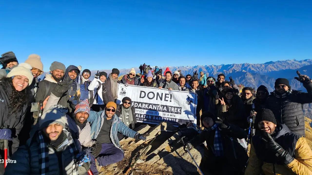
Yes, it is advised to hire a trekking guide. Even though Ali Bedni Bugyal trek is well-marked, hiring a guide is highly recommended, especially for first-time trekkers. A guide ensures safety, aids with navigation, and provides local knowledge about the area’s culture, flora, and fauna. It’s also useful for managing any unforeseen challenges during the trek. Consider Himalayan Daredevils for your trekking adventure.
The starting point of the Ali Bedni Bugyal trek is the village of Lohajung, located in the Uttarakhand state. To reach Lohajung, one can travel from Rishikesh by bus or taxi. It takes about 10-12 hours from Rishikesh to reach Lohajung by road.
The Ali Bedni Bugyal trek generally takes about 6 to 7 days, depending on the itinerary. This includes acclimatization and rest days to adjust to the altitude. The trek covers a total distance of around 35 to 40 kilometers, with daily walks averaging 5 to 7 hours.
The best time to trek to Ali Bedni Bugyal is from pre- monsoon (May to June) and post - monsoon ( September to October). During these months, the weather is clear and pleasant, with moderate temperatures and minimal rainfall. These periods provide the best views of the snow-capped peaks and lush meadows.
For the Ali Bedni Bugyal trek, pack essentials such as warm clothing, trekking boots, a sleeping bag, a raincoat, a first-aid kit, a water bottle, sunscreen, a hat, and snacks. Don’t forget a camera to capture the scenic beauty, along with a headlamp and trekking poles for added support. These are essential items, if you hire a guide they will provide you with gears for smooth trekking.
It is not recommended to pack a laptop for the Ali Bedni Bugyal trek. The trek involves rugged terrain and remote areas, where carrying extra weight can be a problem. It’s best to focus on essentials like clothing, equipment, and food to ensure a comfortable trekking experience. With extra and expensive luggage you will be tensed about your belongings and will miss the views of the stunning nature.
The maximum altitude of the Har Ki Dun trek is around 3,566 meters (11,700 feet) at the Har Ki Dun Valley. The trek takes you through scenic valleys and beautiful meadows, but the altitude remains moderate compared to some higher Himalayan treks, making it more accessible for you.
When trekking, it’s ideal to carry around 8 to 10 kg of weight in your backpack. This includes your essentials like clothing, a sleeping bag, food, and water. Don't over weigh the while packing. To enjoy a trek you need to be cautious about the weight you are taking with yourself.
Temperatures range from 5°C to 18°C during the day and can drop to 0°C or below at night, depending on the season.
Yes, forest entry permits are required. Reputable trek operators usually arrange these.
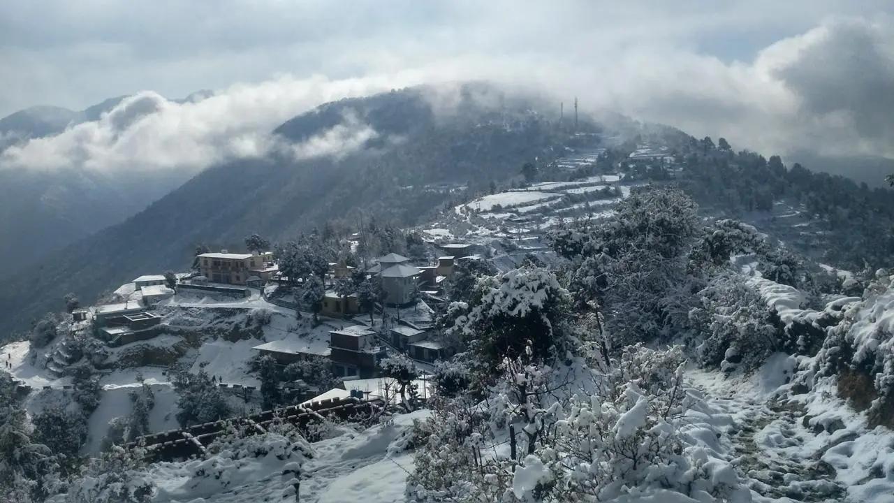
Winter trekking is possible but not recommended for beginners because heavy snowfall can make the trail difficult.
Yes. With experienced guides and organized groups, the trek is safe even for solo travelers.
Cancellation policy
Life is unpredictable and we understand sometimes you have to cancel or change your trip dates and it is our endeavour to make it as easy possible for you. However, please understand we plan everything including guide fees, permits, accommodation and ration in advance. Therefore any cancellation means inconvenience and certain losses to the people involved in various stages of programme. Keeping that in mind, our cancellation charges are as below-
Cancellation prior to 30 days from start of the event: Get monetary refund with 15% of cancellation charges on trek fee.
Cancellation between 30 days and 15 days to the start of event: 50% on trek fee is non refundable and the remaining 50 % will be given as cash voucher which is valid for 1 year.
Cancellation less than 15 days to the start of event: No refund.
Please note cancellation will be only accepted by email.
Booking amount is non refundable
Note: The Himalayan Daredevils reserves the right to cancel a programme before departure in the event of logistical problems arriving due to natural calamities, strikes, wars on any other circumstances that makes the event inadvisable. In this case, 50% on trek fee is non refundable and the remaining 50 % will be given as cash voucher which is valid for 1 year.
Itinerary changes & trip delays:
We plan itineraries based on the information at the time of planning and in rare circumstances, there are subject to change. In the event that the itinerary is changes or delayed due to unforeseen circumstances such as bad weather conditions, transportation delays, government intervention, landslides etc. We will always aim to give you the best experience possible. However The Himalayan Daredevils are not be held responsible for the cost of delay or changes.
Why Choose Us
Our Best Performance
50,000+
Trekkers
PAN India Treks
250+
Treks
Professional
and Experienced Staff
Best
Grade Equipment
Well Organised
Trek Itineraries
Related Blogs
Read and get more about our treks
Roopkund Trek: Detailed Itinerary, Trekking Essentials & Best Time to Visit
Harkidun Trek: Detailed Itinerary, Trekking Essentials & Best Time to Visit
Bali Pass Trek: Detailed Itinerary, Trekking Essentials & Best Time to Visit
Gaumukh Tapovan Trek: Detailed Itinerary, Trekking Essentials & Best Time to Visit
Kedartal trek: Detailed Itinerary, Trekking Essentials & Best Time to Visit
Goechala Trek: Detailed Itinerary, Trekking Essentials & Best Time to Visit
Why Kuari Pass Trek Should Be on Every Trekker’s Bucket List
Why Kedarkantha Peak is a Dream Destination for Trekkers
Complete Guide to the Brahmatal Trek Route and Itinerary
Top 5 Reasons Why Dayara Bugyal Trek Should Be Your Next Himalayan Trek
Discover the Best Himalayan Trekking Shoes
Best Time for Ali Bedni Bugyal Trek: Season-Wise Guide for Trekkers

Top 10 treks to do with friends
Top 10 Reasons to Choose Buran Ghati Trek This Season
Which is Better: Pangarchulla Peak Trek or Kuari Pass Trek?
Why is Kedarkantha Trek Called the ‘Queen of Winter Treks’ in Uttarakhand?
Kedarkantha Trek vs Brahmatal Trek: Which Winter Trek in Uttarakhand is Better?
Affiliated and Recognised by


Download Our Apps