Starting From
19,205
16,700.00

Starting From
19,205
16,700.00

Starting From
19,205
16,700.00
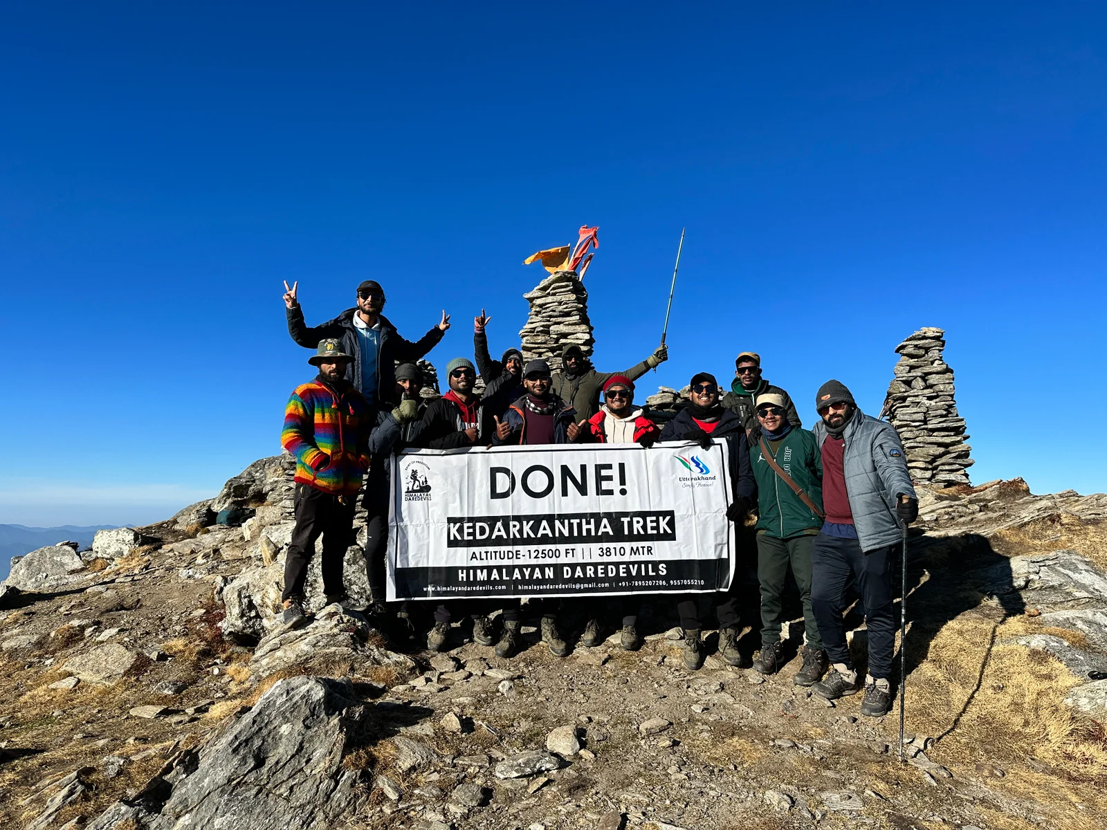
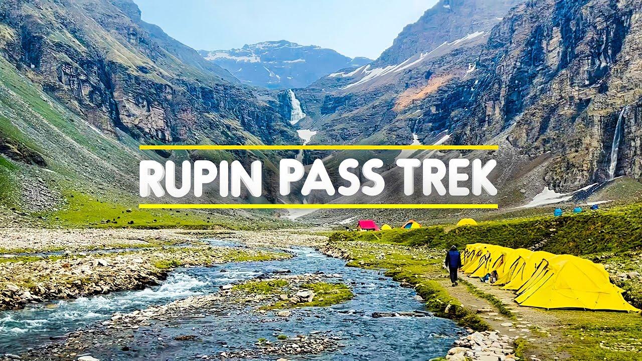
Rupin Pass Trek (388+ Reviews)
A cross over trail through passes
Kalka is the nearest rail head to Shimla and from Dehradun its Dehradun Railwaystation
Jubbarhatti airport which is 22Km away
Jiskun
May, June and Sep, Oct
Jiskun to Sangla
Veg
Hotel/Homestay/Camping
Himachal
7 Days
Moderate
15350 Ft
43 Km
Rupin Pass Trek Overview
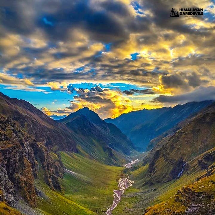
The Rupin Pass Trek is one of the most thrilling and scenic rupin pass trekking experiences and high-altitude trek in the Indian Himalayas, known for its dramatic landscapes and adventurous trail. Spanning approximately 65 kilometers, this trek is regarded as one of the grandest crossover treks in India, connecting deep Himalayan valleys with breathtaking mountain passes.
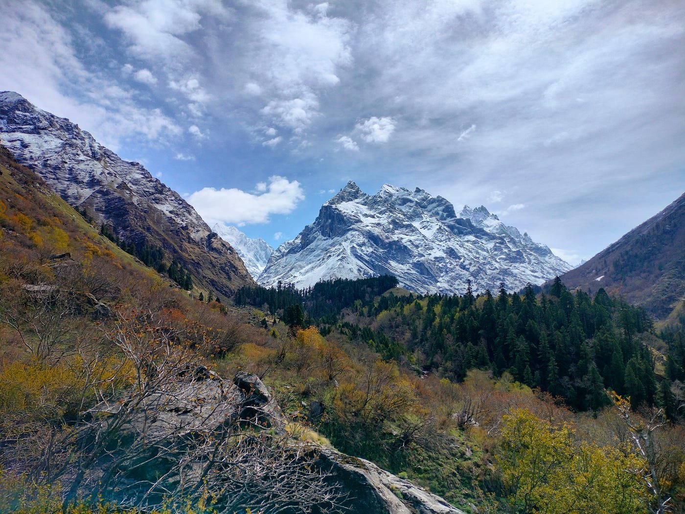
From dense forests of pine and rhododendron to vast alpine meadows and towering waterfalls, the Rupin Pass trek offers constant changes in terrain and scenery. Trekkers cross remote hanging villages, walk alongside roaring rivers, and navigate narrow, steep gullies as they ascend toward the majestic Rupin Pass. Each turn of the trail unfolds like a theatre curtain, revealing stunning views of snow-capped peaks, expansive valleys, and ever-changing Himalayan skies.
Perfect for adventure enthusiasts seeking both challenge and beauty, rupin trek delivers an unforgettable journey through some of the most diverse and dramatic landscapes of the rupin pass trek the Himalayas experience.

Why Should You Trek To The Rupin Pass?
Trekking to the Rupin Pass is more than just reaching a high mountain pass—it is a complete Himalayan adventure that unfolds with new surprises at every stage. Known for its constantly changing landscapes, dramatic climbs, and remote beauty, the Rupin Pass Trek is one of the most rewarding crossover treks in India.
A Trek That Keeps Surprising You
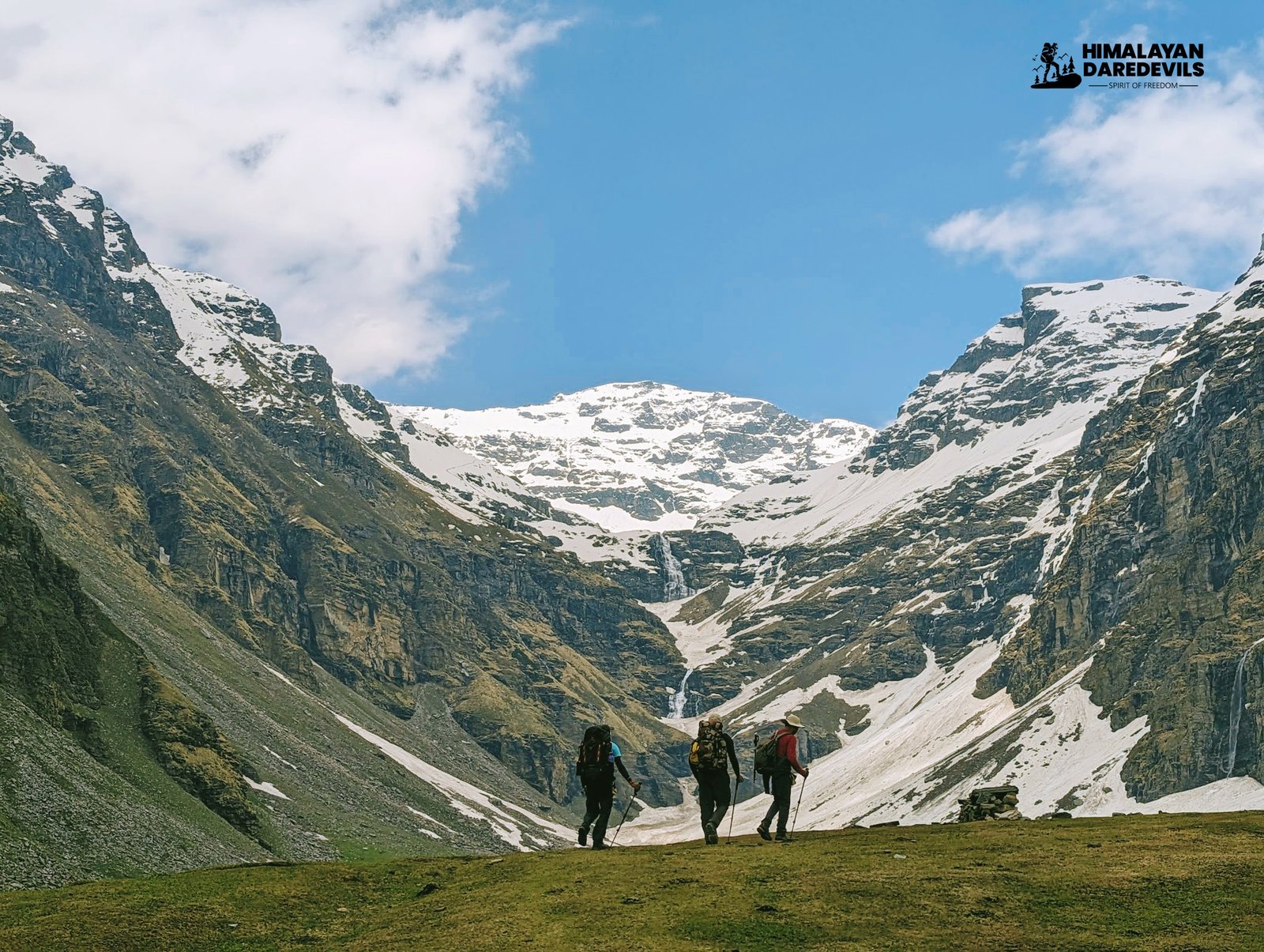
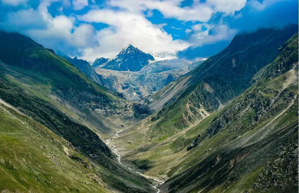
The Rupin Pass Trek in Himachal Pradesh is among the most scenic routes in the Indian Himalayas and a top choice for rupin pass trekking. The trail passes through remote villages, deep valleys, thick forests, and high-altitude meadows before reaching the snowbound Rupin Pass at an altitude of approximately 15,279 feet. Starting near Shimla and moving toward hanging villages, trekkers walk through pine and oak forests, cross glacial streams, and camp beside wide alpine grasslands. With every ascent, the sense of adventure intensifies, making this trek a perfect blend of nature, altitude, and exploration.
A Challenge for the Experienced
The trek is also very popular for its differing terrain which makes it a capable challenge for experienced trekkers. From heady climbs to places where rivers need to be crossed and rocky areas have to be traversed the entire route requires physical effort and mental fortitude. While on a steady ascent, one can notice the change in the landscape from the oak and pine forestry to the high-altitude grassland anchored with flora of a variety of species, right to the vicinity of snow-capped mountains. Throughout the journey, the trekkers can see the onset of waves from huge mountains of the Himalayas which includes the Kinnaur Kailash mountain range that is witnessed from Rupin Pass and is astonishing.
Peaceful Wilderness and Remote Beauty
Besides the strenuous trek, the trek is through remote and peaceful regions allowing trekkers to relax and enjoy the wilderness. The high meadows, distant camps, and clear horizons add together to have a calming effect which is quite rare on a trek. Regions like Saruwas Thatch and Dhanderas Thatch provide excellent camping sites for trekkers who want to view the mountains and valleys surrounding them. These calm places are perfect for rest and acclimatization, enabling trekkers to cope with the elevated altitude when proceeding to the pass.
The Final Ascent and Stunning Views
For most trekkers, one of the joys of the Rupin Pass Trek is attaining the pass. The steep ascent of Rupin Pass is strenuous, mainly because of the height and extreme weather conditions, however, this is the most striking part of the trek. When reaching the summit, the breathtaking scenery of snow-peak mountains, massive glaciers, and vast wild rocky areas makes them forget about everything. The interlinked views and experiences of crossing the Rupin Pass are quite unforgettable and what the trekker encounters next is the view of the Baspa Valley which is truly serene with lush green pastures, forests, and peaceful hamlets.
A True Challenge for Experienced Trekkers
The Rupin Pass Trek is well-known for its diverse and demanding terrain, making it especially appealing to experienced trekkers. The route includes steep ascents, river crossings, narrow gullies, and rocky trails that require both physical endurance and mental strength. As the altitude increases, the landscape shifts from dense forests to open high-altitude grasslands, eventually leading to snow-covered slopes near the pass.

Best Time to Do The Rupin Pass Trek
The best time to do the Rupin Pass Trek is during the pre-monsoon season from May to early June and the post-monsoon season from September to October. These windows offer the most stable weather conditions, safer trails, and the best overall trekking experience in the Himalayas.
During May and early June, the trail is relatively dry and fully accessible after winter. Trekkers are rewarded with expansive mountain views, blooming alpine wildflowers, and pleasant daytime temperatures. This season is especially popular among those who wish to experience the Rupin Pass trek with snow patches, vibrant landscapes, and clear visibility.
The September to October season presents a completely different charm. After the monsoon, the skies turn crystal clear, the terrain becomes sharper and more rugged, and the valleys glow with autumn colors. Although temperatures begin to drop at higher altitudes, the dramatic scenery and peaceful trails make this period ideal for experienced trekkers seeking solitude and stunning Himalayan views.
Trekkers should always be prepared for sudden weather changes, including occasional snowfall near the pass and cold nights at higher camps. The Rupin Pass Trek is not only a physical challenge but also a test of mental endurance, offering a rare opportunity to witness the vast, raw, and largely untouched beauty of the Himalayas.
A Journey That Stays With You
The Rupin Pass Trek is not just a route across mountains—it is an experience that leaves a lasting impression. Every forest trail, cascading waterfall, and remote village has a story to tell. Throughout the journey, the Rupin River flows alongside you, its rhythmic sound becoming a constant companion and a soothing presence on the trail. From hanging villages to towering waterfalls and high-altitude meadows, the trek surprises you at every step with its variety and beauty. It is a journey that challenges you, inspires you, and stays with you long after the trek is complete. Don’t wait for the perfect moment-the Rupin Pass Trek is calling. Connect with Himalayan Daredevils and embark on a truly magical Himalayan adventure led by experienced trek leaders.
The rupin pass altitude reaches approximately 15,250 feet, making it a demanding high-altitude trek suitable for experienced trekkers.
The rupin pass altitude reaches approximately 15,250 feet, making it a demanding high-altitude trek suitable for experienced trekkers.
Tips & Tricks For Rupin Pass Trek by Himalayan Daredevils Expert Guide


Itinerary
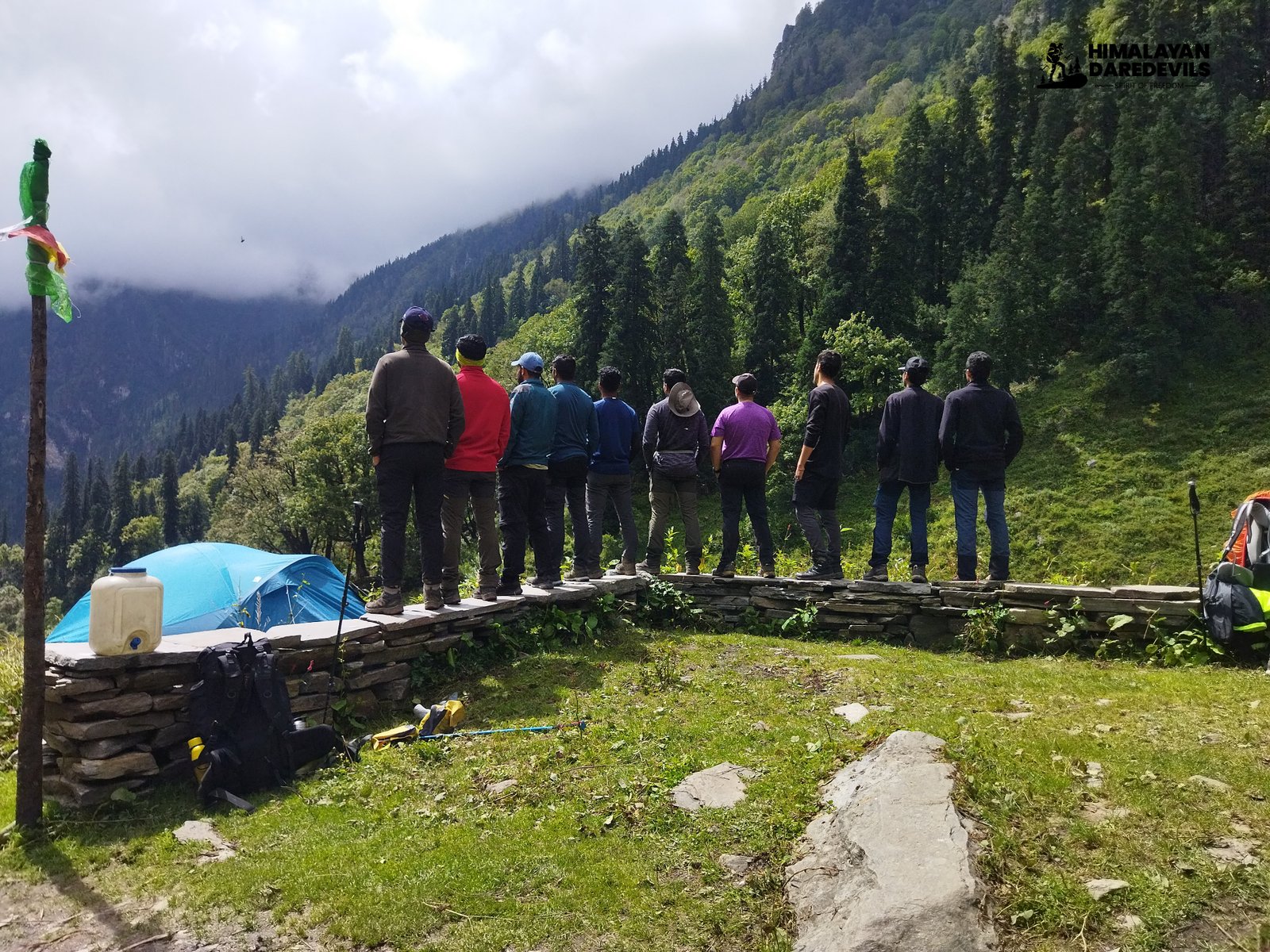
We begin our journey including a 185 km long drive to Jiskun from Shimla that takes about 7 hours. This is a stress-free drive in Himachal, while you take one of the most picturesque drives and leave one of the busiest places ever created behind you.
On the way, see some tranquil villages, huge pine forests, and green valleys cradled in hilly areas packed with the sights of rural Himachal’s charm.
The closer you get to Jiskun, the more rugged the terrain gets and the more narrow and rough the road is; this makes the drive even more exciting.
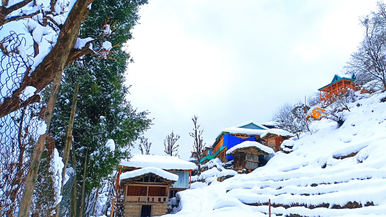
Jiskun is located at an altitude of 7,700 feet, get to Jiskun and witness the calmness of this village and the breathtaking views of the mountains this village is surrounded by.
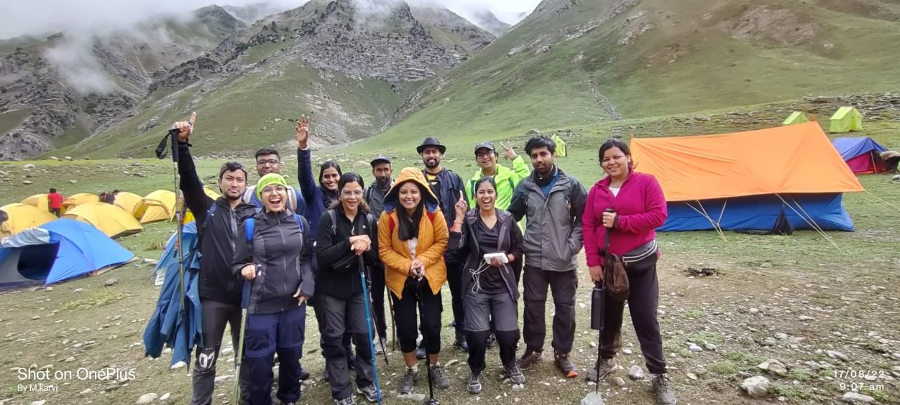
Get set at the base camp of Jiskun where the trekkers prepare for the hard-packed days ahead and unwind themselves. It’s a nice place to be before stepping onto the grueling Himalayan wilderness.
SHORT ITINERARY:
DETAILED ITINERARY:
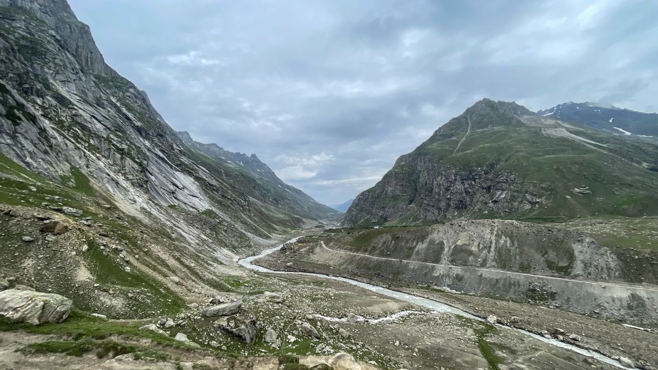
To start the journey, you will travel by road from Shimla to Jiskun which is around 185 km. The driving time is approximately 7 hours and is also one of the most beautiful drives in Himachal Pradesh. After leaving the busy streets of Shimla City behind and a few kilometers along the narrow road you will find some peaceful villages, tall pine trees, and valleys surrounded by hilly terrain. You will encounter rougher landscape as we get nearer to Jiskun village which is perched at an elevation of 7630 feet.
This basecamp, which is the starting point of Rupin Pass Trek, facilitates trekkers with the possibility of enhancing a long trek through harsh Himalayan conditions in a respected environment first. Jiskun is a great place to begin because of its breathtaking scenery and great peace followed by the demanding and tough days of trekking. The basecamp can provide trekkers with the necessary comfort and support before the actual trek into the heart of the Himalayas begins.
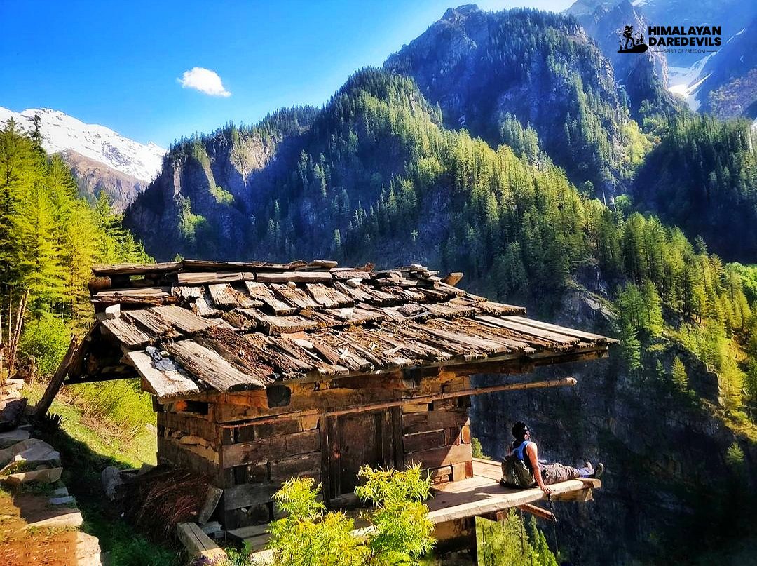
The first marker in your adventure begins from Jiskun. You cut down swiftly through the deodar and walnut groves, making it easy for you.
Cross over a wooden bridge and gaze at the towering rock cliffs ahead, alongside which an ancient path, now almost forgotten, has been cut into the cliff beautifully. This path appears out of place, its creation a mystery, and allows you a chance to think and admire its sculpting.
The trail continues to rise but there are magnificent views as you ascend through the lowland mixed forests of trees with a steep cliff followed on one side. Though there's a steep look of the trail when seen from below, the actual climb is quite easy and the beauty that surrounds the place with the chirping of the birds, is indeed breathtaking.
After approximately one hour, which is about 900 meters of hiking, you will step into Jakha, a traditional village that is known not to consume any meat. With serene countries this time around, it is a great setup for such a place to help you to catch a breather before continuing your trek.
SHORT ITINERARY:
DETAILED ITINERARY:
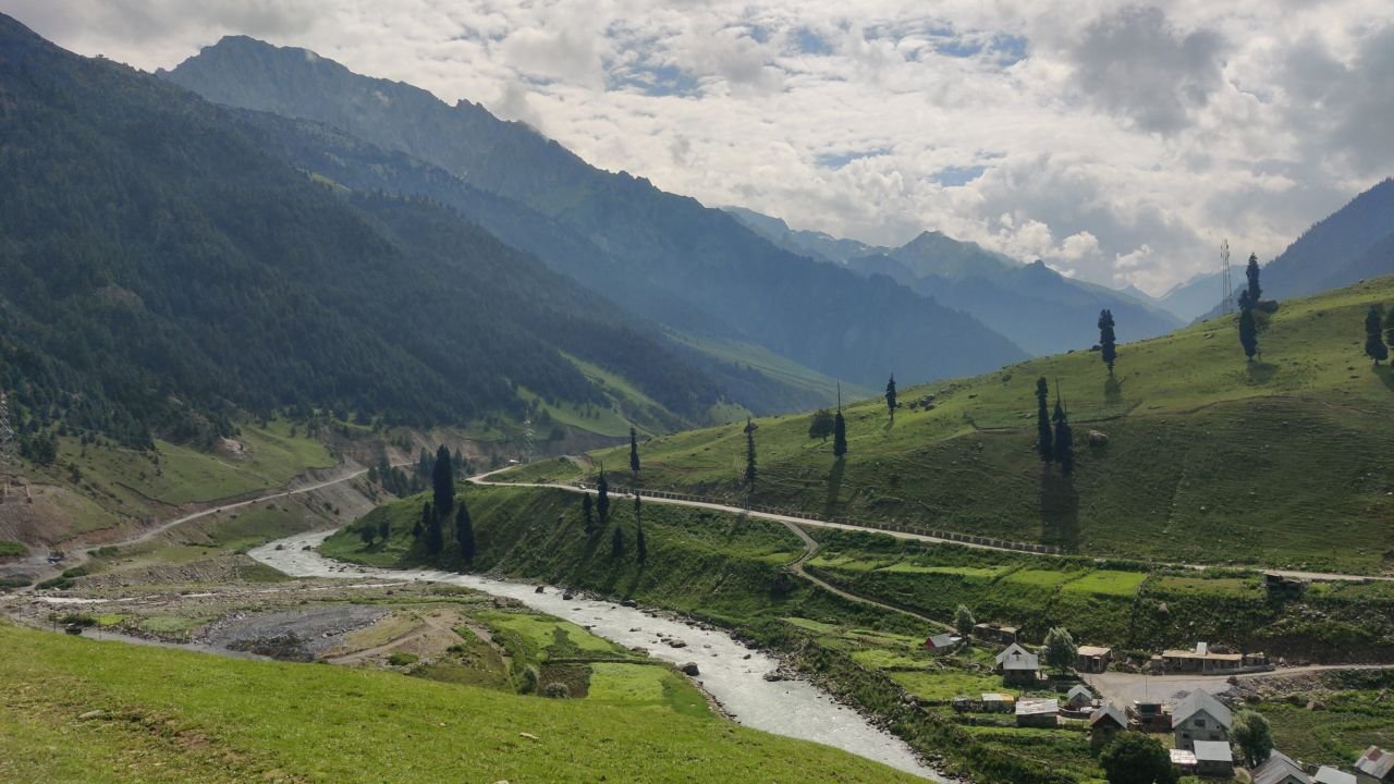
The next village to visit on the Rupin Pass trek is Jakha which is only 3 1⁄2 km away from the starting point. On leaving Jiskun the track drops quickly through deodar and walnut grove to where there is a deep and mysterious fold in the mountain range. Where it has been said, no man has ever set foot at the higher portions of the fold. One can still see remnants of an ancient wooden bridge that has been shrouded by trees. From this level, look across the new wooden bridge and arch your head to a new rock cliff where an old path is embedded – ridiculous and unsuited to its surroundings that you take a few moments to wonder how and who created it.
It takes about one hour to climb through one of the most scenic hiking trails. The views are quite dynamic. The trail begins by making its way steadily up the slope’s ridgeline. From a lower perspective, it seems to be a steep trail that stretches to the heavens. After beginning the climb, it is not as severe as it appears to be. The path is beautifully covered by mixed trees and the face of a cliff on one side of the valley, along with birds singing in this area. Two-thirds way up, be mindful of another broad path that branches off to your left. The trail is mostly ascending aside from one section that is a gentle stroll. Jakha is a village that is wholly steeped in the traditions.
No flesh is consumed in this place. There is no need to expect live animals or snacking on tinned meat. The camping ground is located a little above the village and is also used as a playing field for the children. Another option for a campsite is the compound of the school itself. Jakha is the final place to get any last-minute supplies and also to search for porters if you happen to be low on either. For the next few days of your trek, there is hardly any person you will bump into, except gaggles of shepherds keeping their sheep.
First, start to climb Jakha from the majestic upper fields of the upper Jakha village where farmers and cows go about their daily routines before heading into the wilderness.
The beginning of the fir forest comes abruptly and it feels almost like crossing over a threshold. One moment you are in open meadows and the next moment you are engulfed with the lush evergreen trees.
Such great trees help you navigate through the ancient wilderness which is still intact and stunning.
The beauty and peace of the forest cannot be described in words. Tall trees interspersed with autumn leaves further enhance the tranquility and natural beauty of this trail.
SHORT ITINERARY:
DETAILED ITINERARY:
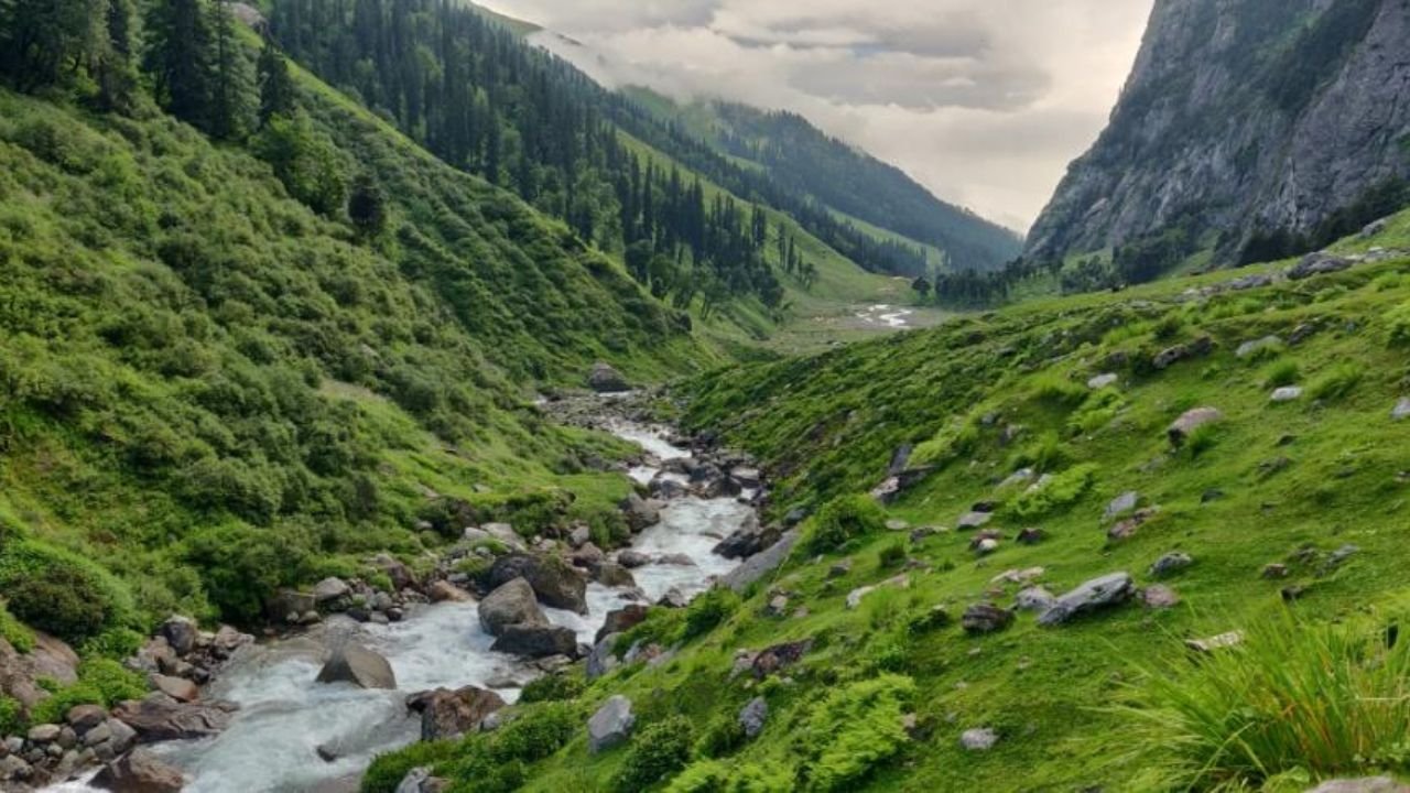
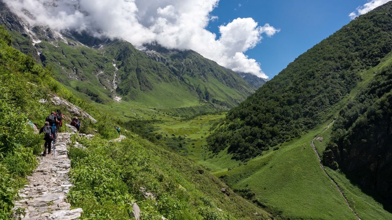
The trek from Jakha to Saruwas Thatch brings one to the heart of the green valleys, vibrant blossoms, and breathtaking beauty of the Himalayas. The day starts with a beautiful trek over a beautiful fir beam which is truly all uphill, one of the best on any trek. The squirrels together with the lovely towering trees, the lovely aroma of growing pine trees, and the tranquil nature of the morning complement one another.
Later on, as we continue the trek, we descend into a gorge where the Rupin River flows giving its waters a free run on the rugged land. The gentle ripples of the river can always be heard as you slice through the thick shrubbery. As you carve along the mountainside, burgeon these dwarf rhododendrons that can be found around Udaknal which are literally a must for the eyes to behold.
The route then courses toward Saruwas Thatch, a beautiful meadow, where the trekkers would wish to pause and appreciate the fabulous views of the mountains and valleys in the vicinity. The magnificent sceneries will be the first thing you will meet once you ascend Saruwas Thatch, and after such a beautiful day this will be an exceptional location to pitch camp. Such serenity and beauty of nature in this section appear to be one of the highlights of the Rupin Pass trek.
In the morning, a stroll through the scenic meadows studded with blue blossoms would be quite a visual treat, particularly in summer and autumn. While on the journey, the wide flat territory with many scenic sights makes one’s eyes sparkle.
In continuation, the pathway becomes visible with remarkable Himalayan mountains in the background. It feels calm and tranquil, allowing trekkers to indulge in breathtaking vistas of the high-altitude region, the wilderness mostly untouched by civilization.
The ascent, which is brief in duration, poses some difficulties since the trekker has to go from an altitude of 10,770 ft to about 11,700 ft. The landscape becomes rough and rugged, with water flowing towards Dhanderas Thatch base camp.
Soak in the beauty of the Bridge, about 1,500 ft from Rupin Waterfall.
SHORT ITINERARY:
DETAILED ITINERARY:
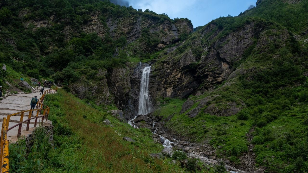
The fourth day of the Rupin Pass is arguably the most beautiful, with wide meadows and Dhanderas Thatch at the far end. So let’s get the trek underway and start walking up these beautiful meadows, which get very hot in the summer because blue flowers blossom beautifully throughout the meadows. Wonderful photos can be taken at this point. Both summer and autumn seasons offer generous hues to this part of the landscape. The next setting is breathtaking as the vast numerous peaks of the Himalayas stand sentinel over the area as you move further in the trek and it feels peaceful to be in such a wilderness location in the higher regions of the world.
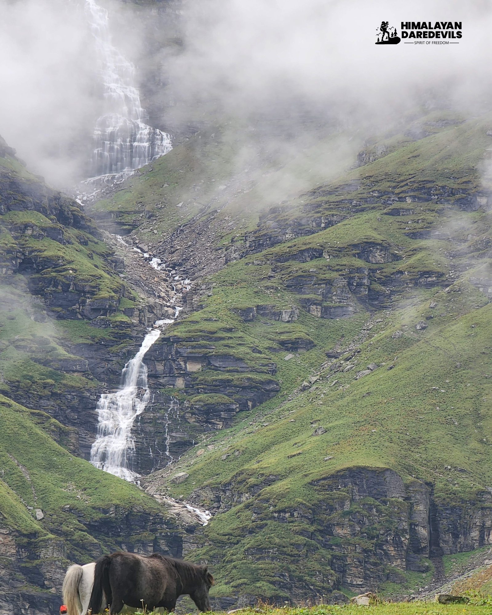
Indeed, the climb is quite short, but it does not come easy as the trail goes from an elevation of 10,770 ft to 11,700 ft. The terrain becomes grimmer as you reach the end, and the sound of flowing water echoes back and forth as you draw closer to the Dhanderas Thatch campsite. This site lies under the 1500 ft high Rupin Waterfall. It is the most breathtaking place where you can put up your tents with the roaring sound of the waterfall in the background. The ambiance narrated by the water perforating into the rock below is sublime and indescribably beautiful. This scenic viewpoint is ideal for relaxing, enjoying nature, and telling stories.
Start the trek from Dhanderas Thatch at an easy pace so that your body can accommodate the changes in altitude. The climb from the tail end of the waterfall to its top will help you adjust to the strenuous pull that is required on the next day to the Rupin Pass.
The first leg of the climb takes you to the head of the waterfall approximately one kilometer from the Dhanderas Thatch. Be careful of the snow patch at the top of the waterfall. Do not just go and stand there and step on the snow. Rather, go around and move uphill over some rocks to find the path that runs towards the top at an angle. You should get trekking poles or ice axes to balance if they are there.
If the trail on the snow is a little difficult to find, then you could use your feet or your ice axe to make cuts into the snow to cross that particular area safely. This particular part of the trek is important for normalizing the body temperature for the trek before reaching out to the Rupin Pass.
SHORT ITINERARY:
DETAILED ITINERARY:
Today might be the most significant day of your whole trek. Above everything else, the climb to the top of the waterfall will greatly assist you in your subsequent climb to the Rupin Pass. Additionally, the first stage will come in handy when the time comes to cross the Rupin pass.
The starting altitude at Dhanderas Thatch already enables us to maintain approximately twenty-five hundred feet more to cross the additional elevation of the mountains enclosing the Rupin Pass region. It is significant, and one can almost make sure that many people will face issues of altitude sickness. Better is to climb up at least about one thousand five hundred ft which is about the head of the waterfall, so that you can allow your body to be feeling the altitude effects. As you are somewhat acclimatized, your body will be ready for the next day’s strenuous climb of the Rupin pass. Please, in contrast to most days, begin your day at a more relaxed pace. Allow your arms and legs to gain strength back. Immediately following breakfast, step up for the climb of the waterfall.
From Dhanderas thatch till the head of the waterfall, it might be about one kilometer away. On the route, you will have great opportunities to jump and hop across various streams and also be dazzled by vibrant yellow butterfly-like heads of marigold flowers dancing in the wilderness. Another time, the flowers were rolled in so thick that it looked like a clear soft fold as we moved deep into the flower beds.
The snow patch at the bottom of the waterfall is serious. Do not step onto the snow patch directly; instead, head uphill on the boulder-strewn hillside till you discover the trail which runs diagonal to the snow patch. It seems sensible to use a stick or trekking pole for balance. At this point an ice axe is highly recommended. If the trail is faint, begin to use your boots or ice axe to cut steps and then very carefully cross the ice sheet. This lets you to the top of the lower falls.
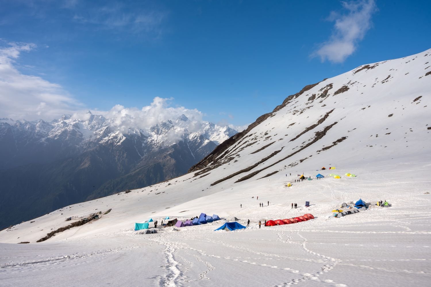
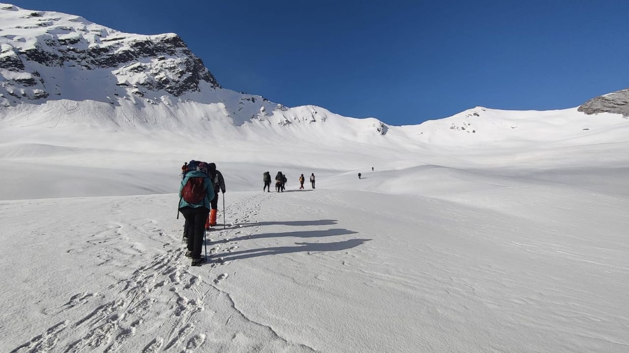
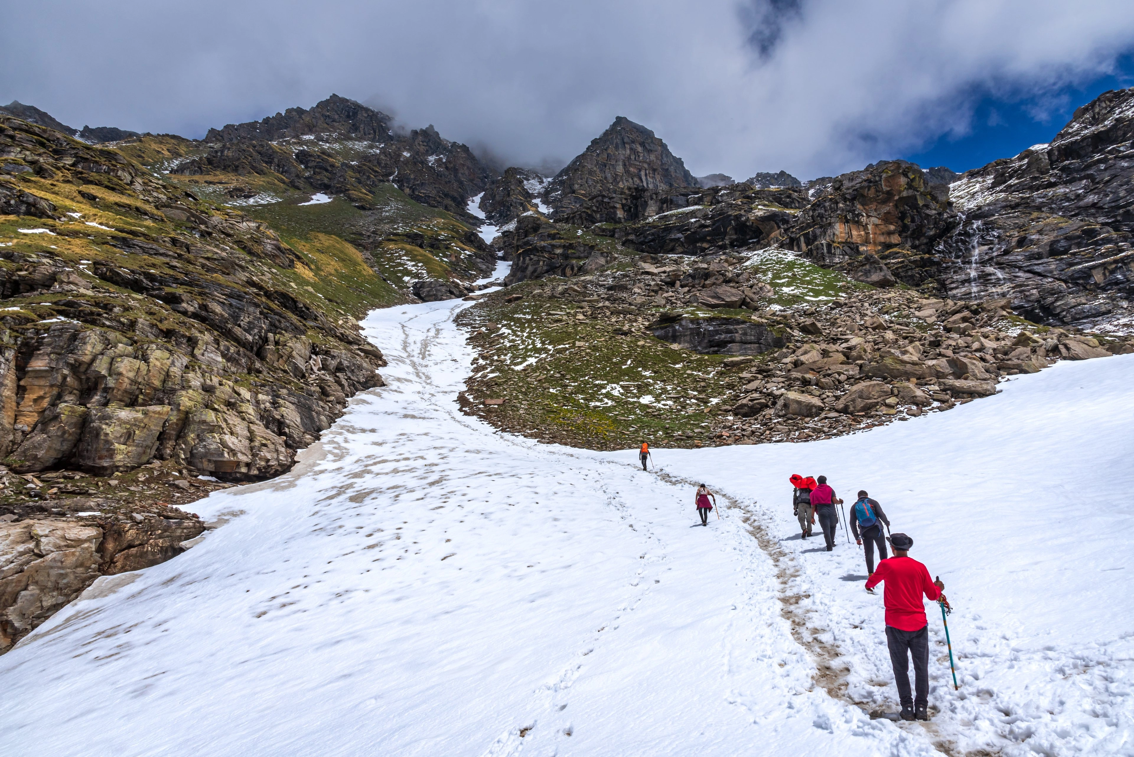
The day starts quite early at Upper Waterfall camp 13,275 Feet; it is quite a task to pull oneself from one’s dreams and a hearty breakfast is surely desirable before going for the 7.4 km up-hill trek to Rupin top 15,279 ft. This should be in the range of 9-10 hours approx and is likely to be the hardest and longest section including snow and rocky areas in moderate amounts of portions.
While you move upwards, the winds will be stronger and the thin air will make the journey more challenging. The range keeps getting more and more beautiful, the sight of snow-capped peaks and tabletop glaciers makes the view even more stunning.
Finally reaching Rupin Pass it already feels like the hardest part of the trek is behind. You can begin the descent from the summit, but making loose skip contacts will require precision. At this point, it is impossible to describe the feeling since the most difficult part of the trek has been surpassed.
Ronti Gad from this position is at a height of 13,005 feet which takes around 3-4 hours to descend to. It is perhaps the only time in life where the pain while going up and the joy while coming down is truly transformative. On reaching the site, one could lie down, see the first stretches of paradise and know that the capital of the pass has been extended.
SHORT ITINERARY:
DETAILED ITINERARY:
Rupin Pass Trek day 6 is arguably the most demanding yet exhilarating section of the trek – the pass-crossing day. The day starts with an early start from the Upper Waterfall camp at an elevation of 13,275 ft. After a substantial meal, the trekkers head towards the Rupin Pass which has an elevation of 15,279 ft. The day’s trek is quite long whereby a distance of about 7.4 Km is expected to be covered in around 9-10 hours.
The first section of this stage involves climbing through snow and rocky elements with relatively moderate levels of stamina engagement. As the climbing continues towards the crossing point of the Pass, the winds grow stiffer and the air grows a little thin. However, as you start moving upwards, the sights get even better with icily shrouded mountain peaks and sheets of glaciers all around.
Once this pass is crossed, the descent starts towards Ronti Gad, a stunning campsite that stands at an elevation of 13,005 feet. Just like any other trek, the descent in a way is a different ball game altogether and there are risks associated with it as well as one has to be extra careful about the loose rocks and patches of ice. The journey to Ronti Gad takes approximately 3-4 hours, however fatigue is not felt as much as the feeling of completion of the camp is very high. At Ronti Gad, during this time the trekkers can settle down and admire the breathtaking scenery while reminiscing about the successful crossing of the Rupin Pass and the battles that were confronted.
- Trek 11.9 km in 6 hours, descending from almighty 13,005 ft to 8,660 ft from a mountainous region across alpine snow regions which are rather rugged.
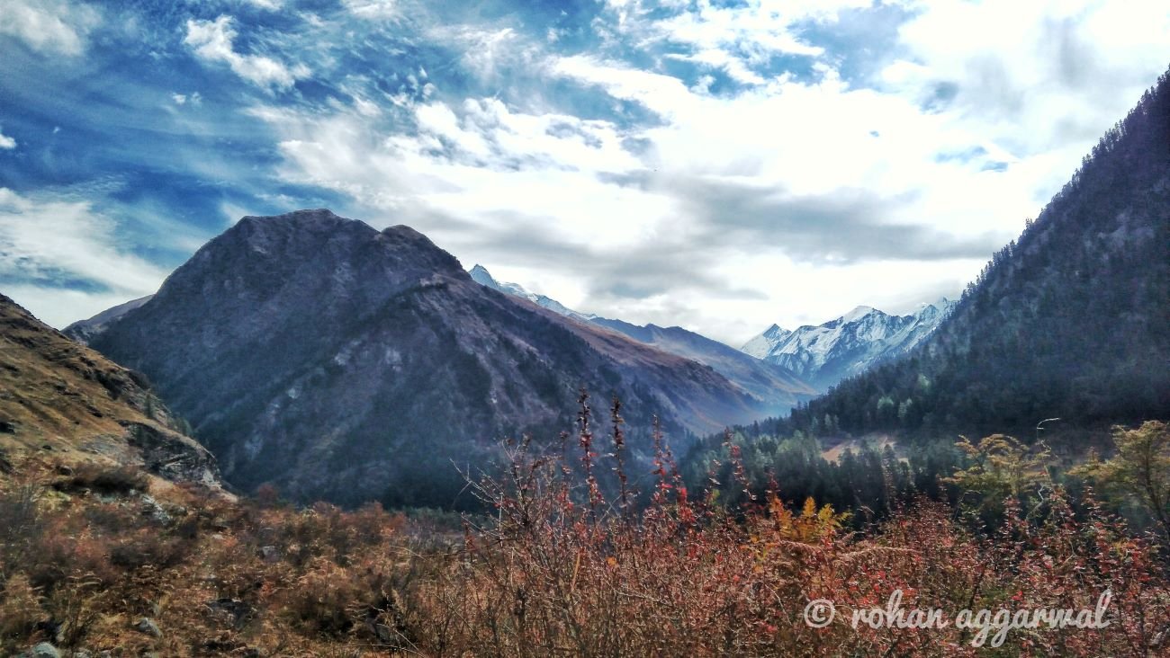
As it moves, the melting snow on the mountains is succeeded by grassland, which now serves as a good contrast to the white peaks that were seen earlier.
The path starts to get wider as you approach Sangla, with the river and bank lined with greenery and many small villages.
After Sangla, proceed for a lovely 6-7 hour drive that passes through stunning Kinnaur Valley. Finally, flex your legs at Shimla Old Bus Stand and reminisce about the stunning trek.
SHORT ITINERARY:
DETAILED ITINERARY:
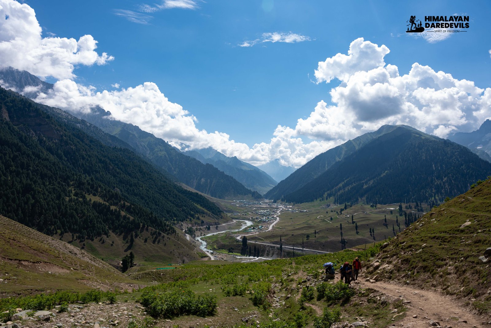
On Day 7 of the Rupin Pass Trek, The Ronti Gad descent to Sangla is achieved after trekkers have traveled a distance of 11.9 km for a period not exceeding 6 hours. The first day begins at an elevation of 13005 feet, whereas the last day at Sangla elevation is 8,660 without any significant gap. The first half of the trek descends through rough terrain down to the foothills above the valleys. Further, as you descend, alpine snow regions give way to extensive grassland areas that seem completely unlike the white peaks and posts that you were trekking.
As you come closer to Sangla, the valley widens, and the trail runs alongside the river which fetches a journey among the hills through parts of vegetation and villages. The last part of the trek runs along the banks of the river and the green plants and water ending off the hard journey of the trekkers. After arriving at Sangla, the first base camp of Shimla is where a car awaits.
It takes nearly 6-7 hours to drive back to Shimla and while you are at it, you can also enjoy the mesmerizing surroundings of Kinnaur Valley which adds a soothing finish to an exhilarating experience. The trek concludes at the Shimla Old Bus Stand where you are left off and think about what indeed has been a great expedition.
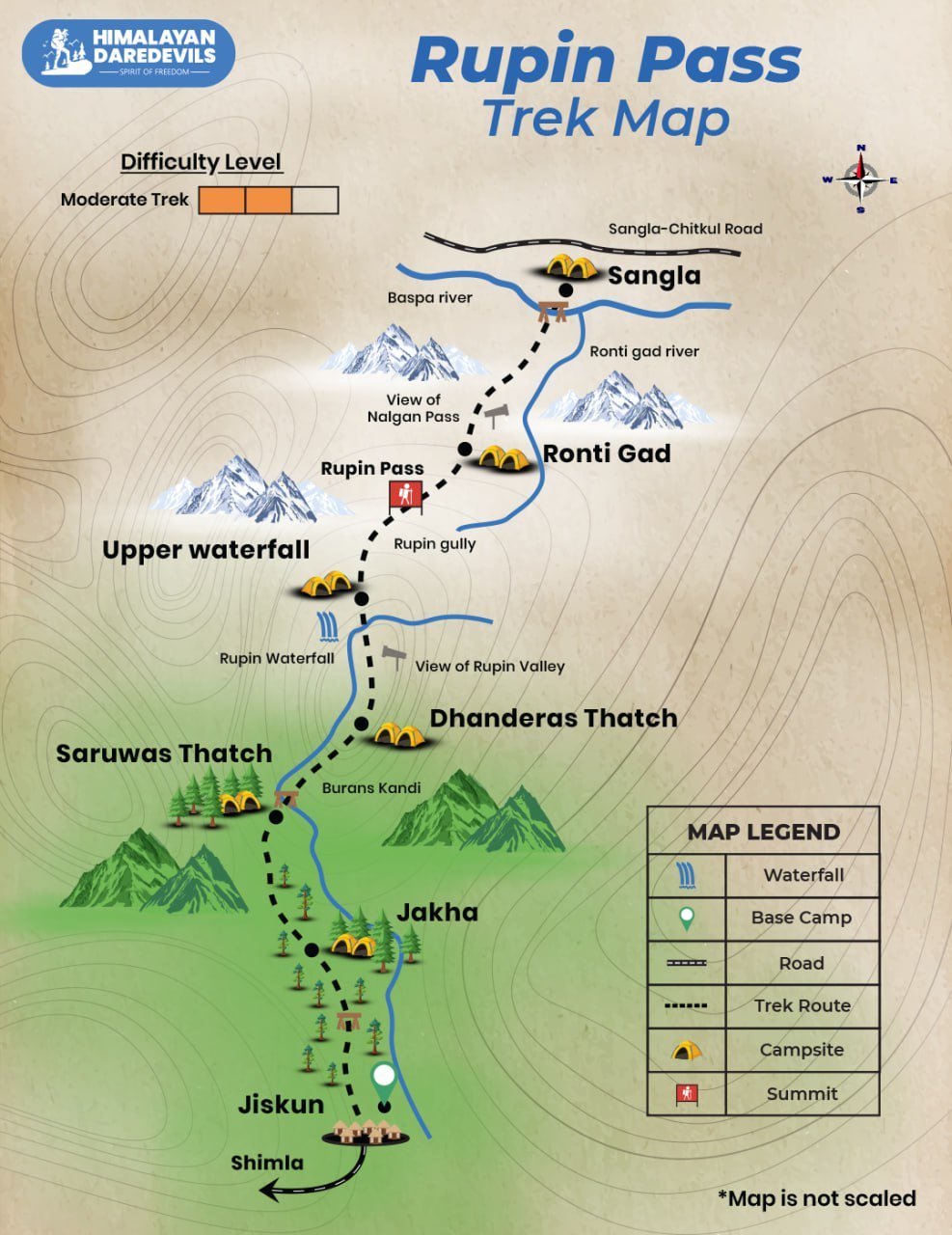
Rupin Pass Trek Map
Trek Review Videos

Inclusions
Exclusions
1. Meals while on trek (Veg).
2. All necessary entry fees and permits.
3. Accommodation:- Guest house, Home stay, camping during Trek.
4. Mountaineering qualified & professional trek Leader, guide, cook and Support staff.
5. First aid medical kits, stretcher and oxygen cylinder.
6.Trek equipment: Sleeping bag, mattress, tent (twin sharing), kitchen & dinning tent, toilet tent, utensils and crampon (if required)
7. Staff Insurance.
8. Porters/mules to carry central equipment.
1. Any kind of personal expenses.
2. Food during the transit.
3. Mules or porters to carry personal luggage.
4. Transport (Non Ac) (Note: cab or tempo traveller can be provided for additional cost) Shimla to Shimla 3000Rs
5. Insurance.
6. Any kind of emergency evacuation charges
7. 5% GST
8.Any expense incurred or loss cost by reasons beyond our control such as bad weather, natural calamities (landslides, floods), flight delays/rescheduling/ cancellations, any accidents/medical evacuations, riots/strikes/war/pandemics etc.
9. Anything not specifically mentioned under the head.
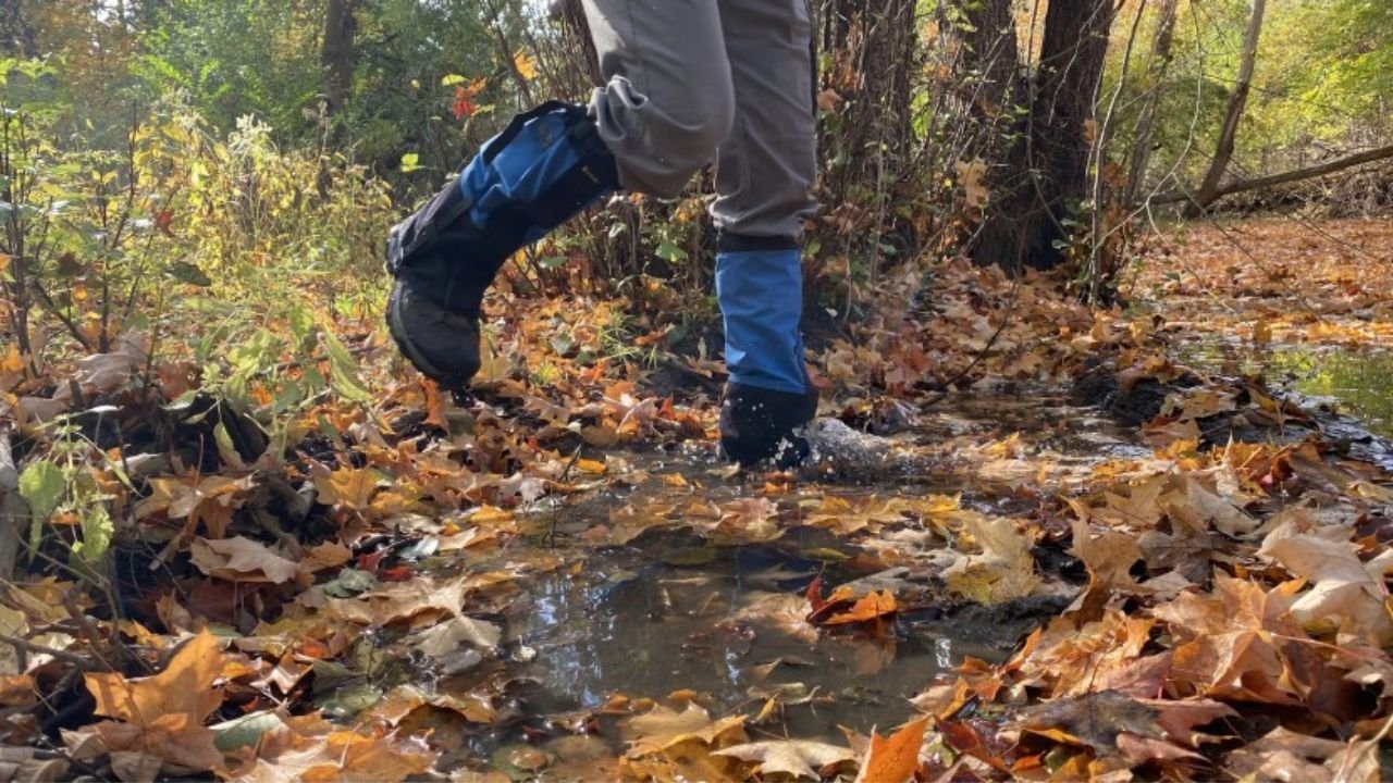
What to carry on Rupin Pass Trek
Shoes and backpack
- Trekking shoes with ankle support
- Backpack with rain cover
Warm Layers and Clothes
- Warm layers (PaddedJacket)
- 3 layers if you're trekking in spring, summer and monsoon (1 woollen sweater, 1 fleece, 1 padded jacket)
- 4 layers if you're trekking in autumn (1 woollen sweater, 2 fleece, 1 padded jacket)
- 5 layers if you're trekking in winter (1 pair of thermals, 1 woollen sweater, 2 fleece, 1 padded jacket) - 3 Collared T-shirts (Wear one, carry two)
- 2 quick-dry trek pants (Wear one, carry one)
Accessories
- Sunglasses
- Sun cap with flaps
- Waterproof gloves
- Balaclava
- Woolen socks (3 pairs)
- Headlamp
- Trekking pole
- Rain jacket + pants / poncho
Toiletries:
- Sunscreen
- Moisturiser
- Light towel
- Lip balm or vaseline
- Toilet paper
- Toothbrush
- Toothpaste
- Reusable plastic covers (for used clothes)
How to reach Rupin Pass Trek
The Rupin Pass Trek begins from Shimla, which is well connected to major cities in India by air, road, and rail. Below is a simple, step-by-step guide to help you plan your journey smoothly.
Step 1: Take a Flight from New Delhi to reach Chandigarh
The most convenient way to travel from New Delhi to Chandigarh is by air.
- Mode of Transport: Flight
- Travel Time: Approximately 50 minutes
Why Chandigarh?
Chandigarh is the nearest major airport and a key transit hub for travelers heading toward Shimla and the Rupin Pass trek.
Alternatively, travelers can also reach Chandigarh by train or overnight bus from New Delhi, depending on convenience.
Step 2: Travel from Chandigarh to Shimla
From Chandigarh, proceed to Shimla, the starting point of the Rupin Pass Trek.
- Mode of Transport: Bus or Taxi
- Travel Time: Around 3 to 4 hours
Route Highlight:
The journey offers scenic views of rolling hills, forests, and mountain roads, making it a pleasant introduction to the Himalayan landscape.
Regular government and private buses operate between Chandigarh and Shimla, providing flexible travel options throughout the day.
Important Note for Trekkers
It is recommended to reach Shimla at least one day in advance to allow time for rest, acclimatization, and pre-trek briefings. This ensures a smoother and safer start to your Rupin Pass trekking experience.
Fitness and preparation guide for Rupin Pass Trek
We recommend jogging as the best routine to get fit for a trek. It works on the same muscles that you use while trekking — your calves, glutes and hamstrings. It helps increase your stamina day by day. It is also an easy routine that does not require any equipment or tools.
Fitness target:
To do this trek comfortably, you must be able to cover 5 km in under 35 minutes. This is the minimum fitness required for this trek.
How to achieve this fitness?
- Start jogging at least 4 days a week
- If you cannot run 5 km immediately, start with 2 km and increase to 5 km over 2-3 weeks.
- Once you’re able to run 5 km, increase your pace day by day.
- Gradually increase your pace and bring it down to 5 km in less than 35 mins.
- You must be able to run 5 km in 35 mins consistently for at least 2 weeks before the trek.
This trek requires at least 6-8 weeks of preparation. The longer, the better. So plan your trek soon and start preparing.
FAQ
Rated as a tough trek meant for seasoned trekkers, the Rupin Pass Trek involves steep ascents and descents with a variety of terrains, including snow-capped areas at higher elevations. The trek crosses a height of 14’400 feet, greatly increasing the chance of suffering from altitude sickness. Therefore, a good fitness level, endurance, and the ability to cope with changing weather conditions are a must.
The Rupin Pass Trek is expected to take between 6 and 7 days to finish. However, the amount of time taken to complete the trek can vary due to the speed of the group and the weather. The trek has a mix of moderate to difficult sections but has enough time to rest and adjust. Included in this time is that the trek gives an experience of dense jungle, high altitude grassland, and other snowy patches while the highest altitude gained is 15133 feet. It is required to have stable time management and a proper strategy to enhance the enjoyment and safety of the trekking.
Due to the pleasant sky, moderate temperature, and easy access to trails, the best period to attempt the Rupin Pass Trek is in the spring and summer seasons, that is, from mid-May to the beginning of June and September to October. It is ideal not to attempt this trek in winter and monsoon months as it is extremely inhospitable due to heavy snowfall and heavy showers.
Of course there are permits which are required for trekking the Rupin Pass which go through restricted areas. Some of the areas, particularly Inner Line areas, require an Inner Line Permit (ILP) which is arranged by a registered trekking agency. You may also need permission for the Forest Department which is deployed depending upon the route and the season. I would recommend you to consult the service provider in relation to proper documentation.
Longing to go for the Rupin Pass trek, I would recommend you focus on building over cardiovascular endurance, leg strength, and overall stamina. Running, cycling and swimming should be supplemented with strength training particularly focusing on the legs and core regularly. Because of the nature of the trek which involves steep descends and ascents as well as high altitudes, you will need to practice long hikes on different terrains to build endurance and prepare your body to change altitudes.
While going for the Rupin Pass Trek one should never forget to carry along with them comfortable trekking shoes, Cold Resistant warm clothing (multiple layers are recommended) a waterproof coat and mittens, a hat as well as a sleeping bag of suitable temperature for the person. Headlamps, trekking poles, and a daypack. Answers to questions regarding fitness, acclimatization to high altitudes as well as past trekking experiences form prerequisites for a safer and more enjoyable trek.
On the Rupin Pass you will witness beautiful meadows, amazing landscapes, and alpine lakes. The waterfall is the key highlight of the Rupin Pass trek. The villages that you will come across will introduce you to the local heritage. The breathtaking views of Himalayas valleys and peaks will leave you mesmerized.
The Rupin pass altitude is 15,250 feet. Reaching to this altitude requires trekking through challenging terrains, with shifts in elevation. The Rupin pass connects the northern and southern Himalayan region. The pass is full of amazing views and after reaching this altitude you will feel a sense of achievement.
At higher altitudes, altitude sickness is common. You might face altitude sickness symptoms, headaches, nausea and fatigue. As the trek ascends to more than 15,000 feet, there will be a decrease in oxygen level which will affect your breathing. Therefore, acclimatize properly and stay hydrated to avoid these effects.
The base point of Rupin Pass trek is Shimla. From Shimla you will be picked by the Himalayan Daredevils team. You can reach Shimla through train, aeroplane or road.
Cancellation policy
Life is unpredictable and we understand sometimes you have to cancel or change your trip dates and it is our endeavour to make it as easy possible for you. However, please understand we plan everything including guide fees, permits, accommodation and ration in advance. Therefore any cancellation means inconvenience and certain losses to the people involved in various stages of programme. Keeping that in mind, our cancellation charges are as below-
Cancellation prior to 30 days from start of the event: Get monetary refund with 15% of cancellation charges on trek fee.
Cancellation between 30 days and 15 days to the start of event: 50% on trek fee is non refundable and the remaining 50 % will be given as cash voucher which is valid for 1 year.
Cancellation less than 15 days to the start of event: No refund.
Please note cancellation will be only accepted by email.
Booking amount is non refundable
Note: The Himalayan Daredevils reserves the right to cancel a programme before departure in the event of logistical problems arriving due to natural calamities, strikes, wars on any other circumstances that makes the event inadvisable. In this case, 50% on trek fee is non refundable and the remaining 50 % will be given as cash voucher which is valid for 1 year.
Itinerary changes & trip delays:
We plan itineraries based on the information at the time of planning and in rare circumstances, there are subject to change. In the event that the itinerary is changes or delayed due to unforeseen circumstances such as bad weather conditions, transportation delays, government intervention, landslides etc. We will always aim to give you the best experience possible. However The Himalayan Daredevils are not be held responsible for the cost of delay or changes.
Why Choose Us
Our Best Performance
50,000+
Trekkers
PAN India Treks
250+
Treks
Professional
and Experienced Staff
Best
Grade Equipment
Well Organised
Trek Itineraries
Related Blogs
Read and get more about our treks
Best Treks in Himachal Pradesh - Himalayan Daredevils
The Beauty of Sar Pass Trek - A Visual Journey Through the Himalayas
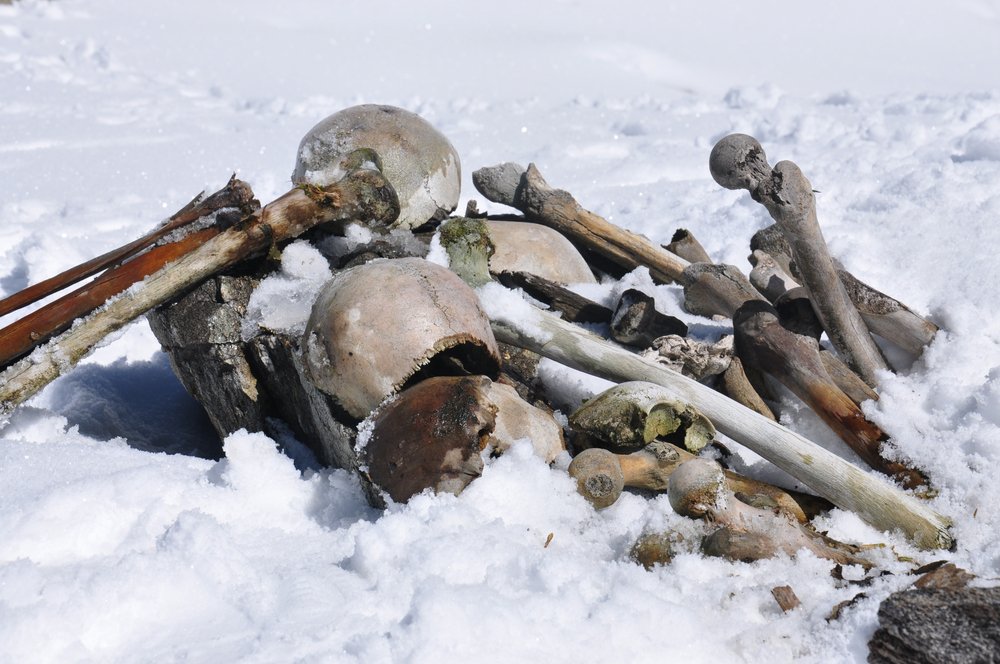
Exploring The Mysterious Skeleton Lake In Uttarakhand
Explore the beauty of Har Ki Dun Trek - A complete Guide
Sar Pass Trek: Detailed Itinerary, Trekking Essentials & Best Time to Visit
Harkidun Trek: Detailed Itinerary, Trekking Essentials & Best Time to Visit
Bali Pass Trek: Detailed Itinerary, Trekking Essentials & Best Time to Visit
Best Time to Visit Rupin Pass Trek- Seasonal Guide for Trekker

Kashmir Great Lakes Trek – A High-Altitude Journey to Remember
Hampta Pass Trek: Know The Route and The Package Before You Go
Kashmir Trek Comparison: Kashmir Great Lakes Vs Tarsar Marsar

Fitness Mistakes That Can Ruin Your High-Altitude Trek

Essential Trekking Gear for Kashmir Great Lakes Trek
Key Highlights of the Hampta Pass Trek You Shouldn’t Miss
Kashmir Great Lakes trek: Detailed Itinerary, Trekking Essentials & More
Valley of Flowers Trek- What It Gives and What It Doesn’t
Why Every Trekker Must Take Safety Seriously
What Are Trekking Gaiters and Why You Need Them

Top 10 treks to do with friends
Rupin Pass Trek Best Time to Visit: Complete Seasonal Guide
Best Time to Do Rupin Pass Trek full Guide.
Affiliated and Recognised by


Download Our Apps