Starting From
57,498
49,999.00

Starting From
57,499
49,999.00
Starting From
57,499
49,999.00
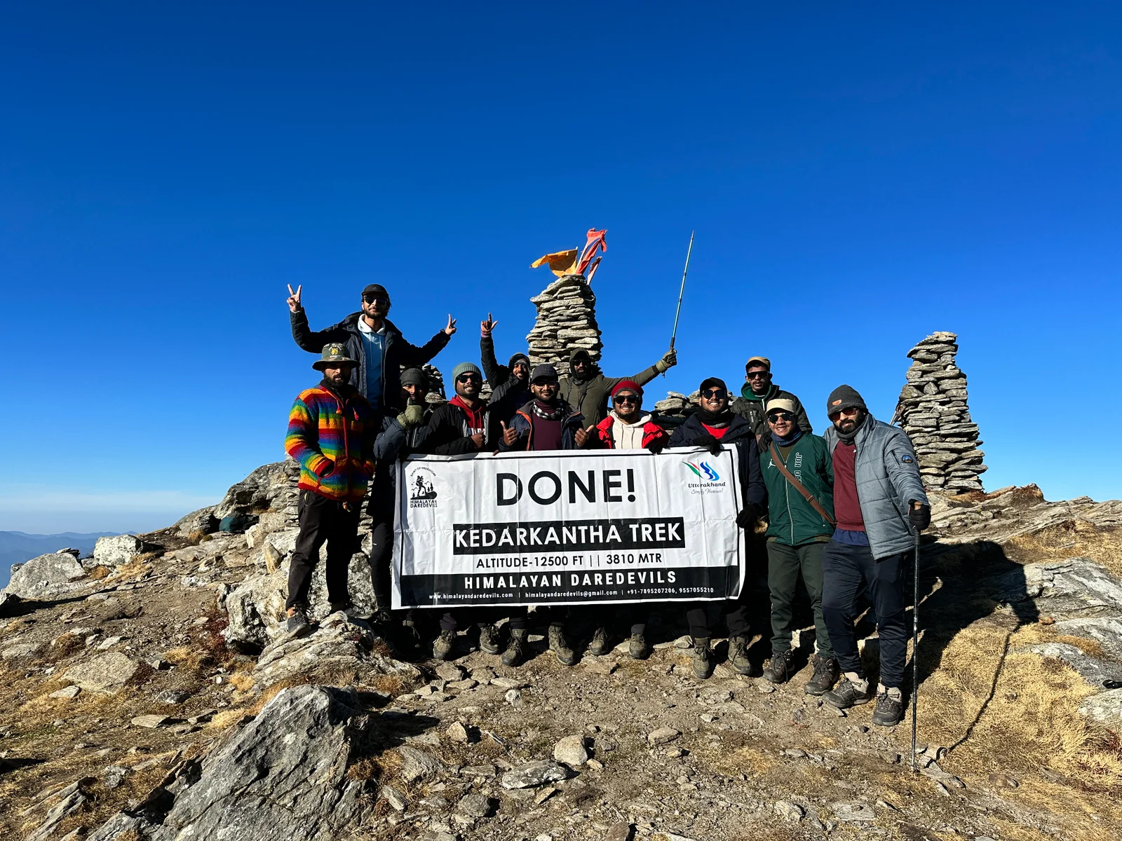
Pin Parvati Pass Trek (325+ Reviews)
A cross over trail through passes.
Pathankot is the nearest railhead to the base camp
Bhuntar, which is 52 km away from Manali
Manali
Monsoon Trek (July-Aug) Autumn Trek (Sep-Mid Nov)
Manali to Manali|Including Transport
Veg
Camping /Hotel/Guesthouse
Himachal Pradesh
10 Days
Difficult
17500 Ft
110 Km
Overview
The Great Indian Himalayas is a home to the wonders of nature, in the hills and jungles of this land hides beautiful scenes that are sure to capture your imagination. The Pin Parvati Pass Trek gives you an opportunity to witness these wonders and be a part of them. This 10 day trek in the remote edge of the Himalayas will make you aware of the grand mysteries that hide in these valleys and snow capped peaks.
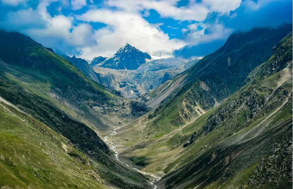
The Pin Parvati Pass is a Gateway that connects two vastly different worlds lying next to each other in the Himalayas. On one side of the Pass are the green hills of Parvati Valley, covered with pine and deodar trees, home to various animals and birds; while on the other side is the cold desert of the Pin Valley, which is a bare and simple beauty of its own. In just 10 days and 110 Kilometers you are able to see all of the colors of the Himalayas, the green of the deodar trees, the white of the snow covered mountains and the blue of the glacial streams and lakes. The Pin Parvati Pass Trek is truly a complete Himalayan experience.
Key highlights of the Pin Parvati Pass
Here are the Key Highlights of the Pin Parvati Pass Trek that makes it one of the most exciting treks in India:
Crossing The Great Himalayan Divide-
The stark contrast that the Pin Parvati Pass Trek provides, by taking you from one valley to the other, is what makes it so special. You climb up to reach the Pin Parvati Pass, which stands at a height of 5,319 m (17,457 ft), from here one can see snow capped mountains shining under the bright blue sky. On one side of the Pass lies the dense green jungle and flowing waterfalls of the Parvati Valley and on the other side lies the barren mountain and desert like landscape of Spiti. This contrast is not just in landscape but also in the flora and fauna as well the culture of both the regions.
Hot Water Springs at Kheerganga-
Kheerganga is an enchanting and culturally rich stop at the Pin Parvati Pass Trek. The highlight of Kheerganga is the sulphur-rich hot water pool, believed to have healing properties. Surrounded by snow-covered peaks and alpine forests, taking a dip here feels surreal.
This location also holds spiritual significance as according to Hindu mythology, Kheerganga is where Lord Shiva meditated for thousands of years. Here you will find a small temple dedicated to Lord Shiva and Parvati near the hot springs, where pilgrims and trekkers often offer prayers.
Glacier Crossings & Snowfields-
One of the most thrilling aspects of the Pin Parvati Trek is the trail through the expansive glaciers and snowfields. After the trekkers ascend above 4,500 meters, the landscape changes and shifts into a high-altitude alpine zone where you will find grey mountains covered in snow and ice. The snow fields stretch for kilometers and demand physical strength and strong will from the trekkers, one must carry specialised gear for this terrain, by carrying basic mountaineering equipment like crampons and trekking poles you ensure that your trek is safe.
The glacier crossing near the pass at around 5,319 meters is both physically demanding and visually awe-inspiring. The glacial stretch to the Pin Parvati Pass is indeed challenging, but it takes you near the towering peaks and dramatic Himalayan vistas. It's this intense yet rewarding segment that solidifies Pin Parvati as a true expedition-level trek.
Unique Flora & Fauna of the Pin Parvati Pass Region:
The Great Himalayan Wall separates the Parvati Valley from the Pin Valley, this separation creates differences in landscape, culture and even ecology. On one side of the Pass is the cold desert of Pin Valley, while on the other is the lush green forests of Parvati valley. These landscapes are also home to unique flora and fauna, many of which are exclusive to the region.
The arid and harsh environment of Spiti gives birth to plants like Juniper, Sea Buckthorn, and Alpine Grasses. Along with these unique plants the trekkers must keep an eye for animals like Himalayan blue sheep (bharal), ibex, marmots, and even signs of snow leopards, though sightings are rare. Golden eagles and Himalayan griffon vultures are often seen circling overhead. This incredible mix of vegetation and wildlife adds a rich natural dimension to the trek, beyond just scenic beauty.
On the Kullu side, the mountains are covered in dense forests of oak, pine, deodar, and rhododendron. During the summers the alpine meadows come alive, green and vibrant with the many colored wildflowers. These meadows attract a variety of butterflies and insects adding to the biodiversity of the region. Along with this you may also see animals like the Himalayan Goral, Wild Boar, Giant Flying Squirrel or even Himalayan Black Bear roaming around in the jungle.
Stunning Campsites on the Pin Parvati Pass Trek:
On the Pin Parvati Pass Trek you will find beautiful campsites where you will get to spend the night and relax surrounded by stunning natural vistas.
Tunda Bhuja (~3,285 m)
Surrounded by snow capped peaks and silver birch forests the Tunda Bhuja campsite is often described as one of the most picturesque lower camps by many trekkers.
Odi Thatch & Mantalai Lake (~4,100 m)
Odi Thatch is a grassy alpine meadow which offers you a clear midnight sky perfect for stargazing. Mantalai Lake, the origin of the Parvati River, is a sacred glacial lake with spiritual significance and a surreal, high-altitude ambiance.
Tiya or Mudh Village (~3,600–3,700 m)
A campsite near the Mud village is surrounded by Spitian-style white washed houses and Fluttering flags. Next to the camp the Pin river flows making it a perfect spot to enjoy amazing sunset views. The Campsites on the Pin Parvati Pass are not just a resting place but each a window to a new world.
Best Time To Trek To The Pin Parvati Pass Trek
The best time to trek to the Pin Parvati Pass Trek is from Mid-July to Mid-September as these months provide the best view of the shining snow capped mountains and the deep green valleys. By this time the snow melts and the trek is accessible and safe to trek on, along with this the sheet of ice that covers the green meadows also melts away revealing the emerald alpine grass and multi-colored wildflowers. This is also a pre-monsoon period and because of that the air is crisp and clear, a perfect time for enjoying sunsets and sunrise.
Seasonal Breakdown for the Pin Parvati Pass Trek
Here is a seasonal breakdown of the best time to trek to the Pin Parvati Pass Trek, this will help you in choosing the best month for your trek.
July (Mid to End)-
Pros: The pre monsoon period brings out the colors of the Pin Parvati Pass Trek, the meadows become fresh and green, while the streams and waterfalls are at their fullest. You will also enjoy solitude during this time as there are few trekkers during this time.
Cons: There might still be patches of snow on the trek, along with this the monsoon effect on the Kullu side makes the trail slippery and muddy.
August-
Pros: You will find the best trek conditions during this month, stable weather and dry trail conditions. Wildflowers bloom across Kullu meadows and butterflies roam around jumping from one flower to the next.
Cons: Kullu side may receive some rain and river crossing may bring some challenges because of increased water levels.
September (Early to Mid)-
Pros: There is a post monsoon freshness in the air. Crisp and clear atmosphere makes the views of the great mountains and blue skies strikking. This period also sees lesser crowd and so you can enjoy the scenes in solitude
Cons: The nights are cold and there is also a risk of snowfall in places with higher altitude.
Avoid These Months
October to May: The trek is inaccessible due to heavy snowfall, closed passes, and freezing temperatures.
Try to trek in the month of August for the best balance of weather, trail conditions, and crowd-free experience.
Temperature of the Pin Bhaba Pass Trek
Temperatures on the Pin Parvati Pass Trek vary greatly depending on altitude and time of day. Here's a rough breakdown of average temperatures from mid-July to mid-September, the main trekking season:
Itinerary of Pin Parvati Pass Trek
Drive via Rohtang Pass and Kunzum La, crossing scenic valleys and high-altitude terrain
Arrive in Kaza, the gateway to Spiti
Overnight stay at a hotel or guesthouse in Kaza
SHORT ITINERARY:
Distance: 203 km / Time: 10–11 Hours / Altitude: 12,500 ft (3,810 m)
DETAILED ITINERARY:
Your Journey begins from Manali, from here you will drive to Kaza the administrative headquarter of Spiti. The drive to Kaza is scenic and a journey of its own. On the road you will get to see the many gifts of mother nature and how Himalayan landscape can take dramatic turns.
The first leg climbs toward Rohtang Pass (13,050 ft), which often remains snow-covered even in summer. This pass connects the two valleys and is known for its dramatic topography and stunning panoramic views. After this the road descends down to Chandra Valley, which is known for its famous Chandra Tal. The road now climbs up again leaving the valley behind taking you to Kunzum La (14,931 ft), one of the highest motorable passes in the region.
Here you find views of snow-covered peaks and prayer-flag-lined chortens at the summit. After crossing Kunzum, the terrain changes drastically — barren mountains, dry riverbeds, and unique rock formations lead you into Spiti. You reach Kaza by evening, rest and acclimatise, prepare for your trek
Drive to Mudh, the last village of Pin Valley
Start trek along the Pin River through barren, beautiful terrain
Camp overnight near Tiya
SHORT ITINERARY:
Distance: 50 km drive + 4 km trek / Time: 2 hrs drive + 2 hrs trek / Altitude: 12,795 ft (3,900 m)
DETAILED ITINERARY:
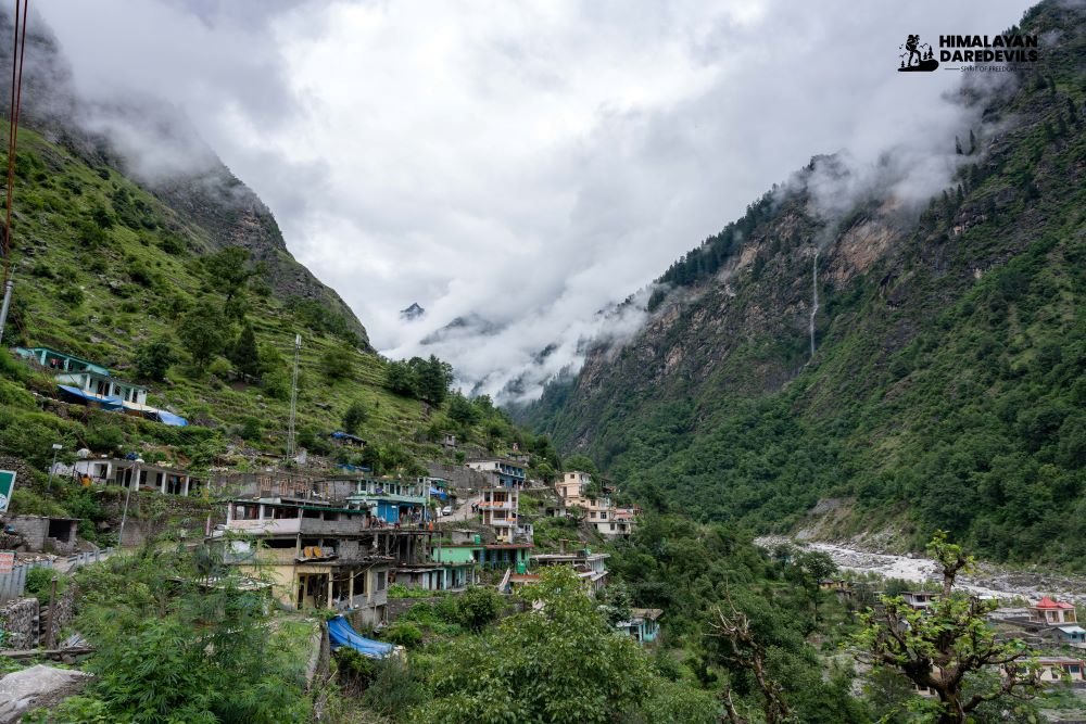
After a filling breakfast at Kaza, you begin a short and beautiful drive into the Pin Valley National Park, heading towards Mudh (or Mudh) Village, the last inhabited settlement in the valley and the starting point of the trek. The road to Mudh village stretches parallel to the Pin River, you will see a stark and dramatic landscape with towering cliffs, riverbeds and Himalayan wildlife like ibex and blue sheep.
Mudh is surrounded by rugged brown mountains and barley fields. A quick lunch there and you are ready to begin your trek to Tiya, your first campsite. The trail is moderate and flat, moving along the mountain stream. You will cross a few small streams and walk on sandy and rocky terrain. The oxygen levels are low here so you must keep yourself hydrated and climb slow.
At Tiya you will find wide pasture and next to it the river flowing below. Spend the night here under the stars and prepare for the next day.
Trek through a desolate high-altitude landscape
Gradual altitude gain with rocky terrain and glacier-fed streams
Camp overnight near Shiya
SHORT ITINERARY:
Distance: 7–8 km / Time: 5–6 Hours / Altitude: 14,765 ft (4,500 m)
DETAILED ITINERARY:
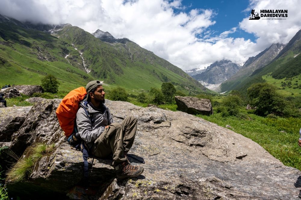
The trek from Tiya to Siya starts early and takes you deep into the wild and remote himalayan terrain. The trek still runs parallel to the Pin Valley, your silent partner on this trek. On your way you will find vast meadows in between the tall brown mountains, wild alpine flowers shining in the barren desert like stars and glacial streams coming down from the snow capped mountains.
The gradual climb will reveal the glaciers feeding the streams and by afternoon you will have reached the Shiya Campsite, a high altitude gazing ground used in summers by the local shepherds. Camp is set near the river, with basic comforts and dramatic views in all directions. Stay warm, stretch lightly, and hydrate well to help your body continue acclimatizing for the higher altitudes ahead.
Route becomes steeper with moraine and loose rocks
Camp at Pin Base Camp, prepare for pass crossing
SHORT ITINERARY:
Distance: 6–7 km / Time: 5–6 Hours / Altitude: 15,780 ft (4,810 m)
Trek to the base of Pin Parvati Pass
DETAILED ITINERARY:
Today’s trek will take you to the foot of the Pin Parvati Pass. The challenge begins early in the day as the terrain becomes rugged and steep right as you leave the Shiya camp. As you gain altitude you will see the landscape change, the rocky terrain filled with few wildflowers and meadows earlier is now covered with glacial rubble in places. You follow a carefully crafted path to reach the top and find yourself surrounded by sharp peaks and hanging glaciers, a thrilling sight.
Gradually climbing the steep trail and crossing glacial streams you will finally reach the Pin Base Camp by afternoon. The base camp is wind swept and surrounded with towering peaks. From here you can see the Pin Parvati Pass, hidden behind the clouds. This campsite is exposed and cold, so prepare for below-freezing nighttime temperatures.
The focus for the evening is rest, hydration, and mental preparation for the longest and most demanding day ahead—the Pin Parvati Pass crossing.
Early morning ascent to Pin Parvati Pass, the highest point of the trek
Steep descent into lush Parvati Valley
Reach Mantalai Lake, camp near the sacred glacial waters
SHORT ITINERARY:
Distance: 18–20 km / Time: 11–12 Hours / Altitude: Cross 17,460 ft (5,319 m), descend to 13,440 ft (4,097 m)
DETAILED ITINERARY:
Day 5 is the big day, the Pin Parvati Pass Crossing awaits. You will start your day very early, at around 3 to 4 in the morning, starting the trek before sunrise so that it is easy to walk on firm snow and to take the benefit of the stable weather. The climb from the base camp begins steeply, you find your way crossing glacial debris and lose rocks, this is the time when a proper gear makes a lot of difference.
The ascent to the Pass is slow and gradual, it will take you around 4 to 5 hours to reach the summit, which is a narrow way between two towing ridges. From here, the landscape transforms dramatically: barren Spiti behind you, and the lush, green Kullu Valley now spread out in the distance.
After taking in the view and a brief rest begin the long descent. This part is equally demanding, with boulder fields, snow patches, and slippery slopes. Trek poles are essential. By late afternoon or early evening, reach Mantalai Lake, a sacred glacial source of the Parvati River.
Set up camp beside the serene lake. Despite exhaustion, this day will likely be one of the most unforgettable experiences of your trek.
Spend the day recovering and exploring the beautiful lake area
Optional short hikes, photography, or meditation
SHORT ITINERARY:
Distance: 0 km / Time: Acclimatization / Altitude: 13,440 ft (4,097 m)
DETAILED ITINERARY:
After the physically demanding pass crossing, Day 6 is reserved for recovery. Spend the day resting at Mantalai Lake, a sacred high-altitude body of water revered by locals as the origin of the Parvati River. The landscape around the lake is stunning — glacial streams, prayer flags, and snow-capped peaks reflect on the turquoise water, making it a spiritual and photographic highlight.
This is a day and the rest time allows your body to fully acclimatise, enjoy a hot breakfast, soak in the views, and take time to stretch and rehydrate. You may take a short acclimatization hike around the lake and also find a few trekkers coming up from the Kullu side. Take this day to share stories and experiences while sitting around the campfire.
Trek through flower-covered meadows and scenic river valleys
Reach the grazing grounds of Odi Thach
Camp overnight in lush surroundings
SHORT ITINERARY:
Distance: 7–8 km / Time: 4 Hours / Altitude: 12,520 ft (3,816 m)
DETAILED ITINERARY:
After the rest day at Mantalai, begin your descent to the Kullu Valley. The trail down to the valley will offer a refreshing contrast to the start and arid landscape of Spiti Valley. You find on your way down, the green meadows with wildflowers blooming among them, soon you will also find the Parvati River flowing alongside the trek, just like the Pin River in the Spiti valley.
You will find some rocky terrain along with some muddy patches but overall the trek is easier to tread on compared to the tough previous days. The sound of water follows you and eventually leads you to the Odi Thach; a large meadow used by the Gujjar and Gaddi shepherds during the summer months. The stone huts and the grazing flocks surround the landscape. You reach Odi Thach by afternoon, enjoy the peaceful spit with soft grass and rest for the day.
Long descent through forested valleys and boulder sections
Reach Tunda Bhuj, known for its birch trees and scenic cliffs
Camp overnight by the river
SHORT ITINERARY:
Distance: 12–14 km / Time: 8 Hours / Altitude: 10,500 ft (3,200 m)
DETAILED ITINERARY:
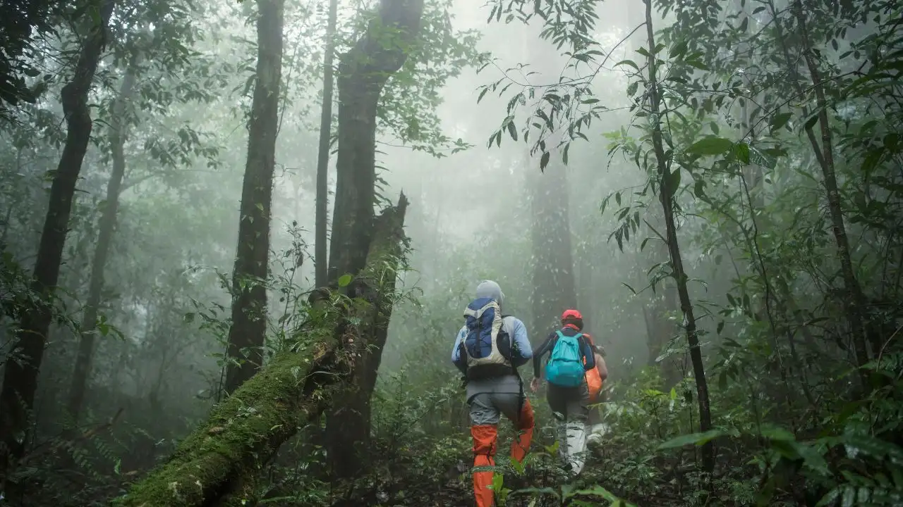
Today’s descent from Odi Thach to Tunda Bhuj takes you through one of the most beautiful and diverse sections of the Pin Parvati trek. As you lose altitude the vegetation starts to cover up more ground contrasting the barren landscape that you saw earlier in the trek. The trail brings you near to cascading waterfalls and deep river valleys all hidden in the thick dense Himalayan jungle. You will also get to cross river streams by walking on beautiful wooden log bridges and make your way between thick foliage.
The air grows warmer and by late afternoon you find yourself at your next campsite Tunda Bhuj, a campsite surrounded by birch trees and massive cliffs. Rest here for the night, the warm night brings dreams and twinkling stars.
Descend into pine forests and pass shepherd settlements
Arrive at Kheerganga, famous for its natural hot water springs
Relax in the hot pool and camp overnight
SHORT ITINERARY:
Distance: 6–7 km / Time: 4 Hours / Altitude: 9,120 ft (2,780 m)
DETAILED ITINERARY:
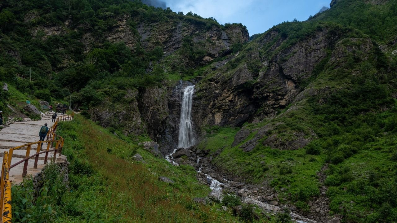
The trail of the ninth day is short but charming, you descend down making your way from between the forests of Parvati Valley, with changing vegetation — from birch and pine to dense oak and deodar. The trail is filled with waterfalls that are sure to delight the mind.
The forest begins to open up as you approach Kheerganga. Kheerganga is famous for its natural hot water springs, which sit at the edge of a cliff overlooking the valley. According to local legend, Lord Shiva meditated here for thousands of years, and the waters are believed to have healing powers.
You’ll camp near the spring or stay in basic lodges or tents. A dip in the warm, sulphur-rich pool is the perfect way to relax sore muscles and reflect on the journey so far. The atmosphere here is lively, yet peaceful — a spiritual haven in the wild.
Final descent through dense forest trails
Reach Barshaini, the trek’s end point
Drive onward to Kasol or Bhuntar as per your travel plans
SHORT ITINERARY:
Distance: 6 km / Time: 3 Hours / Altitude: 7,250 ft (2,210 m)
DETAILED ITINERARY:
On your final day of the trek after a relaxing breakfast you begin the day’s trek, a gentle but steady descent through dense pine and deodar forests, passing small waterfalls, wooden bridges, and moss-covered stones. The trail is wide and well-worn, often bustling with day-trekkers and pilgrims making their way to or from Kheerganga.On the way down to the civilization you will pass through Rudranag where a you will find a sacred temple and ancient waterfall welcoming your arrival
By late morning or early afternoon, you reach Barshaini, a small hamlet at the confluence of the Parvati and Tosh rivers. This marks the official end of your trek.
From here, you can hire a vehicle to head toward Kasol, Manikaran, or Bhuntar for your return journey. Though the trek is over, the experiences — the landscapes, challenges, and serenity of the high Himalayas — will stay with you long after you’ve left the trail.
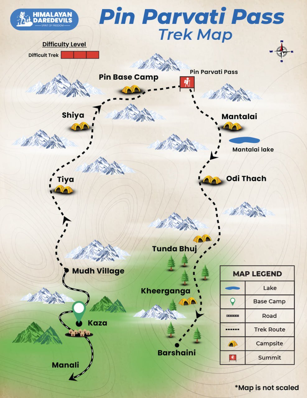
Pin Parvati Pass Trek Map

Inclusions
Exclusions
- Meals while on trek (Veg).
- All necessary entry fees and permits.
- Accommodation:- Guest house, Home stay, camping during Trek.
- Mountaineering qualified & professional trek Leader, guide, cook and Support staff.
- First aid medical kits, stretcher and oxygen cylinder.
- Trek equipment: Sleeping bag, mattress, tent (twin sharing), kitchen & dinning tent, toilet tent, utensils and crampon (if required)
- Staff Insurance.
- Porters/mules to carry central equipment.
- GST 5% (it is Mandatory)
- Any insurance (HDD recommends each trekker to get insurance)
- Any Meals/accommodation beside the itinerary or not mentioned in the program.
- Any Bus / Airfare to/from trek start/end point
- Personal Medical expenses do carry your medication.
- Any personal services such as Laundry, phone calls, liquors, mineral water, etc.
- Any still / video camera fee
- Any Entrance fee Monuments, Monasteries, Museums, Temples – Pay directly on the spot.
- Mules or porter charges to carry private baggage (Offload Charges for bag 1000 per day, per bag. Note: Bag weight should not be more than 10 kg.
- Any emergency evacuation charges
- Transport (Non Ac)
- Any expense incurred or loss cost by reasons beyond our control such as bad weather, natural calamities (landslides, floods), flight delays/rescheduling/ cancellations, any accidents/medical evacuations, riots/strikes/war/pandemics etc.
- Any services that are not mentioned in the cost inclusion section.
What to carry
Pin Parvati Pass Trek is an high altitude trek. The trekking gear you have to have for this particular trek differs from normal treks. Thus read this whole segment.
There is an important question that the trekker who is doing trek asks, like what all things to carry while trekking. Below we have provided the details on everything you should carry; an easy way to remember is by Head to foot or foot to head. We have prepared from Head to foot.
- Head Lamps – If there are treks which you might do at night and even when camping for the night. Headlamps help a lot.
- Hats or Cap – Beanie Cap will protect you from winds and sometimes freezing temperatures for the night. Hats protect you from the sun during the day and also ensure they have a strap so the hat doesn’t blow from the wind.
- Sunglasses – if you want to carry sunglasses, you will need specific sunglasses for trekking. The glasses should protect from UV rays, fit your face perfectly so it doesn’t fall while you climb, jump, or cross an obstacle, and be according to the weather conditions of the place; the glass should be made to fit different weather conditions.
- Buff / Balaclava – You must carry this to protect your mouth or neck from extreme temperatures and keep it warm.
- T-shirt / Long sleeve shirt – you should carry at least 4 to 5 T–shirts, so if one gets wet or dirty, you can wear another. Long sleeve shirts help to protect from sun UV rays.
- Hiking / Trekking Jacket – down jackets (-5 to-10 C) or three-layer jackets.
- Thermals – at least two pairs of thermals help keep the body warm during cold weather.
- Undergarments – you can carry them according to your habitual and hygiene requirements.
- Gloves – 1 pair of gloves will keep your hand warm and nice.
- Shorts / Legging / Pants – Bring 3 to 4 warm, comfortable shorts. Leggings can be used specifically in the chilling morning and evening to keep your body warm and act as dry. You can carry some nylon blend and light and quick-drying pants. Warm covers ups like fleece-lined tracksuit pants or ski pants.
- Socks – you should at least carry 3 to 4 pairs.
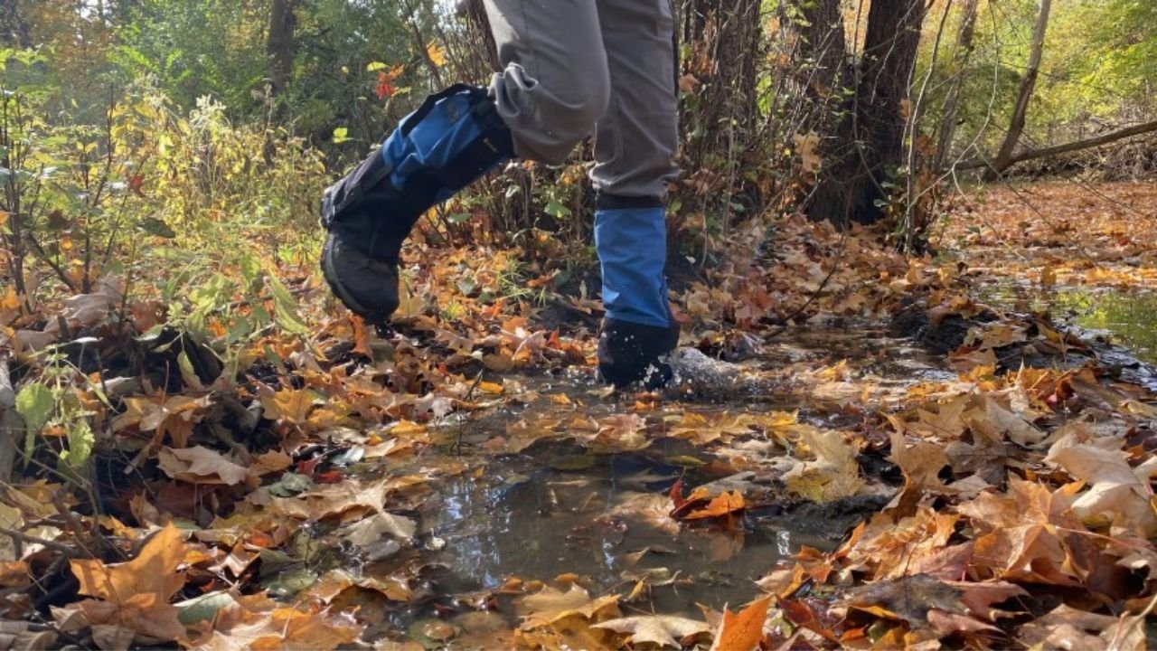
- Footwear – Trekking shoes which are waterproof and have ankle support. Walking / Hiking sandals which can be used off the trek, i.e., in the morning and evening hours, basically to get your feet rest from heavy boots, sometimes used for crossing streams and rivers, it’s more comfortable and safer than crossing barefoot or wetting your boots. Sneakers (Optional) can be worn for normal driving days or used around the camp.
- Rain Wears – you can carry a raincoat, rain jacket, and pants. During long rains, the waterproof jackets start leaking, but the poncho does get work in keeping you dry, so choose accordingly. Rain covers, small waterproof to cover your backpack and a daypack for your gadgets.
- Backpack – Make sure your backpack should be comfortable, neither too big nor too small, and for a week’s trek, 60-70 litres of the backpack should be enough to hold all your belongings. Ensure your backpack has good hip & Shoulder support, and pockets should be accessible quickly.
- Daypack – All trekkers should keep in mind that a daypack is very important; this will be a great help to you while on the trek, also every single day, you won’t be carrying your backpack; therefore, for day excursions, shorter hikers, sightseeing, you can carry your stuff in it.
Compulsory Documents to Carry
These files must be submitted to the Forest Department before your trek. With none of these, you will not be permitted to trek. Original and photocopy of government photo identity card. Carry Ids like Aadhaar, voter id, etc.
How to Reach for Pin Parvati Pass Trek
The Pin Parvati Pass trek (Spiti to Kullu) starts from Mud (Mudh) village in Pin Valley, Spiti, and ends at Barshaini in Parvati Valley (Kullu side). Mudh is the last motorable village in Pin Valley and lies around 50 km from Kaza, the headquarters of Spiti. To reach Mudh, travelers must first get to Manali, then cross the Rohtang Pass and Kunzum La to reach Kaza, followed by a short road trip to Mudh.
Reaching Manali
By Train:
From Delhi:
Board the Kalka Shatabdi (12005) from New Delhi at 7:40 AM, reaching Kalka by 11:45 AM.
Then:
Take a taxi or bus from Kalka or Chandigarh to Manali (10–12 hours, approx. 300–320 km).
From Chandigarh:
Chandigarh is well connected to Manali by road. You can take a direct Volvo or HRTC bus or hire a private taxi (takes 9–10 hours).
By Bus:
From Delhi (ISBT Kashmere Gate)- Overnight Volvo and HRTC buses run to Manali, taking about 12–14 hours.
From Chandigarh- Direct buses (Volvo and local) to Manali are frequent and take about 8–10 hours.
From Manali to Mudh (Spiti Side)
Manali to Kaza (via Rohtang Pass & Kunzum La):
Distance: ~200 km | Travel Time: 8–10 hours (weather dependent)
Transport: Hire a shared Sumo, tempo traveler, or private taxi from Manali early morning.
Roads are rough and only open from mid-June to mid-October.
Kaza to Mudh Village:
Distance: ~50 km | Travel Time: 1.5–2 hours
Taxis and shared jeeps are available from Kaza.
Mudh is the last village in Pin Valley and the trek's starting point.
Fitness and preparation guide for Pin Parvati Pass Trek
Trekking across Pin Parvati Pass demands a high level of cardiovascular endurance, muscular strength, and mental stamina, especially because it's a longer and tougher trek than most. With high-altitude glacier crossings, long walking days (up to 10–12 hours), and steep ascents and descents, proper training is crucial to ensure safety and success.
1. Cardiovascular Fitness
The Pin Parvati Pass trek spans over 100 km and reaches 5,319 m, to complete this trek with comfort and ease excellent cardio fitness is key. You'll often trek 6–10 hours a day in thin air. Being able to hike at a steady pace without exhaustion is vital.
The goal is to consistently cover 5 km in under 40 minutes at moderate intensity before the trek.
Steps to follow:
Start by jogging 2–3 km daily, 4–5 times per week
Gradually build to 4.5–5 km over 6–8 weeks
Include incline walking or stair climbing to simulate mountain terrain
2. Leg and Lower Body Strength
You’ll face steep climbs, glacial moraines, and long descents—strong legs help reduce fatigue and prevent injury.
Recommended Exercises:
Squats – Build strength in thighs and hips for uphill hikes.
Step-ups or Lunges – Train stabilizers for downhill control and joint support
Training Tips:
Perform 3 sets of 15 reps, 3–4 times per week
Add weight (e.g., a loaded backpack) as you progress
3. Core Conditioning
A strong core enhances balance, posture, and back support when carrying a heavy backpack across rocky ridgelines and snow-covered slopes.
Recommended Exercises:
Planks – Build static core strength and endurance
Leg Raises / Russian Twists – Improve lower abs and rotational strength
Training Tips:
Start with 30–45 second planks; aim for 1–2 minutes
Do 3 sets of 20 leg raises or twists on each side
4. Upper Body Strength
You’ll carry a loaded backpack for 9–11 days. Strong shoulders, back, and arms help maintain good posture and reduce fatigue from pack weight.
Recommended Exercises:
Push-ups – Strengthen chest, triceps, and shoulders
Pull-ups or Bodyweight Rows – Develop back and grip strength
Training Tips:
Aim for 3 sets of 10–15 push-ups
Add 3 sets of 5–8 pull-ups, 2–3 times per week
5. Total Body Conditioning & Cardio
This trek tests endurance, agility, and resilience. Full-body cardio workouts help simulate long days on trail.
Recommended Exercises:
Burpees – Improve cardiovascular endurance and agility
Mountain Climbers – Strengthen core, legs, and coordination
Training Tips:
Do 3 sets of 10–12 burpees
Add 3 sets of 20–30 mountain climbers, 3x/week
Train consistently and include weekend hikes with a loaded backpack (8–10 kg) to simulate real conditions. Pin Parvati isn’t just about strength — it’s about maintaining performance day after day at high altitudes, through snow, rivers, and rocky trails.
FAQ
Pin Parvati Pass Trek has two best seasons. The first is from the third week of June till Second week Of July. The Second window is from the third week of August till First week of September. The difference in both windows is to do with the level of snow around the Pin Parvati Pass. Attempting this trek in late September and October has become tricky. The weather in the valley makes pass crossing difficult during these late months.
Cancellation policy
Life is unpredictable and we understand sometimes you have to cancel or change your trip dates and it is our endeavour to make it as easy possible for you. However, please understand we plan everything including guide fees, permits, accommodation and ration in advance. Therefore any cancellation means inconvenience and certain losses to the people involved in various stages of programme. Keeping that in mind, our cancellation charges are as below-
Cancellation prior to 30 days from start of the event: Get monetary refund with 15% of cancellation charges on trek fee.
Cancellation between 30 days and 15 days to the start of event: 50% on trek fee is non refundable and the remaining 50 % will be given as cash voucher which is valid for 1 year.
Cancellation less than 15 days to the start of event: No refund.
Please note cancellation will be only accepted by email.
Booking amount is non refundable
Note: The Himalayan Daredevils reserves the right to cancel a programme before departure in the event of logistical problems arriving due to natural calamities, strikes, wars on any other circumstances that makes the event inadvisable. In this case, 50% on trek fee is non refundable and the remaining 50 % will be given as cash voucher which is valid for 1 year.
Itinerary changes & trip delays:
We plan itineraries based on the information at the time of planning and in rare circumstances, there are subject to change. In the event that the itinerary is changes or delayed due to unforeseen circumstances such as bad weather conditions, transportation delays, government intervention, landslides etc. We will always aim to give you the best experience possible. However The Himalayan Daredevils are not be held responsible for the cost of delay or changes.
Why Choose Us
Our Best Performance
50,000+
Trekkers
PAN India Treks
250+
Treks
Professional
and Experienced Staff
Best
Grade Equipment
Well Organised
Trek Itineraries
Related Blogs
Read and get more about our treks
Hampta Pass vs Pin Bhaba Pass: Which Trek to Choose?
Top 5 Himalayan Monsoon Trek in India
Best Treks in Himachal Pradesh - Himalayan Daredevils

11 Must-Do Himalayan Monsoon Treks in India (July-September)
Why Every Trekker Must Take Safety Seriously
What Are Trekking Gaiters and Why You Need Them
Affiliated and Recognised by


Download Our Apps