Starting From
45,998
39,999.00

Starting From
45,999
39,999.00
Starting From
45,999
39,999.00
Annapurna Base Camp Trek (319+ Reviews)
One way the Trek starts and ends at Nayapul (Pokhara)
Pokhara is not connected to any railways
Pokhara International Airport
Pokhara
Spring trek (Mid Feb-Mid April), Summer Trek (Mid April-June), autumn Trek (Sep-Mid Nov)
Pokhara to Pokhara
Veg
Hotels and Teahouse
Nepal
9 Days
Moderate
13550 ft
70 Km
Overview
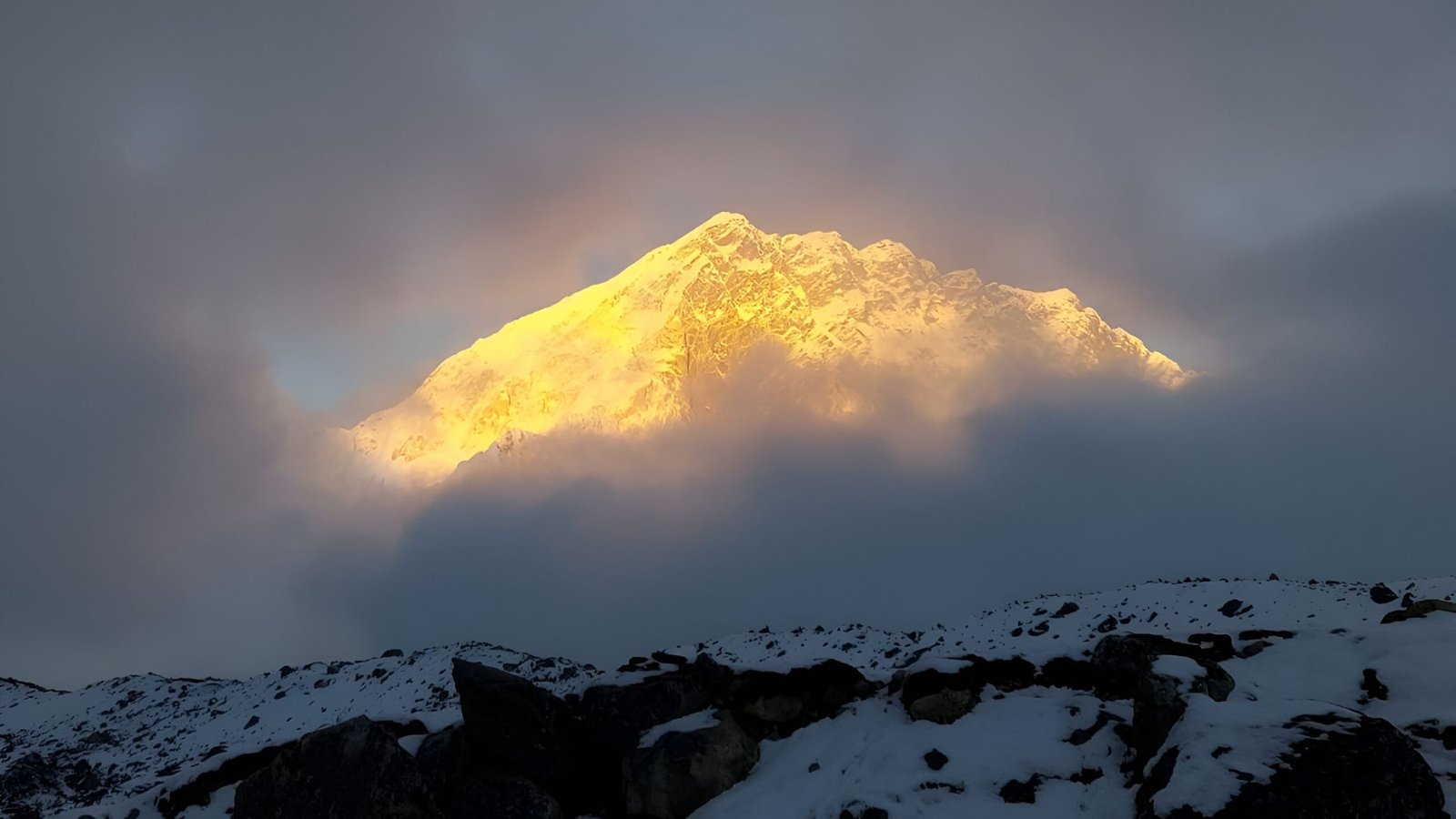
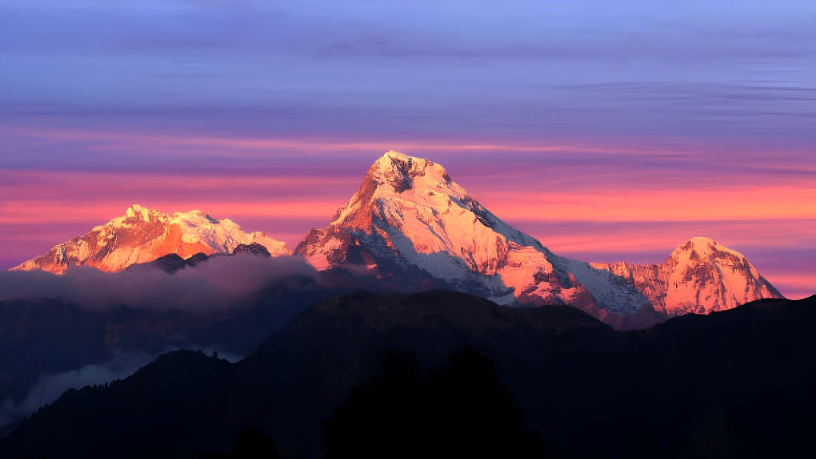
The Annapurna Base Camp trekking to the heart of the Himalayas is one of the most popular trekking adventures in the world and is often described as a classic Annapurna Base Camp trek in Nepal. This Annapurna Basecamp trekking route literally brings trekkers face to face with an eight-thousander, offering an unforgettable high-altitude experience on a moderate-difficult trek. The fascinating Annapurna massif includes the world’s tenth highest peak, Annapurna I (8,091 m), making trekking Annapurna Base Camp a memorable journey into the heart of Nepal’s highest mountains. It has the highest fatality ratio among the eight-thousanders. This formidable aura apart, the ABC trek holds several treasures for the mountain lover.
Itinerary
Duration: 7 hours Altitude: 2,760 ft Driving Distance: 215 km Highlights: The drive through the rolling hills of Nepal. The lakeside near the hotel. Reach Pokhara on your own before 4.00 PM. You will meet the rest of the team at the hotel. The briefing will be conducted at the hotel at 6.00 PM on Day 1. Go for a walk by the lakeside after the briefing and retire early after dinner. You’ll need to conserve energy for the long trek ahead!
-
Drive Duration: 3-4 hours | Trek Duration: 3-4 hours
Altitude Gain: ⇗ 4,620 ft (2,760 ft to 7,380 ft)
Difficulty: Trek gradient is moderate.
Highlights: Tea house culture of Nepali villages.
Pokhara is the gateway to the Annapurna region. You start the drive from Pokhara at 7.00 AM to Lower Ghandruk. Ghandruk is the biggest village you will find on the trek. You will see old stone and slate roofed houses lining the slope. You will also find a lot of tea houses spread through the entire village. This is your first introduction to the tea house culture of trekking. You will experience this throughout the trek.
From Ghandruk, the trail descends gradually to Kyunri Khola (stream). Once you cross the bridge across the stream, the trail split. Take the trail on the right – this ascends steeply for about an hour to Komrong.
-
Duration: 5-6 hours
Altitude Loss: ⇘ 260 ft (7,380 ft to 7,120 ft)
Difficulty: Starts with a short gradual descent for about an hour. This is followed by an ascent all the way to Chomrung. You can refill your water bottles at tea houses on the way.
Highlights: Views of majestic mountains.
Komrong is located on top of a ridge. From Komrong, you can see Chhomrong on the other side of the mountain, separated by Kimrong Khola. Descend from Komrong towards Kimrong. In half an hour you will cross a small stream. The trail ascends from here to reach Kimrong Khola in half an hour.
Once you cross Kimrong Khola, keep to your right. You will be following Kimrong Khola along the mountainside. The muddy trail ascends gradually. You will see Komrong on the other side now. Snow capped mountains such as Machapuchare, Annapurna South, Hiunchuli and the tip of Gangapurna gradually begin to appear. After about an hour, you will reach the first few lodges of Chhomrong, at the edge of the mountain. The trail splits here – take the ascending stone steps to reach Chomrung at the top.
From the top you can again see Annapurna South, much closer now. Also visible is the entire Chhomrong village, which lies on the other side of the mountain. On the opposite side you will see Sinuwa village, which you will trek through on Day 3.
Chhomrong is known as the gateway to the Annapurna Sanctuary. From here, you get a grandstand view of the peaks that were visible on the trail. Do not miss the sunset view on Annapurna South from here
Chhomrong, like Ghandruk, is lined with tea houses. There are also several shops that sell essentials like batteries, memory cards and toilet paper. Rest here for the day. There is a checkpost here where you need to register yourself again. Visit the office and show your TIMS card.
-
Duration: 6-7 hours
Altitude Gain: ⇗ 1,340 ft (7,120 ft to 8,460 ft)
Difficulty: Moderate-difficult. Initial descent for 20 minutes followed by a steep ascent for about an hour. Gradual ascent for half an hour followed by a steep 30 minute descent. Finish with a 2 hour ascent to Dovan. You can refill your water bottles at tea houses on the way.
Highlights: Walk through the most beautiful forests of the Annapurna Conversation Area
The trek today begins with a descent on the stone steps towards Chomrung village. Along Chomrung, for about 500 metres, you will find tea houses on either side. In 20 minutes you will reach Chomrung Khola. The last guest house before the bridge on Chomrung Khola is place-marked as Sinuwa – ignore this since Sinuwa is at least an hour away.
The trail climbs steeply on stone steps after the bridge. 15 minutes of climbing brings you to the hamlet of Tilche, which has a few houses. Another 10 minutes of trek from Tilche brings you to Lower Sinuwa. From here, the trail again climbs steeply on stone steps to reach Upper Sinuwa. This takes around 20 minutes – you can see the place as you start climbing. You will get good views of Machapuchare and Annapurna III from the viewpoint. Both Lower and Upper Sinuwa have a few lodges.
The trail to Sinuwa is lined with fields and thin forests. Beyond Upper Sinuwa (7,675 ft), you will be entering the Annapurna Sanctuary area. This is marked by dense forests and clustered tea houses. Cutting trees for firewood is prohibited. The tea houses are all powered by hydroelectric power plants. You can spot some of the small scale power plants along the trail.
The mud trail from Sinuwa to Bamboo climbs up gradually for the first 30 minutes, till you reach a clearing. You will see an abandoned ACAP checkpost here (8,100 ft). From here, it’s a steep descent to Bamboo on stone steps for about 30 minutes.
All this while you are walking through dense forest. The Modi Khola flows alongside but you can only hear it. As you approach Bamboo you feel yourself getting closer to the source of the sound of this running river. Have lunch at one of the lodges in Bamboo.
The ascent to Dovan begins immediately where the lodges of Bamboo end. Cross the wooden bridge that you will reach in 10 minutes. Climb further up for about 40 minutes till you get another wooden bridge. Dovan is 10 minutes from here, up the same trail.
This stretch is one of the most beautiful walks of the trek. The forest is dense and the climb is not too strenuous. You can stay in any of the 5 lodges in Dovan – they’re all in a single lane. Only the tip of Machapuchare is visible from Dovan.
-
Duration: 6-7 hours
Altitude Gain: ⇗ 3,675 ft (8,460 ft to 12,135 ft)
Difficulty: Moderate-difficult. Begins with a gradual ascent. Proceeds in a series of gradual and steep ascents. You can refill your water bottles at tea houses on the way.
Highlights: View of the fishtailed mountain.
The trail winds slowly up from Dovan towards Himalaya. In about 10 minutes, you’ll reach a fork in the trail – take the one to the left. Cross the wooden bridge that you get in about 15 minutes and continue ascending. The path is a mix of short stretches of steep and gradual ascents. Walk past the shrine that you get on your left till you reach another fork in the trail (about an hour from Dovan).
Both routes lead to Himalaya but the mud route to the right is shorter and steeper and joins the other one 5-10 minutes later. Another 10 minutes of climbing brings you to a point where the trail opens up to the Modi Khola. Machapuchare becomes visible again here. You will also see Himalaya from here. Fifteen minutes on an undulating trail brings you to Himalaya. There are a few lodges in Himalaya in case you wish to take a break.
The trail that goes to the right from the first fork that you hit earlier today goes to a small hut. This is one of the small hydroelectric power plants which supplies electricity to surrounding villages. You are likely to find signs of past landslides and avalanches on the trail today.
Climb up steadily from Himalaya for about an hour to reach an overhanging rock called Hinku cave. The entrance to the cave is blocked. From here, the trail slowly descends for 10-15 minutes till you reach two big snow patches. Cross the snow patches and one stream. Climb up for for about 20 minutes to reach Deurali. Have lunch at Deurali.
After Himalaya, the terrain starts to shift from dense forest to alpine boulder. The only vegetation you find are Bamboo, Ferns and grass. You will be climbing up and down small boulders on a large part of the trail.
It’ll take you 10 minutes of climbing through boulders to cross the last lodge at Deurali. From here, the trail opens up to the valley with Modi Khola thundering past next to you. You will see Machapuchare and Gangapurna in the distance.
Keep walking ahead till you reach descending stone steps leading to Bagar in about 40 minutes. Continue past the abandoned lodges here and climb steadily up from for about 1 hour. You will reach a bridge and cross Modi Khola. MBC is 20-30 minutes from here, up steep steps. Soak in the magnificent views of Machapuchare (22,955 ft) in front and Annapurna to your left.
The terrain on this stretch is marked with small snow bridges that need to be crossed. You are also entering grasslands, marked with few Daphne trees. Small flowering plants adorn the trail with their colours. The mountains on either side are rocky. Small waterfalls flow from either side into Modi Khola. This is also marked as an avalanche prone area.
You will be ascending close to 4,000 ft. Watch out for signs of AMS. Make sure you don’t rush through the trail – walk slowly to help your body acclimatise.
-
Duration: 2 hours
Altitude Gain: ⇗ 1,415 ft (12,135 ft to 13,550 ft)
Difficulty: Moderate. Steep ascent in the beginning for about 1 km after which the trail ascends gradually to reach ABC. You can refill your water bottles at tea houses on the way.
Highlights: The first light on the Annapurna massif.
Start early from Machapuchare Base Camp. The peaks glowing with the golden and orange tints of sunrise are a must watch. ABC is about 90 degrees to the left of the direction you came in to Machapuchare Base Camp.
The initial 1 km is a steep ascent. Then the trail ascends gradually. As you walk, you will see sunrise hit Annapurna I and slowly extend towards Annapurna South. The last stretch to ABC is a walk on moraines. If you are lucky, you can spot some Marmut on the way to ABC.
You are surrounded by mountains at ABC. Annapurna I, Annapurna III, Annapurna South, Gangapurna, Gandharvachuli and Machapuchare are right there in front of you. Pick a spot at the edge of the Annapurna glacier and soak in the views.
-
Duration: 8-9 hours
Altitude Loss: ⇘ 5,875 ft (13,550 ft to 7,675 ft)
Difficulty: Moderate-difficult. Mix of steep and gradual descent, tracing the same route back. You can refill your water bottles at tea houses on the way.
Highlights: Steep descent through the Annapurna Conservation Area
This is perhaps the longest day of the trek. You will be tracing back the same route you took to reach ABC all the way to Bamboo – crossing MBC, Deurali, Himalaya and Dovan. Today’s trek includes long stretches of steep descent interspersed with short ascents. Himalaya is good place to stop for lunch.
-
Duration: 6-7 hours
Altitude Loss: ⇘ 1,905 ft (7,675 ft to 5,770 ft)
Difficulty: Moderate-difficult. Steep ascent for about 45 minutes followed by steep descent for about 2 hours. Another steep descent for about 45 minutes followed by a steeply descending trail all the way. You can refill your water bottles at tea houses on the way.
Highlights: The hotsprings at Jhinu.
Take the trail to Sinuwa and begin climbing up steep steps till you reach the abandoned check post. This should take you around 45 minutes. Descend from here till Sinuwa fo about 45 minutes. From Sinuwa, it’s a hard descent to Chomrung Khola for about an hour followed by a steep ascent to Chomrung for about 45 minutes.
Checkout from the ACAP office at Chomrung before you leave.
Take the ascending trail from Chomrung up to the fork with the signpost for Juini. This should take you about 5 minutes. Descend on the steep steps to reach Jhinu in 1.5-2 hours.
The view of the sub tropical forests from Jhinu is one of the best. Jhinu faces Modi Khola and is famous for hot springs. Enjoy a nice bath here.
Note: The Jhinu hotsprings are common for both men and women. So come prepared accordingly with your swimwear.
-
Trek Duration: 4 hours | Drive Duration: 2-3 hours
Altitude Loss: ⇘ 1,190 ft (5,770 ft 4,580 ft)
Difficulty: Easy-moderate. Steep descent for about 30 minutes followed by gradual ascent.
Highlights: The colourful display of butterflies after Jhinu.
Take the steeply descending trail from Jhinu to reach the bridge at Kimrong Khola in about 30 minutes. After crossing the bridge, take the trail to the left. The ascending trail to the right goes to Somrong. Keep walking along the houses on the trail straight ahead. You will reach New Bridge in about an hour. This stretch of the trail is a mix of gradual and steep ascents. Many different kinds of butterflies thrive in this region, below 5,000 ft. So, you will have a colourful display of these as you reach lower from Jhinu.
Continue on the trail from New bridge. Within 5 minutes you see a fork to Landruk on the left and to Kyumi on the right. Take the trail to Kyumi. After about 20 minutes on this undulating trail, you will reach a small village, Uppu Dandu. Take the descending stone steps from here to reach Kalchane in another 20 minutes. You will find a couple of tea houses here.
The trail from Kalchane forks again in about 10 minutes. Take the route to Kyumi – to the left and descending. Keep to the right on this trail. You will reach Kyumi in about 20 minutes. Kyumi is a small, quaint village with 5 tea houses. Have lunch here.
From Kyumi, take the ascending trail towards Ghandruk. You will hit a fork within 5 minutes – take the trail to Birethanti and reach the roadhead in about 45 minutes. This is Syauli Bazaar. This is where the trek ends. If you’re traveling on your own, regular buses and jeeps to Pokhara can be boarded here.
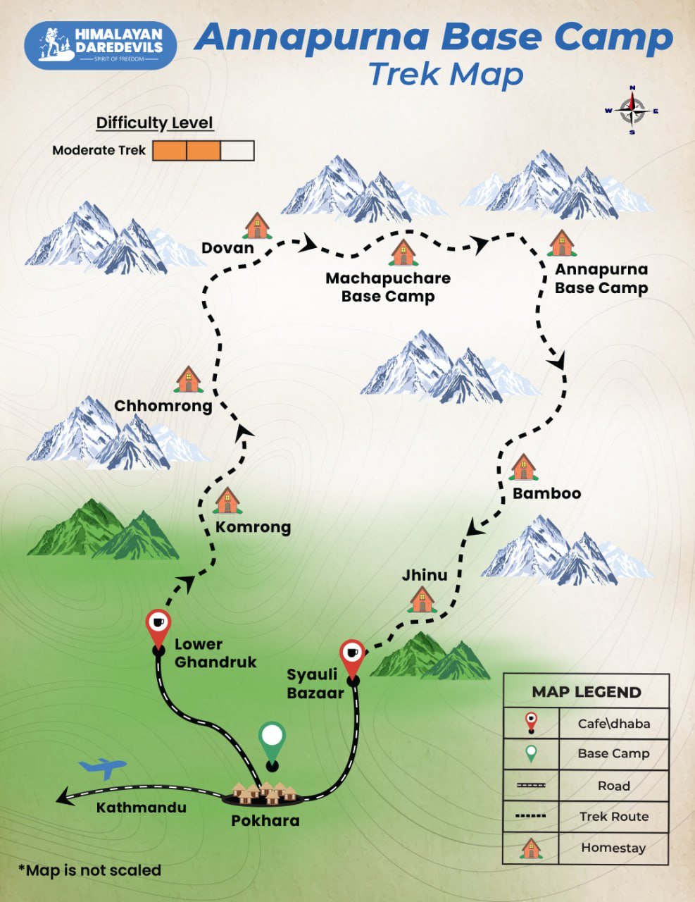
Annapurna Base Camp Trek Map
Inclusions
Exclusions
- Accommodation in Pokhara on Day 1 to Day 8 in Jhinu
- Accommodation in guesthouse/lodge on all trek days
- Permits (Upto the amount charged for Indian nationals)
- Safety Equipment
- Medical Kit
- English speaking trekking guide and his salary Insurance for Nepalese staff
- Best available tea house accommodation & food. Per person, one item from the menu is allowed during all meals of the day (breakfast, lunch & dinner). Order more at your own cost.
- Any Expense of personal nature.
- Any meals during the trek/road journey/hotel accommodation apart from what is mentioned in the inclusion
- Any tip to porters or guides which is a customary thing in Nepal
- Travel Insurance and Rescue Evacuation in case of emergency
- Any kind of Insurance
- 5% GST
- Any Expense not specified in the inclusions list.
- Any expense incurred or loss cost by reasons beyond our control such as bad weather, natural calamities (landslides, floods), flight delays/rescheduling/ cancellations, any accidents/medical evacuations, riots/strikes/war/pandemics etc.
What to carry
This is a list of essential items for individuals doing the trek with Himalayan Daredevils. This list contains only those items which the participants are required to bring with them. The list excludes those items which are provided by Himalayan Daredevils on the trek. We have divided the items into five categories. All the items in the list are essential except for those marked as optional.
Trekking Gear
- Ruck sack bag with rain cover. Qty -1
- Day Pack Bag - Recommended for treks with summit day
- Head Torch with spare Batteries. Qty -1
- U V protection sunglasses. Qty -1 Here is how you can choose the best sunglasses for trekking
- Water Bottles: 2 bottles of 1 liter each
Footwear
- Non-skid, deep treaded, high-ankle trekking shoes Qty -1
- Pair of light weight Slipper/Sandals Qty -1
Clothing
- Quick Dry Warm lower or Track Pants. Qty - 2
- Full sleeves T-shirts/ Sweatshirts. 1 for every 2 days of trekking
- Pair of thick woolen socks. 1 pair for every two days of trekking
- Thermal Body warmer Upper & Lower. Qty-1
- Undergarments. Qty - 1 for every day of trekking
- Warm jacket closed at wrist & neck .Qty-1
- Full sleeves sweater. Qty -1
- Rain wear ( Jacket & Pants ) . Qty-1
- Pair of waterproof, warm gloves. Qty-1
- Woolen cap. Qty-1
- Sun shielding Hat. Qty -1
Toiletries
- Personal toiletries kit (Small Towel, Toilet paper, paper soap, Bar soap, toothbrush, toothpaste, cold cream, etc.)
- Sun screen lotion small pack. Qty -1 Here is your Sun Protection 101 to stay safe in the bright sunny outdoors.
- Lip Balm small pack. Qty-1
Utensils
- Small size, Light weight & Leak proof lunch box. Qty-1
- Plate. Qty- 1
- Spoon.Qty-1
- Tea/Coffee (plastic) Mug.Qty-1
Miscellaneous
- Camera (Optional)
- Carry your medicines in plenty in case you have any specific ailment. Consult your doctor before joining the trek.
- Dry fruits, Nuts, Chocolate bars (Optional)
How to reach
The base camp for the trek is Pokhara, which is well connected from Delhi by air and land through Kathmandu.
Pick-Up Information
- It is essential for everyone to arrive at Pokhara (3:00 pm).
- Upon booking the trek, you are required to come to our hotel. Your trek coordinator will provide you with details such as the name of the Pokhra hotel, its location, and the contact person's number.
By Air: There are multiple daily flights from Delhi to Kathmandu.
Tribhuvan International Airport is the only International airport located in Kathmandu, Nepal. One can fly to Tribhuvan airport and then can take an additional flight to Pokhara. The distance between Pokhara and Kathmandu is around 200 kms and can be covered in 30 minutes. Popular airlines such as Buddha Air, Yeti Airlines, and Simrik Air serve this Pokhara route.
By Rail: You can take a train from Delhi to Raxaul Junction in Bihar on the Indo - Nepal border. From Raxaul, take a 5 km bus/taxi to the border, from where Kathmandu is a 10 hour road journey. Buses and taxis are easily available at the border.
By Road: The road distance from Delhi to Kathmandu is 1,145 km. There is a Delhi Government luxury bus service from Delhi Gate for Kathmandu that takes around 36 hours. This is the most time consuming but budget-friendly option at INR 2300 for the bus journey.
One can directly travel to the cities like Gorakpur or Varanasi in Uttar Pradesh, and by crossing the Sunauli border can catch a bus or book a private car to reach Pokhara. The journey will take upto 8 hours to complete. Or one can fly to Kathmandu and then take public or private transport to Pokhara. The distance between these two cities is 200 kms which may take upto 6 to 7 hours.
Kathmandu to Pokhara: From Kathmandu, you can opt to fly to Pokhara, or take one of several shared cabs that ply on the route daily. Since the trek starts from Pokhara you can take regular buses and taxis that ply from Pokhara to Kathmandu.
Fitness and preparation guide for Annapurna Base Camp Trek
We recommend jogging as the best routine to get fit for a trek. It works on the same muscles that you use while trekking — your calves, glutes and hamstrings. It helps increase your stamina day by day. It is also an easy routine that does not require any equipment or tools.
Fitness target:
To do this trek comfortably, you must be able to cover 5 km in under 35 minutes. This is the minimum fitness required for this trek.
How to achieve this fitness?
- Start jogging at least 4 days a week
- If you cannot run 5 km immediately, start with 2 km and increase to 5 km over 2-3 weeks.
- Once you’re able to run 5 km, increase your pace day by day.
- Gradually increase your pace and bring it down to 5 km in less than 35 mins.
- You must be able to run 5 km in 35 mins consistently for at least 2 weeks before the trek.
This trek requires at least 6-8 weeks of preparation. The longer, the better. So plan your trek soon and start preparing.
FAQ
Depending on your own interests and the kind of experience you're searching for, there is no one optimal time to complete the Annapurna Base Camp trek. Although the walk may be completed year-round, the weather and terrain can change drastically from season to season. The weather is often clear and dry from September to November, with daily highs of 15 to 25 °C (59 to 77 °F). The trails will be busiest at this time of year because it is Nepal's and the Annapurna region's busiest trekking season. The weather is warmer and cozier from March through May, when daily highs range from 20 to 30 °C (68 to 86 °F). Due to the blooming flowers and the beautiful skies, this is also an excellent time to go hiking. The monsoon season (June to August) is typically not the best time to hike because the terrain can be muddy and slippery and it is frequently gloomy and rainy. However, if you don't mind the rain and want a more genuine experience, this might also be a terrific time to visit. The weather is colder from December to February, with higher elevations seeing below-freezing temperatures. Although this is not the most popular period to trek, it might be an excellent alternative for individuals who prefer chilly weather and want a more sedate, tranquil experience
Guests staying during the Annapurna Base Camp climb are often accommodated in guesthouses or teahouses, which are modest, locally owned facilities that provide basic comforts like beds, blankets, and electricity. The guesthouses are typically found in the communities that line the path, and their dining spaces and restrooms are frequently shared. Meals are often served in the guesthouses and include regional specialties like dal bhat (a rice and lentil dish), momos (dumplings), and other kinds of curries. Additionally typically offered are tea and coffee. Vegetarian alternatives can typically be found in the guesthouses. It is important to note that guesthouses can be basic and facilities may not be of the same standard as in developed countries. Hospitality is usually warm and welcoming.
The trek to Annapurna Base Camp is a moderate to difficult one, requiring several hours of walking each day and climbing to an altitude of 4,130 meters (13,550 feet). It is essential to be in good physical condition before starting the trip, as it is extremely demanding. To prepare for the trip, you should regularly do cardiovascular exercises such as jogging, cycling or swimming as well as weight exercises to strengthen the leg muscles. Shorter hikes are also a great way to get used to walking for long periods of time. It is critical to listen to your body and take pauses as needed. The pace of the walk can be modified to your physical level, and you can always take a rest day or hire a porter to carry your baggage if necessary
Cancellation policy
Life is unpredictable and we understand sometimes you have to cancel or change your trip dates and it is our endeavour to make it as easy possible for you. However, please understand we plan everything including guide fees, permits, accommodation and ration in advance. Therefore any cancellation means inconvenience and certain losses to the people involved in various stages of programme. Keeping that in mind, our cancellation charges are as below-
Cancellation prior to 30 days from start of the event: Get monetary refund with 15% of cancellation charges on trek fee.
Cancellation between 30 days and 15 days to the start of event: 50% on trek fee is non refundable and the remaining 50 % will be given as cash voucher which is valid for 1 year.
Cancellation less than 15 days to the start of event: No refund.
Please note cancellation will be only accepted by email.
Booking amount is non refundable
Note: The Himalayan Daredevils reserves the right to cancel a programme before departure in the event of logistical problems arriving due to natural calamities, strikes, wars on any other circumstances that makes the event inadvisable. In this case, 50% on trek fee is non refundable and the remaining 50 % will be given as cash voucher which is valid for 1 year.
Itinerary changes & trip delays:
We plan itineraries based on the information at the time of planning and in rare circumstances, there are subject to change. In the event that the itinerary is changes or delayed due to unforeseen circumstances such as bad weather conditions, transportation delays, government intervention, landslides etc. We will always aim to give you the best experience possible. However The Himalayan Daredevils are not be held responsible for the cost of delay or changes.
Why Choose Us
Our Best Performance
50,000+
Trekkers
PAN India Treks
250+
Treks
Professional
and Experienced Staff
Best
Grade Equipment
Well Organised
Trek Itineraries
Related Blogs
